

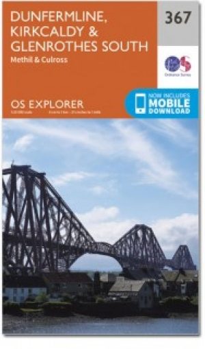
Wandelkaart 367 Dunfermline- Kirkcaldy & Glenrothes - OSI
Omvat Dunfermline- Kirkcaldy en te Firth of Forth


Korte omschrijving
Wandelkaarten Fife, Schotland van Ordnance Survey. Ideaal voor tochten in Schotland.
Wandelkaart Dunfermline- Kirkcaldy & Glenrothes South - Schotland Productbeschrijving: Methil & Culross. 367 / Dunfermline, Kirkcaldy & Glenrothes South, Fife, Schotland - OS Explorer ka...

Specificaties
- Uitgever: Ordnance Survey
- ISBN-13: 9780319246153
- HOOFDCATEGORIEËN: Wandelkaart
- Activiteiten: Wandelen, Hiking & Trekking
- Regio: Fife, Schotland
- Land: Schotland
- TOPO's & Stafkaarten: Topografisch wandelen
- Schaal: 1:25000
- Taal: Engels
- Reeks/Serie: Explorer Series OS
Volledige omschrijving
Wandelkaart Dunfermline- Kirkcaldy & Glenrothes South - Schotland
Productbeschrijving: Methil & Culross.
367 / Dunfermline, Kirkcaldy & Glenrothes South, Fife, Schotland - OS Explorer kaart 367 toont Dunfermline, Kirkcaldy en te Firth of Forth. Het Fife kustpad (deel van de North Sea Trail) is inbegrepen, alsook de Lomond Hills Regionaal Park en Loch erts. De OS Explorer kaart voor Dunfermline, Kirkcaldy & Glenrothes South is beschikbaar in zowel de standaard papieren versie als de weerbestendige 'Actief' versie.
367 / Dunfermline, Kirkcaldy & Glenrothes South, Fife, Schotland - OS Explorer map 367 shows Dunfermline, Kirkcaldy and te Firth of Forth. Included is the Fife Coastal Path (part of the North Sea Trail) the Lomond Hills Regional Park and Loch Ore. The OS Explorer map for Dunfermline, Kirkcaldy & Glenrothes South is available in both the standard paper version and weatherproof 'Active' version.
Locatie op kaart
Gekoppelde artikelen

Wandelkaart 367 Dunfermline- Kirkcaldy & Glenrothes - OSI • 9780319246153
standaard versieWandelkaart Dunfermline- Kirkcaldy & Glenrothes South - Schotland Productbeschrijving: Methil & Culross. 367 / Dunfermline, Kirkcaldy & Glenrothes South, Fife, Schotland - OS Explorer kaart 367 toont Dunfermline, Kirkcaldy en te Firth of Forth. Het Fife kustpad (deel van de North Sea Trail) is inbegrepen, alsook de Lomond Hills Regionaal Park en Loch erts. De OS Explorer kaart voor Dun…
Wandelkaart 367 Dunfermline- Kirkcaldy & Glenrothes - OSI • 9780319472354
weatherproof versieWandelkaart Dunfermline- Kirkcaldy & Glenrothes - Fife Schotland Omvat ook: Methil & Culross. Productbeschrijving: OS Explorer kaart 367 toont Dunfermline, Kirkcaldy en te Firth of Forth. Het Fife kustpad (deel van de North Sea Trail) is inbegrepen in het Lomond Hills Regionaal Park en Loch Ore. De OS Explorer kaart voor Dunfermline, Kirkcaldy & Glenrothes South is beschikbaar in zowel…
Overzichtskaarten

OSI Explorer & Explorer Active - Noord Schotland & The Cairngorms
OSI Explorer & Explorer Active - Noord Schotland & The Cairngorms
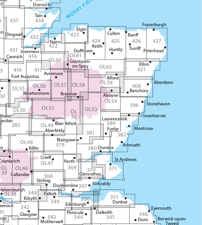
Producten op de overzichtskaart
Klik op een product om naar de detailpagina te gaan.
- Wandelkaart 342 Glasgow Schotland - OSI
- Wandelkaart 348 Campsie Fells- Glasgow - Schotland - OSI
- Wandelkaart 349 Falkirk- Cumbernauld & Livingston - OSI
- Wandelkaart 350 Edinburgh - East Schotland - OSI
- Wandelkaart 351 Dunbar & North Berwick - Edinburgh - OSI
- Wandelkaart 366 Stirling & Ochil Hills West - OSI
- Wandelkaart 367 Dunfermline- Kirkcaldy & Glenrothes - OSI
- Wandelkaart 369 Perth & Kinross - Schotland - OSI
- Wandelkaart 370 Glenrothes North- Falkland & Lomond Hills - OSI
- Wandelkaart 371 St-Andrews & East Fife- Schotland - OSI
- Wandelkaart 379 Dunkeld & Aberfeldy- Glen Almond - OSI
- Wandelkaart 380 Dundee & Sidlaw Hills- Fife - OSI
- Wandelkaart 381 Blairgowrie & Kirriemuir - OSI
- Wandelkaart 382 Arbroath- Montrose & Carnoustie - OSI
- Wandelkaart 385 Rannoch Moor & Ben Alder- Highland's - OSI
- Wandelkaart 389 Forfar- Brechin & Edzell- Tayside - OSI
- Wandelkaart 396 Stoneheaven- Inverbervie & Laurencekirk - OSI
- Wandelkaart 406 Aberdeen & Banchory- Schotland - OSI
- Wandelkaart 416 Inverness & Loch Ness - OSI
- Wandelkaart 417 Monadhliath Mountains North - OSI
- Wandelkaart 421 -llon & Inverurie- Aberdeenshire - OSI
- Wandelkaart 422 Nairn & Cawdor- Inverness - OSI
- Wandelkaart 423 Elgin- Forres & Lossiemouth - OSI
- Wandelkaart 424 Buckie & Keith- Granpian - OSI
- Wandelkaart 425 Huntly & Cullen- Aberdeenshire - OSI
- Wandelkaart 426 Banff- Macduff & Turriff- Aberdeenshire - OSI
- Wandelkaart 427 Peterhead & Fraserburgh- Aberdeenshire - OSI
- Wandelkaart 431Glen Urquhart & Strathglass - OSI
- Wandelkaart 432 Black Isle & Munlochy - OSI
- Wandelkaart OL38 Loch Lomond South & Dumbarton - OSI
- Wandelkaart OL39 Loch Lomond North & Tyndrum - OS
- Wandelkaart OL46 Trossachs NP, Callander & Aberfoyle - OS
- Wandelkaart OL47 Crieff, Comrie & Glen Artney - OS
- Wandelkaart OL49 Pitlorchry & Loch Tummel & Aberfeldy - OS
- Wandelkaart OL50 Ben Alder, Loch Ericht & Laggan - OS
- Wandelkaart OL51 Atholl, Glen Tilt & Beinn Dearg - OS
- Wandelkaart OL52 Glen Shee, Braemar & Cairnwell - OS
- Wandelkaart OL53 Lochnagar, Glen Muick & Glen Clova - OS
- Wandelkaart OL54 Glen Esk, Glen Tanar & Aboyne - OS
- Wandelkaart OL55 Loch Laggan, Creag Meagaidh & Corrieyairack - OS
- Wandelkaart OL56 Badenoch, Upper Strathspey & Kingussie - OS
- Wandelkaart OL57 Cairn Gorm, Aviemore & Loch Morlich - OS
- Wandelkaart OL58 Braemar, Tomintoul & Glen Avon - OS
- Wandelkaart OL59 Aboyne, Alford & Strathdon - OS
- Wandelkaart OL60 Lochindorb & Grantown-on-Spey - OS
- Wandelkaart OL61 Grantown-on-Spey & Hills Cromdale - OS
- Wandelkaart OL62 Correen Hills, Glenlivet & Bennachie - OS
Artikelen uit dezelfde regio
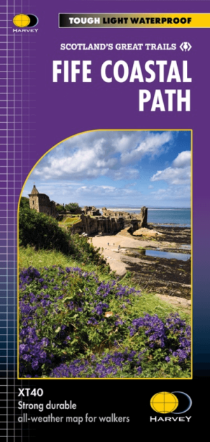
Wandelkaart Fife Coastal Path XT40 - Harvey Maps • 9781851376902
Wandelkaart Fife Coastal Path - Harvey Maps Productomschrijving: Het Fife Coastal Path biedt een gevarieerd aanbod aan landschappen, waaronder ruige kliffen, zandstranden, pittoreske vissersdorpjes en historische kastelen. Het pad biedt wandelaars de mogelijkheid om natuurreservaten te verkennen, wilde dieren te spotten en te genieten van een panoramisch uitzicht op zee. Belangrijke a…

Wandelgids Fife Pilgrim Way - Rucksack Readers • 9781913817183
Wandelgids Fife Pilgrim Way - Rucksack Readers Productomschrijving: Deze route loopt van de Firth of Forth bij Edinburgh naar de beroemde pelgrimsbestemming St Andrews. Andrews. De route is rijk aan industrieel erfgoed en voert langs voormalige mijnbouwgemeenschappen, spoorwegen, textielcentra en kastelen, maar bovenal viert de route het pelgrimskoninkrijk en de geschiedenis van Fife via d…

Wandelgids Mary Queen of Scots Way - Rucksack readers • 9781898481485
Wandelgids Mary Queen of Scots Way - Schotland Productomschrijving: Deze nieuwe route doorkruist Centraal Schotland van kust tot kust, en is verbonden met vele plaatsen die geassocieerd zijn met Mary Queen of Scots. Het loopt voor 107 mijl (172 km) van Arrochar op Loch Long naar St Andrews op de kust van Fife, Loch Lomond kruist met de veerboot naar Inversnaid en gaat dan via Aberfoyle, Ca…
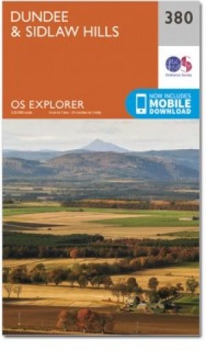
Wandelkaart 380 Dundee & Sidlaw Hills- Fife - OSI • 9780319246269
Wandelkaart Dundee & Sidlaw Hills - Fife East Schotland Productbeschrijving: 380 / Dundee & Sidlaw Hills, Fife, East Schotland - Dubbel zijdige OS Explorer kaart nummer 380 toont Dundee, de heuvels Sidlaw, de Firth of Tay en een deel van het Fife kustpad. Hoogtepunten van het gebied zijn evenals de industriestad van Dundee, Broughty Ferry en de Sidlaws. Kijk uit voor de verspreide cair…

Wandelkaart 59 St-Andrews- Fife- Schotland - OSI • 9780319473825
Wandelkaart St-Andrews - Fife Schotland Productbeschrijving: OS Landranger kaart 59 toont St-Andrews, Kirkcaldy en Glenrothes tussen de Firth of Forth en de Firth of Tay. St Andrews is het best bekend als de geboorteplaats van het golfen, en nog steeds duizenden bezoekers trekt naar de Links-corse. Het heeft ook een van de oudste universiteiten in de wereld. De OS Landranger kaarten reeks …