

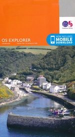
Wandelkaart 348 Campsie Fells- Glasgow - Schotland - OSI
Omvat de Campsie Fells met de piek van Earls op 578m
Korte omschrijving
Wandelkaarten Glasgow, Schotland van Ordnance Survey. Ideaal voor tochten in Schotland.
Wandelkaart Campsie Fells - Glasgow Schotland Productbeschrijving: Kilsyth, Strathblane & Fintry. 348 / Campsie Fells, Glasgow, Schotland - OS Explorer kaart 348 toont de Campsie Fells,...

Specificaties
- Uitgever: Ordnance Survey
- ISBN-13: 9780319245996
- HOOFDCATEGORIEËN: Wandelkaart
- Activiteiten: Wandelen, Hiking & Trekking
- Regio: Glasgow, Schotland
- Land: Schotland
- TOPO's & Stafkaarten: Topografisch wandelen
- Schaal: 1:25000
- Taal: Engels
- Reeks/Serie: Explorer Series OS
Volledige omschrijving
Wandelkaart Campsie Fells - Glasgow Schotland
Productbeschrijving: Kilsyth, Strathblane & Fintry.
348 / Campsie Fells, Glasgow, Schotland - OS Explorer kaart 348 toont de Campsie Fells, met de piek van Earls op 578m. Het laat ook een deel van de centrale Schotland bos, de West Highland Way en Carron Valley Reservoir zien. De OS Explorer kaart voor Campsie Fells is beschikbaar in zowel de standaard papieren versie als de weerbestendige 'Actief' versie.
348 / Campsie Fells, Glasgow, Schotland - OS Explorer map 348 shows the Campsie Fells, with the peak of Earls Seat at 578m. It also shows part of the Central Scotland Forest, the West Highland Way and Carron Valley Reservoir. The OS Explorer map for Campsie Fells is available in both the standard paper version and weatherproof 'Active' version.
Locatie op kaart
Gekoppelde artikelen

Wandelkaart 348 Campsie Fells- Glasgow - Schotland - OSI • 9780319245996
standaard versieWandelkaart Campsie Fells - Glasgow Schotland Productbeschrijving: Kilsyth, Strathblane & Fintry. 348 / Campsie Fells, Glasgow, Schotland - OS Explorer kaart 348 toont de Campsie Fells, met de piek van Earls op 578m. Het laat ook een deel van de centrale Schotland bos, de West Highland Way en Carron Valley Reservoir zien. De OS Explorer kaart voor Campsie Fells is beschikbaar in zowel…

Wandelkaart 348 Campsie Fells Glasgow Schotland - OSI • 9780319472194
weatherproof versieWandelkaart Campsie Fells - Glasgow & Stirling Schotland Omvat ookk: Kilsyth, Strathblane & Fintry. Productbeschrijving: OS Explorer kaart 348 toont de Campsie Fells, met de piek van Earls Seat op 578m. Het omvat ook een deel van de centrale Schotisch forest, de West Highland Way en Carron Valley Reservoir. De OS Explorer kaart voor Campsie Fells is beschikbaar in zowel de standaard pa…
Overzichtskaarten

OSI Explorer & Explorer Active - Noord Schotland & The Cairngorms
OSI Explorer & Explorer Active - Noord Schotland & The Cairngorms
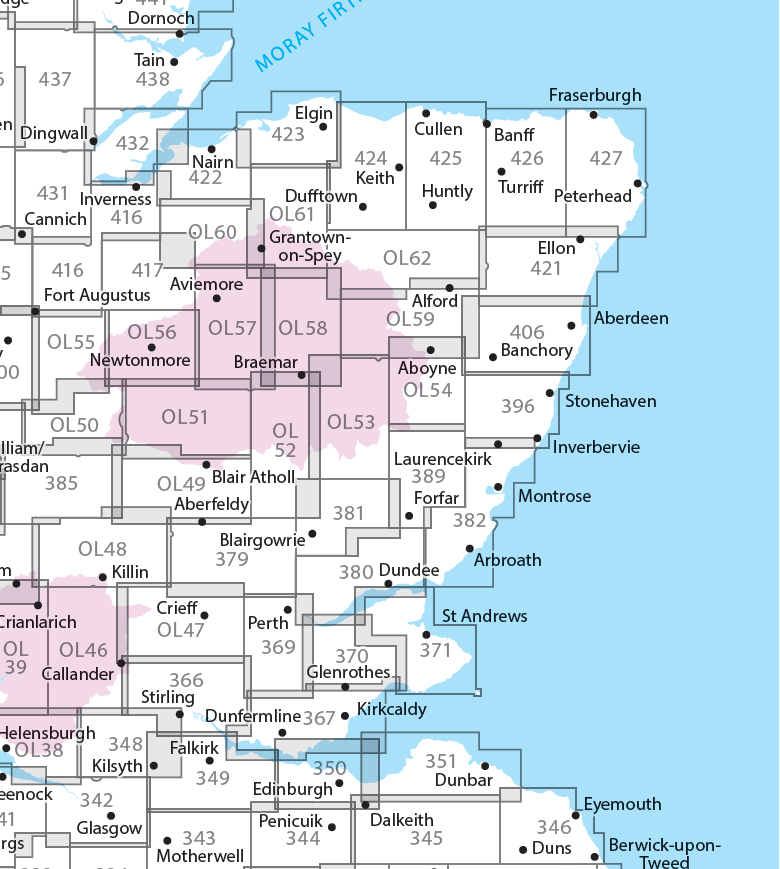
Producten op de overzichtskaart
Klik op een product om naar de detailpagina te gaan.
- Wandelkaart 342 Glasgow Schotland - OSI
- Wandelkaart 348 Campsie Fells- Glasgow - Schotland - OSI
- Wandelkaart 349 Falkirk- Cumbernauld & Livingston - OSI
- Wandelkaart 350 Edinburgh - East Schotland - OSI
- Wandelkaart 351 Dunbar & North Berwick - Edinburgh - OSI
- Wandelkaart 366 Stirling & Ochil Hills West - OSI
- Wandelkaart 367 Dunfermline- Kirkcaldy & Glenrothes - OSI
- Wandelkaart 369 Perth & Kinross - Schotland - OSI
- Wandelkaart 370 Glenrothes North- Falkland & Lomond Hills - OSI
- Wandelkaart 371 St-Andrews & East Fife- Schotland - OSI
- Wandelkaart 379 Dunkeld & Aberfeldy- Glen Almond - OSI
- Wandelkaart 380 Dundee & Sidlaw Hills- Fife - OSI
- Wandelkaart 381 Blairgowrie & Kirriemuir - OSI
- Wandelkaart 382 Arbroath- Montrose & Carnoustie - OSI
- Wandelkaart 385 Rannoch Moor & Ben Alder- Highland's - OSI
- Wandelkaart 389 Forfar- Brechin & Edzell- Tayside - OSI
- Wandelkaart 396 Stoneheaven- Inverbervie & Laurencekirk - OSI
- Wandelkaart 406 Aberdeen & Banchory- Schotland - OSI
- Wandelkaart 416 Inverness & Loch Ness - OSI
- Wandelkaart 417 Monadhliath Mountains North - OSI
- Wandelkaart 421 -llon & Inverurie- Aberdeenshire - OSI
- Wandelkaart 422 Nairn & Cawdor- Inverness - OSI
- Wandelkaart 423 Elgin- Forres & Lossiemouth - OSI
- Wandelkaart 424 Buckie & Keith- Granpian - OSI
- Wandelkaart 425 Huntly & Cullen- Aberdeenshire - OSI
- Wandelkaart 426 Banff- Macduff & Turriff- Aberdeenshire - OSI
- Wandelkaart 427 Peterhead & Fraserburgh- Aberdeenshire - OSI
- Wandelkaart 431Glen Urquhart & Strathglass - OSI
- Wandelkaart 432 Black Isle & Munlochy - OSI
- Wandelkaart OL38 Loch Lomond South & Dumbarton - OSI
- Wandelkaart OL39 Loch Lomond North & Tyndrum - OS
- Wandelkaart OL46 Trossachs NP, Callander & Aberfoyle - OS
- Wandelkaart OL47 Crieff, Comrie & Glen Artney - OS
- Wandelkaart OL49 Pitlorchry & Loch Tummel & Aberfeldy - OS
- Wandelkaart OL50 Ben Alder, Loch Ericht & Laggan - OS
- Wandelkaart OL51 Atholl, Glen Tilt & Beinn Dearg - OS
- Wandelkaart OL52 Glen Shee, Braemar & Cairnwell - OS
- Wandelkaart OL53 Lochnagar, Glen Muick & Glen Clova - OS
- Wandelkaart OL54 Glen Esk, Glen Tanar & Aboyne - OS
- Wandelkaart OL55 Loch Laggan, Creag Meagaidh & Corrieyairack - OS
- Wandelkaart OL56 Badenoch, Upper Strathspey & Kingussie - OS
- Wandelkaart OL57 Cairn Gorm, Aviemore & Loch Morlich - OS
- Wandelkaart OL58 Braemar, Tomintoul & Glen Avon - OS
- Wandelkaart OL59 Aboyne, Alford & Strathdon - OS
- Wandelkaart OL60 Lochindorb & Grantown-on-Spey - OS
- Wandelkaart OL61 Grantown-on-Spey & Hills Cromdale - OS
- Wandelkaart OL62 Correen Hills, Glenlivet & Bennachie - OS
Artikelen uit dezelfde regio

Wandelkaart 343 Motherwell & Coatbridge Glasgow - OSI • 9780319472156
Wandelkaart Motherwell & Coatbridge - Glasgow Schotland Omvat ook: Whitburn & Carluke. Productbeschrijving: Motherwell is een grote stad met een geschiedenis van de zware industrie, maar een korte afstand reizen, en u bent in het bosgebied van Centraal Schotland met mogelijkheden om een gevarieerd landschap van ruige heuvels, kleine dorpjes en farmland te verkennen. OS Explorer kaart 3…
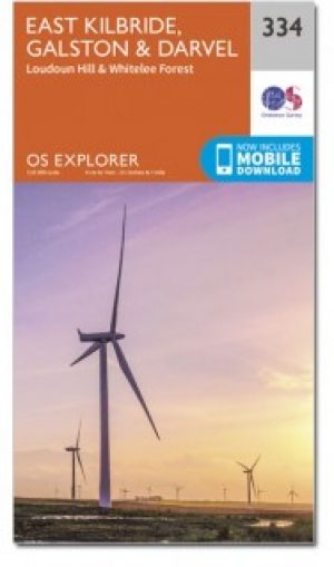
Wandelkaart 334 East Kilbride Galston & Darvel - OSI • 9780319472064
Wandelkaart East Kilbride- Galston & Darvel - Glasgow Omvat ook: Loudoun Hill & Whitelee Forest. Productbeschrijving: OS Explorer kaart 334 omvat het Whitelee Forest en een aantal kleinere Lochs en resivoires. Er is ook de rivier Irvine, een populair gebied voor de vissers. De OS Explorer kaart voor East Kilbride, Galston & Darvel is beschikbaar in zowel de standaard papieren versie al…

Wandelkaart 429 Glen Carron & West Monar Schotland - OSI • 9780319472811
Wandelkaart Glen Carron & West Monar - Glasgow Schotland Omvat ook: Trathcarron & Attadale Forest. Productbeschrijving: Kaart nummer 429 covers Glen Carron en West Monar. Hoogtepunten zijn Attadale Forest, Strathcarron en Loch Dùghaill. Omvat ook Carn Breac, Loch Sgamhain, Ben Killilan en Achnashellach. De OS Explorer kaart voor Glen Carron & West Monar is beschikbaar in zowel de stand…

Reisgids Michelin Schotland - Uitgeverij Lannoo • 9789020928174
Reisgids Michelin Schotland - Lannoo Productomschrijving: De serie Groene Reisgidsen van Michelin is een beproefde en betrouwbare reisgidsenreeks. Of u nu lekker lang met vakantie gaat of er zomaar even tussenuit trekt, de Groene Reisgids wijst u de weg naar alle bijzonderheden die uw reisbestemming te bieden heeft, op een boeiende, grondige en praktische manier. Door de opdeling in re…

Wandelkaart 342 Glasgow- Schotland - OSI • 9780319245941
Wandelkaart Glasgow - Schotland Omvat ook: Paisley, Rutherglen & Kirkintilloch Productomschrijving: Gecentreerd in de regio Glasgow, met OS Explorer kaart 342 ziet u de omliggende gebieden te verkennen rond de stad. Het omvat de Clyde Walkway & Kelvin Walkway en delen van de centrale Schotisch Forest. De OS Explorer kaart van Glasgow is beschikbaar in zowel de standaard papieren versie…