

Wandelkaart OL16 Cheviot Hills, Jedburgh & Wooler - OS
Jedburgh & Wooler- part of Northumberland Natioal Park


Korte omschrijving
Wandelkaarten Northumberland, Engeland van Ordnance Survey. Ideaal voor tochten in England.
Wandelkaart Cheviot Hills, Jedburgh & Wooler - OS Productomschrijving: Cheviot Hills, Jedburgh & Wooler, part of Northumberland Natioal Park. Omvat: Cheviot Hills, Jedburgh & Wooler, par...

Specificaties
- Uitgever: Ordnance Survey
- ISBN-13: 9780319242551
- HOOFDCATEGORIEËN: Wandelkaart
- Activiteiten: Wandelen, Hiking & Trekking
- Auteur: Ordnance Survey
- Regio: Northumberland, Engeland
- Land: England
- Lange afstand wandelroutes: Pennine Way (420 km), St Cuthbert's Way (102 km)
- Nationale parken: Northumberland NP, England
- TOPO's & Stafkaarten: Topografisch wandelen
- Schaal: 1:25000
- Taal: Engels
- Reeks/Serie: Explorer Series OS
Volledige omschrijving
Wandelkaart Cheviot Hills, Jedburgh & Wooler - OS
Productomschrijving: Cheviot Hills, Jedburgh & Wooler, part of Northumberland Natioal Park.
Omvat: Cheviot Hills, Jedburgh & Wooler, part of Northumberland Natioal Park, Pennine Way, E2 European long Distance Path, Borders Abbeys Way & St-Cuthbert's Way.
Ontdek de OL-serie van Ordnance Survey:
De OL-serie (Outdoor Leisure) van Ordnance Survey is dé referentie voor wie gaat wandelen op de Britse eilanden. Deze topografische kaarten maken deel uit van de Explorer-reeks en bieden ongeëvenaarde nauwkeurigheid en detail op een schaal van 1:25.000. Perfect voor wandelaars, hikers en outdoorliefhebbers.
Waarom kiezen voor de OL Explorer-kaarten?
Gedetailleerde topografie: Elk hekje, pad, beekje en hoogteverschil staat erop.
Ingetekende National Trails: Bekende wandelroutes zoals de South West Coast Path, Hadrian’s Wall Path en Pennine Way zijn duidelijk gemarkeerd.
Betrouwbaarheid: Ordnance Survey is al decennialang de standaard voor kaarten in het VK.
Weerbestendige versies beschikbaar – ideaal voor gebruik in weer en wind.
De beste keuze voor wandelaars
Vergeet generieke wandelkaarten. Met de OL-serie krijg je precieze, actuele informatie, zodat je zonder zorgen op pad kunt.
KOOP NU UW TOPOGRAFISCHE WANDELKAART
Bekijk ons aanbod en kies de OL-kaart die past bij jouw volgende wandelroute. Wandel slim, wandel met Ordnance Survey. wandelroute. Wandel slim, wandel met Ordnance Survey.

Overzichtskaarten
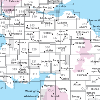
OSI Explorer & Explorer Active - Zuid Scotisch Borders
OSI Explorer & Explorer Active - Zuid Scotisch Borders

Producten op de overzichtskaart
Klik op een product om naar de detailpagina te gaan.
- Wandelkaart 307 Consett & Derwent reservoir - OSI
- Wandelkaart 308 Durham & Sunderland - England - OSI
- Wandelkaart 309 Stranraer & The Rhins - Dumfries - OSI
- Wandelkaart 310 Glenluce & Kirkcowan - Schotland - OSI
- Wandelkaart 311 Wigtown- Whithorn & The Machars - OSI
- Wandelkaart 312 Kirkcudbright & Castle Douglas - OSI
- Wandelkaart 313 Dumfries & Dalbeattie- Schotland - OSI
- Wandelkaart 314 Solway Firth- Wigton & Silloth - OSI
- Wandelkaart 315 Carlisle- Brampton & Longtown - OSI
- Wandelkaart 316 Newcastle upon Tyne - Northumberland - OSI
- Wandelkaart 318 Galloway Forest Park North- Ayrshire
- Wandelkaart 319 Galloway Forest Park South - OSI
- Wandelkaart 320 Castle Douglas & Loch Ken - OSI
- Wandelkaart 321 Nithsdale & Dumfries & Thornhill - OSI
- Wandelkaart 322 Annandale- Dumfries & Galoway - OSI
- Wandelkaart 323 Eskdale & Castle O'er Forest- Schotland - OSI
- Wandelkaart 324 Liddesdale & Kershope Forest - OSI
- Wandelkaart 325 Morpeth & Blyth - Northumberland - OSI
- Wandelkaart 326 Ayr & Troon - South Ayrshire - OSI
- Wandelkaart 327 Cumnock & Dalmellington - OSI
- Wandelkaart 328 Sanquhar & New Cumnock - OSI
- Wandelkaart 329 Lowther Hills- Sanquhar & Leadhills - OSI
- Wandelkaart 330 Moffat & St Mary's Loch - Dumfries - OSI
- Wandelkaart 331 Teviotdale South - Schotisch Borders - OSI
- Wandelkaart 332 Alnwick Amble - Northumberland - OSI
- Wandelkaart 333 Kilmarnock & Irvine - East Ayrshire - OSI
- Wandelkaart 334 East Kilbride- Galston & Darvel - Glasgow - OSI
- Wandelkaart 335 Lanark & Tinto Hills - South Lankashire - OSI
- Wandelkaart 336 Biggar & Broughton - South Lanarkshire - OSI
- Wandelkaart 337 Peebles & Interleithen - Schotish Borders - OSI
- Wandelkaart 338 Galashiels- Selkirk & Melrose - OSI
- Wandelkaart 339 Kelso- Coldstream & Lower Tweed Valley - OSI
- Wandelkaart 340 Holy Island & Bamburgh - OSO
- Wandelkaart 341 Greenock- Largs & Millport - OSI
- Wandelkaart 342 Glasgow Schotland - OSI
- Wandelkaart 343 Motherwell & Coatbridge- Glasgow - OSI
- Wandelkaart 344 Pentland Hills RP- Edinburgh - OSI
- Wandelkaart 345 Lammermuir Hills - Edinburgh - OSI
- Wandelkaart 346 Berwick-upon-Tweed - Northumberland - OSI
- Wandelkaart 349 Falkirk- Cumbernauld & Livingston - OSI
- Wandelkaart 350 Edinburgh - East Schotland - OSI
- Wandelkaart 351 Dunbar & North Berwick - Edinburgh - OSI
- Wandelkaart 361 Isle of Arran - OSI
- Wandelkaart 362 Cowal West & Isle of Bute - OSI
- Wandelkaart OL04 English Lakes - North Western area - OS
- Wandelkaart OL05 English Lakes - North Eastern area - OS
- Wandelkaart OL16 Cheviot Hills, Jedburgh & Wooler - OS
- Wandelkaart OL37 Cowal East- Dunoon & Iverary - OS
- Wandelkaart OL38 Loch Lomond South & Dumbarton - OSI
- Wandelkaart OL42 Kielder Water & Forest - OS
- Wandelkaart OL43 Hadrian's Wall- Haltwhistle & Hexham - OS
Artikelen uit dezelfde regio
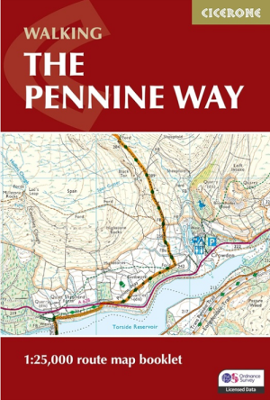
Wandelgids Map Booklet Pennine Way - Cicerone • 9781786311412
Map Booklet Pennine Way - Cicerone Productomschrijving: Map of the 270 miles (435km) Pennine Way National Trail, between Edale in the Peak District and Kirk Yetholm in the Scottish Borders. This booklet is included with the Cicerone guidebook to the trail, and shows the full route on OS 1:25,000 maps. This popular long-distance route typically takes three weeks to complete. Seasons: …

Wandelkaart 340 Holy Island & Bamburgh - OSO • 9780319263907
Wandelkaart Holy Island & Bamburgh - OSI Productomschrijving: Holy Island en Bamburgh zijn 2 aan de kust liggende eilanden/archipel die de interesse trekt van velen in het teken van natuur bezoek, wandelen of fietsen. De locatie is zeer mooi wat de natuur betreft. Omvat: Cheswick, Ancroft, Haggerston, Bowsden, Beal, Fenwick; Holy Island, Holburn, Doddington, Belford, Waren Mill, Bambur…
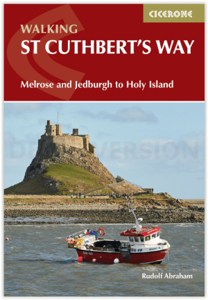
Wandelgids St Cuthbert's Way - Cicerone • 9781786311566
Wandelgids St Cuthbert's Way - Cicerone Productomschrijving: Deze wandelgids beschrijft de lange afstand St Cuthbert's Way door het ongerepte landschap van Northumberland en de Borders. De 100 km lange route begint in Melrose en doorkruist de ruige rotsen en heidevelden van de Cheviot Hills, gaat door het Northumberland National Park naar het sfeervolle Lindisfarne (Holy Island). De tocht …

Wandelgids St-Cuthbert's Way Schotland - Rucksack Readers • 9781913817138
St-Cuthbert's Way Schotland - Rucksack Readers Productomschrijving: Volg in de voetsporen van St Cuthbert in deze gemakkelijke wandeling van 101 km, van Melrose Abbey in de Schotse Borders naar het Heilige Eiland Lindisfarne in Northumberland. St Cuthbert's Way is een van de Great Trails van Schotland en ook een van de Great Trails van Engeland. De route begint bij de ruïnes van Melrose Ab…
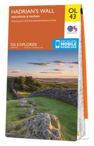
Wandelkaart OL43 Hadrian's Wall- Haltwhistle & Hexham - OS • 9780319263624
Wandelkaart Hadrian's Wall- Haltwhistle & Hexham - OS Productomschrijving: Topografische wandelkaart van Hadrian's Wall- Haltwhistle & Hexham. Omvat: Haltwhistle & Hexham, historic Hadrian's Wall path across Northern England, with parts of Northumberland National park & The Pennine Way. Ontdek de OL-serie van Ordnance Survey: De OL-serie (Outdoor Leisure) van Ordnance Survey is …