

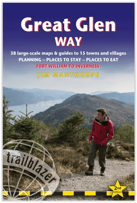
Wandelgids The Great Glen Way - Trailblazer
The Great Glen Way begint waar de West Highland Way eindigt

Korte omschrijving
Wandelgidsen Highlands, Schotland van Trailblazer Publications. Ideaal voor tochten in Schotland.
The Great Glen Way - Trailblazer Publications Productomschrijving: The Great Glen Wayfrom Fort William to Inverness. Het langeafstandswandelpad Great Glen Way begint waar de West Highland Wa...

Specificaties
- Uitgever: Trailblazer Publications
- ISBN-13: 9781912716104
- HOOFDCATEGORIEËN: Wandelgids
- Activiteiten: Wandelen, Hiking & Trekking
- Regio: Highlands, Schotland
- Land: Schotland
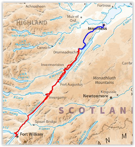
- Historische wandelroutes: The Great Glen Way (119 km)
- Editie: 2
- Taal: Engels
- Iconische Wandelroutes: The Graet Glenn Way, Irerland
- Scotlands Great Trails: Great Glen Way
Volledige omschrijving
The Great Glen Way - Trailblazer Publications
Productomschrijving: The Great Glen Wayfrom Fort William to Inverness. Het langeafstandswandelpad Great Glen Way begint waar de West Highland Way eindigt - in Fort William - en volgt de breuklijn van de Great Glen om na 79 mijl (127 km) te eindigen in Inverness. Het pad loopt langs Loch Lochy, Loch Oich en Loch Ness en volgt ook het jaagpad van het Caledonisch Kanaal. Het is een relatief gemakkelijke wandeling van een week in een prachtig Highland landschap, maar er is een hooggelegen optie tussen Fort Augustus en Drumnadrochit die een nog beter uitzicht op de bergen biedt.
192 pages,
38 trail maps + 10 town plans
40 colour photos + 4pp colour flower guide
8 stage maps + 2 overview maps
Engelse omschrijving: The Great Glen Way long-distance footpath begins where the West Highland Way ends – at Fort William – and follows the Great Glen faultline to finish at Inverness after 79 miles (127km). The trail passes Loch Lochy, Loch Oich and Loch Ness and also follows the towpath of the Caledonian Canal. It’s a relatively easy week-long walk amongst beautiful Highland scenery but there’s a high level option between Fort Augustus and Drumnadrochit that gives even better mountain views.
Features:
1. Unique mapping features – In many walking guides the reader has to read a route description then try to relate it to the map. Our guides are easier to use because walking directions, tricky junctions, places to stay and eat, points of interest and walking times are all written onto the maps themselves in the places to which they apply. With their uncluttered clarity, these are not general-purpose maps but fullyedited maps drawn by walkers for walkers. Downloadable GPS waypoints also included.
2. The largest scale walking maps available – At just under 1:20,000 (8cm or 31/8 inches to 1 mile) our maps are bigger than even the most detailed walking maps currently available in the shops.
3. An all-in-one guide – Trailblazer guides include practical information not usually found in walking guides to the UK: reviews of places to stay, places to eat, attractions along the way and detailed public transport information showing all access points on the path, for weekend and day walkers.
Locatie op kaart
Overzichtskaarten
Hystorische wandel- en fietsroutes
Hystorische wandel- en fietsroutes

Producten op de overzichtskaart
Klik op een product om naar de detailpagina te gaan.
- Wandelkaart South Downs Way - Harvey maps
- Wandelgids North Yorkshire historic walks - Cicerone
- Wandelkaart OL13 - Brecon Beacons NP - Eastern area - OSI
- Wandelgids Pilgrim Pathways walking guide - Trailblazer
- Wandelgids The Great Glen Way - Trailblazer
- Wandelgids Hadrian's wall Path - Knife Edge
- Wandelgids Hadrian's Wall Path - Trailblazer
- Wandelkaart XT40 Offa's Dyke Path - Harvey Maps
- Wandelkaart OL43 Hadrian's Wall - OSI
- Wandelkaart 351 Dunbar & North Berwick- Schotland - OSI
- Wandelgids Walking in the Forest of Dean - Cicerone
- Wandelkaart 130 Salisburry & Stonehenge- Wiltshire - OSI
- Wandelkaart 256 Wrexham- Wrecsam & Llangollen - OSI
- Wandelkaart 130 Salisbury & Stonehenge- Wiltshire - OSI
- Wandelgids John Muir Trail - Cicerone
- Wandelkaart Rob Roy Way National trail - Harvey maps
- Wandelkaart Hadrian's Wall Path - Harvey maps
- Wandelkaart Offa's Dyke Path- Route Map Booklet - Cicerone
Artikelen uit dezelfde regio

Wandelkaart 377 Loch Etive & Glen Orchy- Schotland - OSI • 9780319472446
Wandelkaart Loch Etive & Glen Orchy - Highlands Schotland Omvat ook: Dalmally, Tyndrum, Bridge of Orchy & Taynuilt. Productbeschrijving: Dubbel zijdige OS Explorer kaart 377 toont de omgeving van Loch Etive tot aan Loch Lomond en de Trossarchs National Park. Naast een substantieel deel van de West Highland way zijn er 21 Munro's om op zak te steken, samen een deel van de Ben Nevis en d…

Wandelkaart 414 Glen Shiel & Kintail Forest Schotland OSI • 9780319472699
Wandelkaart Glen Shiel & Kintail Forest - Highland's Schotland Omvat ook: Shiel Bridge, Morvich, Killilan & Kinloch Hourn. Productbeschrijving: Als u van plan bent om zoveel Munros mogelijk af te lopen, gaat u deze OS Explorer kaart 414 nodig hebben. Met 32 Munros op één dubbelzijdige kaart heeft dit gebied ook drie nationale natuurgebieden, Loch Cluanie en Loch Quoich. De OS Explorer …
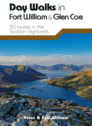
Wandelgids Day Walks in Fort William & Glen Coe - Vertebrate publ • 9781912560646
Day Walks in Fort William & Glen Coe Scotland Productomschrijving: 20 routes in the Scottish Highlands Day Walks in Fort William & Glen Coe features 20 routes between 4.4 and 14.4 miles (7km and 23.2km) in length, spread across the Scottish Highlands. Researched and written by experienced and knowledgeable authors Helen and Paul Webster, founders of the Walkhighlands website, the walk…
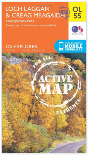
Wandelkaart OL55 Loch Laggan & Creag Meagaidh - OSI • 9780319469736
Wandelkaart Loch Laggan & Creag Meagaidh - Highland's Omvat ook: Corrieyairick Pass Productbeschrijving: OS Explorer kaart OL 55 dekt Loch Laggan, onderdeel van het Cairngorms National Park, Corrieyairick forest en 6 Munros. Deze kaart vervangt de vorige OS Explorer kaart 401 voor dit gebied. De OS Explorer kaart voor Loch Laggan & Creag Meagaidh is beschikbaar in zowel de standaard pa…

Wandelkaart 445 Foinaven Arkle Kylesku Schotland - OSI • 9780319472972
Wandelkaart Foinaven- Arkle- Kylesku - Highland's Schotland Productbeschrijving: OS Explorer kaart 445 toont, Foinaven, Arkle, Kylesku & Scourie in het uiterste noord-westen. Het omvat ook de nationale landschappelijke gebieden van North-West Sutherland Assynt-Coigach, Loch, Loch Laxford en The Minch. De OS Explorer kaart voor Foinaven, Arkle, Kylesku & Scourie is beschikbaar in zowel de s…