
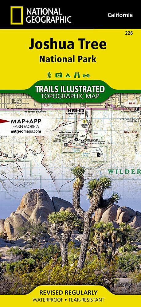
Wandelkaart 226 Joshua Tree NP - California - Nat Geo
Een prachtig gebied tussen Los Angeles en San Diego
Korte omschrijving
TOPO Wandelkaart 226 - Joshua Tree NP- California - Nat Geo Productomschrijving: Het Joshua Tree National Park is een nationaal park in het zuiden van de staat Californië in de Verenigde Sta...

Specificaties
- Uitgever: National Geographic
- ISBN-13: 9781566953009
- HOOFDCATEGORIEËN: Wandelkaart
- Activiteiten: Wandelen, Hiking & Trekking
- Regio: Californië, USA
- Land: Verenigde Staten van Amerika (USA)
- Nationale parken: Joshua Tree NP, California USA
- Schaal: 1:80000
- Afmeting: 10x19
- Taal: Engels
Volledige omschrijving
TOPO Wandelkaart 226 - Joshua Tree NP- California - Nat Geo
Productomschrijving: Het Joshua Tree National Park is een nationaal park in het zuiden van de staat Californië in de Verenigde Staten, ten oosten van het gebied tussen Los Angeles en San Diego en ten noorden van Palm Springs. De afmetingen zijn ongeveer 100 km van oost naar west, en 50 km van noord naar zuid.
Engelse omschrijving: The two distinct ecosystems of the Colorado Desert and the Mojave Desert meet in southeastern California in the Joshua Tree National Park. National Geographic's Trails Illustrated map of the park delivers unmatched detail and valuable information to assist you in your exploration of this fascinating land of surreal geologic features shaped by strong winds, unpredictable torrents of rain, and climatic extremes. Created in partnership with local land management agencies, this expertly researched map features key areas of interest including Black Rock Canyon, Lost Horse Valley, Indian Cove, Cottonwood, Chuckwalla Valley, and the Pinto Mountains.
With miles of clearly marked trails that include mileages between intersections, this map will prove invaluable in your exploration of the park. The map base includes contour lines and elevations for summits and passes. Interesting information about the park, regulations, and safety tips are included as well. Recreation features are clearly marked, including interpretive trails, campgrounds, picnic areas, points of interest, horse camps, and more. Every Trails Illustrated map is printed on "Backcountry Tough" waterproof, tear-resistant paper. A full UTM grid is printed on the map to aid with GPS navigation.
Other features found on this map include: Cadiz Valley, Cathedral City, Coachella Valley, Coxcomb Mountains, Eagle Mountains, Hayfield Lake, Indio, Joshua Tree National Park, Little San Bernardino Mountains, Palm Desert, Rancho Mirage, Twentynine Palms, Yucca Valley.
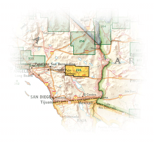
Locatie op kaart
Overzichtskaarten

NAT GEO California trail maps
NAT GEO California trail maps

Producten op de overzichtskaart
Klik op een product om naar de detailpagina te gaan.
- Wandelkaart 205 Sequoia & Kings Canyon NP - California
- Wandelkaart 206 Yosemite NP - California - Nat Geo
- Wandelkaart 218 Redwood National & State Parks - Nat Geo
- Wandelkaart 221 Death Valley NP - Nevada - Natgeo
- Wandelkaart 226 Joshua Tree NP - California - Nat Geo
- Wandelkaart 256 Mojave National park California - Nat Geo
- Wandelkaart 306 Yosemite SW- Yosemite Valley - Nat Geo
- Wandelkaart 307 Yosemite NP North West - Nat Geo
- Wandelkaart 308 Yosemite NE- Tuolumne Meadows - Nat Geo
- Wandelkaart 309 Yosemite SE - Ansel Adams Wilderness - Nat Geo
- Wandelkaart 322 Mount Whitney California - Nat Geo
- Wandelkaart 803 Lake Tahoe Basin - California - Nat Geo
- Wandelkaart 804 Tahoe National Forest West - Nat Geo
- Wandelkaart 805 Tahoe Nat. Forest East - Sierra Buttes - Nat Geo
- Wandelkaart 809 Mammoth Lakes - Mono Divide - Nat Geo
- Wandelkaart 810 Shaver Lake - Sierra National Forest - Nat Geo
Artikelen uit dezelfde regio

Reisgids San Francisco - Gallimard • 9782742453474
Reisgids San Francisco - Gallimard Productomschrijving: Van Chinatown tot de Golden Gate Bridge, van Mission tot Twin Peakes, van SFMoMa tot het Asian Art Museum, van Potrero tot Haight-Ashbury, San Francisco ontvouwt zich in een oogwenk met een gids als geen ander. Franse omschrijving: De Chinatown au Golden Gate Bridge, de Mission à Twin Peakes, du SFMoMa à l'Asian Art Museum, …

Wandelgids California & Southwest USA's NP's - Lonely Planet • 9781838696061
Wandelgids California & Southwest USA's National Parks Productomschrijving: Lonely Planet's California and Southwest USA's National Parks is uw paspoort voor het meest actuele advies over wat je moet zien en overslaan. Wandel door de Grand Canyon, bewonder Sequoia en jaag op watervallen in Yosemite; allemaal met je vertrouwde reisgenoot. Duik in het hart van de nationale parken van Califor…

Wandelkaart 308 Yosemite NE- Tuolumne Meadows - Nat Geo • 9781566953696
Yosemite North East - Tuolumne Meadows - Nat Geo Productomschrijving: National Geographic's Trails Illustrated kaart van Yosemite NE: Tuolumne Meadows and Hoover Wilderness is ontworpen om te voldoen aan de behoeften van outdoor enthousiastelingen door het combineren van waardevolle informatie met ongeëvenaarde details van deze prachtige regio van het park. Deskundig onderzocht en gemaakt …

Wandelkaart 256 Mojave National park California - Nat Geo • 9781566953832
Wandelkaart - Mojave National park California - Nat Geo Productomschrijving: Gelegen op de samenloop van de Mojave, Sonoran, en Great Basin woestijn regio's, Mojave National Preserve is een van de meest diverse woestijn omgevingen in de wereld. Verken de Joshua Tree bossen, zandduinen, vulkanische sintelkegels, kilometershoge bergen en uitgestrekte vergezichten van deze unieke regio met Na…

Reisgids California wine country USA - Top 10 - Eyewitness • 9781409326823
California wine country USA - Top 10 - Eyewitness Productomschrijving: Explore California's world-class wineries, take a leisurely tour on the Napa Valley Wine Train, cycle along the Silverado Trail or venture to the Russian River for the renowned River Jazz and Blues Festival. From Top 10 festivals to the Top 10 beaches - discover the best of California Wine Country with this easy-to-use …