

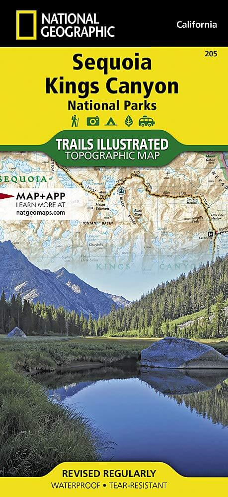
Wandelkaart 205 Sequoia & Kings Canyon NP - California
Gelegen in het zuidelijke deel van de Sierra Nevada
Korte omschrijving
Wandelkaarten Californië, USA van National Geographic. Ideaal voor tochten in Verenigde Staten van Amerika (USA).
TOPO Wandelkaart 205 - Sequoia & Kings Canyon NP Productomschrijving: Sequoia National Park is een nationaal park in het zuidelijke deel van de Sierra Nevada in Californië. Het park grenst a...

Specificaties
- Uitgever: National Geographic
- ISBN-13: 9781566952989
- HOOFDCATEGORIEËN: Wandelkaart
- Activiteiten: Wandelen, Hiking & Trekking
- Auteur: National Geographic
- Regio: Californië, USA
- Land: Verenigde Staten van Amerika (USA)
- Nationale parken: Sequoia & Kings Canyon NP, California USA
- TOPO's & Stafkaarten: Topografisch wandelen
- Schaal: 1:80000
- Taal: Engels
Volledige omschrijving
TOPO Wandelkaart 205 - Sequoia & Kings Canyon NP
Productomschrijving: Sequoia National Park is een nationaal park in het zuidelijke deel van de Sierra Nevada in Californië. Het park grenst aan de noordzijde aan Kings Canyon National Park, en wordt door de National Park Service als geheel beheerd.
Engelse omschrijving: In Sequioa and Kings Canyon National Parks you can walk among the world's largest trees, hike the alpine landscape of the Sierra Crest, and marvel at the towering granite cliffs of one of the deepest canyons in the United States. National Geographic's Trails Illustrated map of Sequoia and Kings Canyon National Parks provides unmatched detail of these parks, meeting the needs of amateur and experienced outdoor enthusiasts alike. Created in partnership with local land management agencies, this expertly researched map features key areas of interest including Sequoia Grove; Giant Sequoia National Monument; John Muir, Golden Trout, Jennie Lakes and Monarch Wilderness Areas; John Muir Trail; Pacific Crest Trail; and Mt. Whitney, the highest peak in the contiguous United States.
With miles of mapped trails in some of the most breathtaking scenery in the entire country, this map can guide you off the beaten path and back again. In addition to detailed and easy-to-read trails, this map includes an accurate road network, campgrounds, scenic overlooks and points of interests, visitor centers and facilities, plus park regulations, backcountry use areas, and contact information for local agencies. The map base includes contour lines and elevations for summits, passes and major lakes. Every Trails Illustrated map is printed on "Backcountry Tough" waterproof, tear-resistant paper. A full UTM grid is printed on the map to aid with GPS navigation.
Other features found on this map include: Cirque Peak, Golden Trout Wilderness, Inyo National Forest, Jennie Lakes Wilderness, John Muir Wilderness, Kings Canyon National Park, Middle Palisade, Monarch Wilderness, Mount Agassiz, Mount Darwin, Mount Goddard, Mount Kaweah, Mount Langley, Mount Muir, Mount Pinchot, Mount Powell, Mount Russell, Mount Sill, Mount Tyndall, Mount Whitney, Mount Williamson, North Palisade, Sequoia National Forest, Sequoia National Park, Sierra National Forest, Sierra Nevada, Split Mountain, Triple Divide Peak.
Locatie op kaart
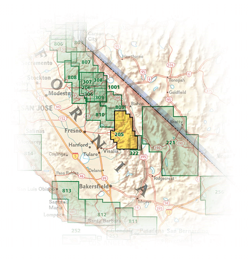
Overzichtskaarten

NAT GEO California trail maps
NAT GEO California trail maps

Producten op de overzichtskaart
Klik op een product om naar de detailpagina te gaan.
- Wandelkaart 205 Sequoia & Kings Canyon NP - California
- Wandelkaart 218 Redwood National & State Parks - Nat Geo
- Wandelkaart 221 Death Valley NP - Nevada - Natgeo
- Wandelkaart 226 Joshua Tree NP - California - Nat Geo
- Wandelkaart 256 Mojave National park California - Nat Geo
- Wandelkaart 306 Yosemite SW- Yosemite Valley - Nat Geo
- Wandelkaart 307 Yosemite NP North West - Nat Geo
- Wandelkaart 308 Yosemite NE- Tuolumne Meadows - Nat Geo
Artikelen uit dezelfde regio

Reisgids San Francisco & Northern California - DK Eyewitness • 9780241360071
San Francisco & Northern California Omvat: Presidio, Pacific Heights and the Marina, Fisherman's Wharf and North Beach, Chinatown and Nob Hill, Financial District and Union Square, Civic Center, Haight Ashbury and the Mission, Golden Gate Park and Land's End, and sights beyond the city, plus major parts of Northern California including Carmel, Mendocino, Napa Wine Country, Lake Tahoe & Yos…

Wandelkaart 803 Lake Tahoe Basin - California - Nat Geo • 9781566953344
TOPO Wandelkaart 803 - Lake Tahoe Basin - California - Nat Geo Productomschrijving: Lake Tahoe Basin is een bosgebied in het Sierra Nevada-gebergte in de Verenigde Staten, dat als National Forest. Het bosgebied ligt verspreid over Placer, El Dorado en Alpine County in Californië en Washoe en Douglas County en Carson City in Nevada. Engelse omschrijving: The largest alpine lake in North…
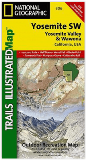
Wandelkaart 306 Yosemite SW- Yosemite Valley - Nat Geo • 9781566953627
Yosemite SW- Yosemite Valley & Wawona - Nat Geo Productomschrijving: De Yosemite Valley is een populaire toeristische bestemming, die elk jaar miljoenen bezoekers ontvangt. De gletsjervallei, omlijst door ontzagwekkende granietformaties als El Capitan en Half Dome, staat bekend om zijn dramatische watervallen, reusachtige sequoia's en biologische diversiteit. National Geographic's Trails I…

Wandelkaart 252 Channel Islands National Park - Nat Geo • 9781566954105
Channel Islands National Park - Nat Geo Productomschrijving: De Channel Islands Nationaal Park, gelegen voor de kust van Californië, zijn de thuisbasis van vele unieke soorten flora en fauna. National Geographic's Trails Illustrated kaart van Channel Islands National Park bestrijkt met ongeëvenaard detail de vijf eilanden die het park omvat, inclusief The Nature Conservancy gebied van Sant…
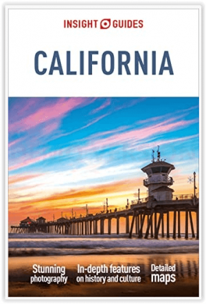
Reisgids California - Insight Guides ENG • 9781839053306
Reisgids California - Insight Guides Productomschrijving: Van het beslissen wanneer je gaat tot kiezen wat je gaat zien als je aankomt, dit is alles wat je nodig hebt om je reis te plannen en het beste van Californië te ervaren, met diepgaande insiderinformatie over must-see topattracties zoals Hollywood en verborgen culturele juweeltjes zoals de Pacific Coast Highway. Engelse om…