

Wandelkaart 307 Yosemite NP North West - Nat Geo
Hetch Hetchy Reservoir & Pacific Crest and John Muir trails


Korte omschrijving
Wandelkaarten Californië, USA van National Geographic. Ideaal voor tochten in Verenigde Staten van Amerika (USA).
Yosemite North West - Nat Geo Omvat: Emigrant Wilderness, Lake Eleanor, Stanislaus National Forest, Yosemite National Park. Engelse omschrijving: National Geographic's Trails Illustrated...

Specificaties
- Uitgever: National Geographic
- ISBN-13: 9781566954129
- HOOFDCATEGORIEËN: Wandelkaart
- Activiteiten: Wandelen, Hiking & Trekking
- Auteur: National Geographic
- Regio: Californië, USA
- Land: Verenigde Staten van Amerika (USA)
- Waterafstotende kaart: Nat Geo waterproof series
- Nationale parken: Yosemeti NP, California USA
- Schaal: 1:40000
- Taal: Engels
Volledige omschrijving
Yosemite North West - Nat Geo
Omvat: Emigrant Wilderness, Lake Eleanor, Stanislaus National Forest, Yosemite National Park.
Engelse omschrijving: National Geographic's Trails Illustrated map of Yosemite North West- Hetch Hetchy Reservoir is designed to meet the needs of outdoor enthusiasts by combining valuable information with unmatched detail of this magnificent region of Yosemite National Park. Expertly researched and created in partnership with the National Park Service, U.S. Forest Service and others, the map's coverage extends from the park's northwestern border to the White Wolf area and features key points of interest of Yosemite Wilderness including Lake Eleanor, Grand Canyon of the Tuolumne River, Tilden Lake and Pate Valley as well as the Emigrant Wilderness in the neighboring Stanislaus National Forest.
Get off the beaten path and back again by following precisely mapped trails with mileage markers, including portions of the Pacific Crest and John Muir trails, which are both highlighted. To aid in your navigation of the region, the map includes contour lines, elevations, labeled peaks and summits, water features and selected waypoints. Some of the marked recreation features are campgrounds, campsites, fee stations and ski areas. Ranger stations are clearly marked as well. Also included are camping, hiking, wilderness permit, and safety information.
Every Trails Illustrated map is printed on "Backcountry Tough" waterproof, tear-resistant paper. A full UTM grid is printed on the map to aid with GPS navigation.
Locatie op kaart
Overzichtskaarten

NAT GEO California trail maps
NAT GEO California trail maps

Producten op de overzichtskaart
Klik op een product om naar de detailpagina te gaan.
- Wandelkaart 205 Sequoia & Kings Canyon NP - California
- Wandelkaart 218 Redwood National & State Parks - Nat Geo
- Wandelkaart 221 Death Valley NP - Nevada - Natgeo
- Wandelkaart 226 Joshua Tree NP - California - Nat Geo
- Wandelkaart 256 Mojave National park California - Nat Geo
- Wandelkaart 306 Yosemite SW- Yosemite Valley - Nat Geo
- Wandelkaart 307 Yosemite NP North West - Nat Geo
- Wandelkaart 308 Yosemite NE- Tuolumne Meadows - Nat Geo
Artikelen uit dezelfde regio

Reisgids San Diego - Top 10 - DK Eyewitness • 9780241367964
DK Eyewitness TOP 10 - San Diego California Omvat: Downtown, Old Town, Uptown, Mission Valley, Ocean Beach & Coronado. Productomschrijving: Verken de prachtige tuinen van Balboa Park, bezoek de beroemde San Diego Zoo, wandel langs de Embarcadero naar het historische tallship Star of India, of geniet van het nautische erfgoed van de stad in het Maritiem Museum. Van de Top 10 tuinen en n…

Reisgids San Francisco pocket guide - Lonely Planet • 9781787014114
San Francisco pocket guide - Lonely Planet Coverage Includes: Golden Gate Bridge, The Marina, Fisherman’s Wharf, North Beach, Chinatown, Downtown, SoMa, Hayes Valley, Civic Center, The Mission, The Haight, Golden Gate Park, and more Product description: Lonely Planet Pocket San Francisco is your passport to the most relevant, up-to-date advice on what to see and skip, and what hidden d…

Wandelkaart 268 Lassen Volcanic NP - California - Nat Geo • 9781566956796
TOPO Wandelkaart 268 - Lassen Volcanic NP - Nat Geo Productomschrijving: Het Lassen Volcanic National Park is een Amerikaans nationaal park in het noordoosten van de staat Californië. Het meest in het oog springende kenmerk in het park is de Lassen Peak, een 3181 meter hoge kegelvulkaan en de meest zuidelijke vulkaan in het Cascadegebergte. Engelse omschrijving: Lassen Volcanic Nation…
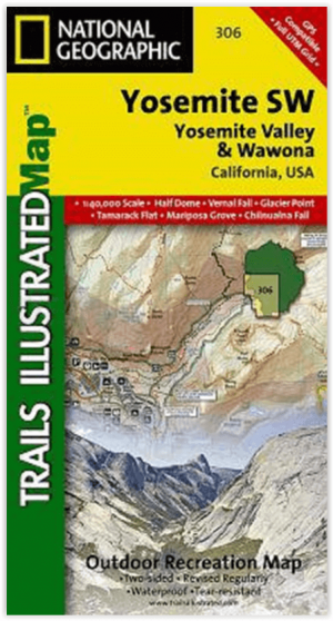
Wandelkaart 306 Yosemite SW- Yosemite Valley - Nat Geo • 9781566953627
Yosemite SW- Yosemite Valley & Wawona - Nat Geo Productomschrijving: De Yosemite Valley is een populaire toeristische bestemming, die elk jaar miljoenen bezoekers ontvangt. De gletsjervallei, omlijst door ontzagwekkende granietformaties als El Capitan en Half Dome, staat bekend om zijn dramatische watervallen, reusachtige sequoia's en biologische diversiteit. National Geographic's Trails I…
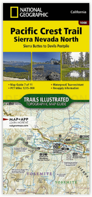
Wandelkaart 1008 Pacific Crest Trail - Nat Geo • 9781566957908
Wandelkaart Pacific Crest Trail - Nat Geo Productomschrijving: De Pacific Crest Trail, die in de topografische kaartengids voor de Sierra Nevada North staat aangegeven, loopt door subalpiene bossen en vulkanische rotsformaties en blijft dicht bij de Sierra Crest. De John Muir Trail loopt 160 mijl samen met de PCT en splitst zich in het westen van de PCT bij Tuolumne Meadows in Yosemite Nat…