
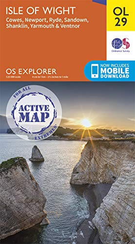
Wandelkaart OL29 Isle of Wight & Cowes - OSI
Also including Newport & Ryde
Korte omschrijving
Wandelkaart Isle of Wight & Cowes England Productomschrijving: Kaart nummer OL29 in de OS Explorer-kaartserie is de perfecte kaart voor uw dagje uit en vakanties op het Isle of Wight. Een id...

Specificaties
- Uitgever: Ordnance Survey
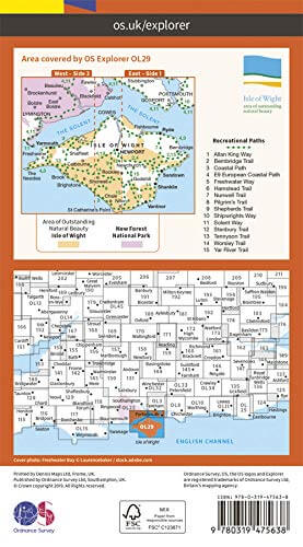
- ISBN-13: 9780319475638
- HOOFDCATEGORIEËN: Wandelkaart
- Activiteiten: Wandelen, Hiking & Trekking
- Regio: Isle of White
- Land: England
- Waterafstotende kaart: Ordnance Survey ACTIVE Explorer Weatherproof Maps
- Schaal: 1:25000
- Afmeting: 13x24
- Taal: Engels
- Reeks: Explorer ACTIVE
Volledige omschrijving
Wandelkaart Isle of Wight & Cowes England
Productomschrijving: Kaart nummer OL29 in de OS Explorer-kaartserie is de perfecte kaart voor uw dagje uit en vakanties op het Isle of Wight. Een ideale bestemming voor strandliefhebbers, wandelaars, surfers en mountainbikers, het Isle of Wight herbergt vele attracties. Hoogtepunten van het gebied zijn onder meer: The Needles, Ventnor, Blackgang Chine, Sandown, Newport en Osborne House.
Engelse omschrijving: Map sheet number OL29 in the OS Explorer map series is the perfect map for your days out and holidays on the Isle of Wight. An ideal destination for beach lovers, walkers, surfers and mountain bikers, the Isle of Wight is home to many attractions. Highlights of the area include: The Needles, Ventnor, Blackgang Chine,Sandown, Newport and Osborne House.
Locatie op kaart
Overzichtskaarten

OSI Explorer & Explorer Active - Zuid England
OSI Explorer & Explorer Active - Zuid England

Producten op de overzichtskaart
Klik op een product om naar de detailpagina te gaan.
- Wandelkaart 117 Cerne Abbas & Bere Regis - Dorset - OSI
- Wandelkaart 118 Shaftesbury & Cranbourne Chase - OSI
- Wandelkaart 129 Yeovil & Sherborne - Somerset - OSI
- Wandelkaart 130 Salisburry & Stonehenge- Wiltshire - OSI
- Wandelkaart 131 Romsey & Andover - Hampshire - OSI
- Wandelkaart 135 Ashdown Forest - East Sussex - OSI
- Wandelkaart 141 Cheddar Gorge & Mendip Hills - OSI
- Wandelkaart 142 Shepton Mallet & Mendip Hills - OSI
- Wandelkaart 143 Warminster & Trowbridge - Wiltshire - OSI
- Wandelkaart 144 Basingstoke - Alton & Whitchurch - OSI
- Wandelkaart 145 Guildford & Farnham- Surrey - OSI
- Wandelkaart 146 Dorking- Box Hill & Reigate- Surrey - OSI
- Wandelkaart 147 Sevenoaks & Tonbridge- Kent - OSI
- Wandelkaart 154 Bristol West & Portishead- Bristol - OSI
- Wandelkaart 155 Bristol & Bath & Bristol Area - OSI
- Wandelkaart 156 Chippenham & Bradford-on-Avon - OSI
- Wandelkaart 157 Marlborough & Savernake Forest - OSI
- Wandelkaart 158 Newbury & Hungerford- Berkshire - OSI
- Wandelkaart 159 Reading- S.E. England - OSI
- Wandelkaart 160 Windsor- Weybridge & Bracknell - OSI
- Wandelkaart 161 London South - OSI
- Wandelkaart 162 Greenwich & Gravesend - OSI
- Wandelkaart 167 Thornbury- Dursley & Yate - England- OSI
- Wandelkaart 168 Stroud- Tetbury & Malmesbury - OSI
- Wandelkaart 169 Cirencester & Swindon - England - OSI
- Wandelkaart 170 Abingdon & Wantage - Oxfordshire - OSI
- Wandelkaart 171 Chiltern Hills West AONB - Wycombe - OSI
- Wandelkaart 172 Chiltern Hills East AONB - Wycombe - OSI
- Wandelkaart 173 London North- England - OSI
- Wandelkaart 174 Epping Forest & Lee Valley- Essex - OSI
- Wandelkaart 179 Gloucester- Cheltenham & Stroud - OSI
- Wandelkaart 180 Oxford- England - OSI
- Wandelkaart 181 Chiltern Hills North AONB- Wycombe - OSI
- Wandelkaart 182 St-Albans & Hatfield- Hertfordshire - OSI
- Wandelkaart OL22 New Forest- Southampton & Ringwood - OSI
- Wandelkaart OL32 Winchester & New Alresford - OSI
- Wandelkaart OL33 Haslemere- Petersfield & Midhurst - OSI
- Wandelkaart OL34 Crawley- Horsham & Cranleigh - OSI
- Wandelkaart OL29 Isle of Wight & Cowes - OSI
- Wandelkaart OL3 Meon Valley- Portsmouth & Gosport - OSI
- Wandelkaart OL3 Meon Valley- Portsmouth & Gosport - OSI
- Wandelkaart OL11 Brighton & Hove - Ordnance Survey
- Wandelkaart OL25 Eastbourne & Beachy Head - OSI
- Wandelkaart OL8 Chichester South Harting- England - OSI
Artikelen uit dezelfde regio

Wandelkaart 196 The Solent & Isle of Wight - OSI • 9780319475195
Wandelkaart The Solent & the Isle of Wight - England Productbeschrijving: Kaart nummer 196 in de OS Landranger kaarten reeks, is de ideale kaart om te gebruiken bij het plannen van daguitstapjes of vakantie in de Solent en The Isle of Wight. Het gebied is beroemd om zijn zeilen, kust-wandelingen en het New Forest Nationaal park. Hoogtepunten van het gebied zijn onder andere: Lyndhurst, Sou…

Wandelkaart 196 The Solent & Isle of Wight - OSI • 9780319262948
Wandelkaart The Solent & Isle of Wight England Productbeschrijving: Kaart nummer 196 in de OS Landranger kaarten reeks is de ideale kaart om te gebruiken bij het plannen van dagexcusies of vakantie in de Solent en The Isle of Wight. Het gebied is beroemd om zijn kust-wandelingen en het New Forest Nationaal park. Hoogtepunten van het gebied zijn onder andere: Lyndhurst, Southampton, Calshot…