

Wandelkaart 143 Warminster & Trowbridge - Wiltshire - OSI
Het westen van Wiltshire- Cranbone Chase & West Wiltshire


Korte omschrijving
Wandelkaarten Wiltshire, West England van Ordnance Survey. Ideaal voor tochten in England.
Wandelkaart Warminster & Trowbridge - Wiltshire England Omvat ook: Westbury & Mere. Productbeschrijving: Kaart nummer 143 in de OS Explorer kaarten reeks heeft betrekking op het westen v...

Specificaties
- Uitgever: Ordnance Survey
- ISBN-13: 9780319243367
- HOOFDCATEGORIEËN: Wandelkaart
- Activiteiten: Wandelen, Hiking & Trekking
- Regio: Wiltshire, West England
- Land: England
- TOPO's & Stafkaarten: Topografisch wandelen
- Schaal: 1:25000
- Taal: Engels
- Reeks/Serie: Explorer Series OS
- De Engelse Graafschappen: Wiltshire
Volledige omschrijving
Wandelkaart Warminster & Trowbridge - Wiltshire England
Omvat ook: Westbury & Mere.
Productbeschrijving: Kaart nummer 143 in de OS Explorer kaarten reeks heeft betrekking op het westen van Wiltshire, als ook Cranbone Chase & de West Wiltshire Downs. Hoogtepunten van het gebied zijn onder andere: Mid Wilts Way, Wessex Ridgeway, Monarch's Way en Imber Range Perimeter Path. De OS Explorer kaart voor Warminster & Trowbridge is beschikbaar in zowel de standaard papieren versie als de weerbestendige 'Actief' versie.
Productdiscription: Map sheet number 143 in the OS Explorer series covers the west of Wiltshire, taking in Cranbone Chase & West Wiltshire Downs. Highlights of the area include: Mid Wilts Way, Wessex Ridgeway, Monarch's Way and Imber Range Perimeter Path. The OS Explorer map for Warminster & Trowbridge is available in both the standard paper version and weatherproof 'Active' version.
Locatie op kaart
Gekoppelde artikelen

Wandelkaart 143 Warminster & Trowbridge - Wiltshire - OSI • 9780319243367
standaard versieWandelkaart Warminster & Trowbridge - Wiltshire England Omvat ook: Westbury & Mere. Productbeschrijving: Kaart nummer 143 in de OS Explorer kaarten reeks heeft betrekking op het westen van Wiltshire, als ook Cranbone Chase & de West Wiltshire Downs. Hoogtepunten van het gebied zijn onder andere: Mid Wilts Way, Wessex Ridgeway, Monarch's Way en Imber Range Perimeter Path. De OS Explorer…

Wandelkaart 143 Warminster & Trowbridge- Wiltshire - OSI • 9780319470152
weatherproof versieWandelkaart Warminster & Trowbridge - Wiltshire England Productbeschrijving: Kaart nummer 143 in de OS Explorer kaarten reeks heeft betrekking op het westen van Wiltshire, alsook Cranbone Chase & West Wiltshire Downs. Hoogtepunten van het gebied zijn onder andere: Mid Wilts Way, Wessex Ridgeway, Monarch Way en Imber Range Perimeter Path. De OS Explorer kaart voor Warminster & Trowbridge is…
Overzichtskaarten

OSI Explorer & Explorer Active - Z.W. England Devon - Cornwall
OSI Explorer & Explorer Active - Z.W. England Devon - Cornwall

Producten op de overzichtskaart
Klik op een product om naar de detailpagina te gaan.
- Wandelkaart 102 Land's End - OSI
- Wandelkaart 102 Land's End - OSI
- Wandelkaart 103 The Lizard- Cornwall England - OSI
- Wandelkaart 103 The Lizard- Cornwall England - OSI
- Wandelkaart 104 Redruth & St Agnes- Cornwall - OSI
- Wandelkaart 104 Redruth & St Agnes- Cornwall - OSI
- Wandelkaart 105 Falmouth & Mevagissey - Cornawall - OSI
- Wandelkaart 106 Newquay & Padstow - Cornwall - OSI
- Wandelkaart 107 St-Austell & Liskeard- Cornwall - OSI
- Wandelkaart 108 Lower Tamar Valley & Plymouth - OSI
- Wandelkaart 109 Bodmin Moor- Cornwal - OSI
- Wandelkaart 111 Bude- Boscastle & Tintagel- Devon - OSI
- Wandelkaart 112 Launceston & Holsworthy- Devon - OSI
- Wandelkaart 113 Okehampton- Devon England - OSI
- Wandelkaart 113 Okehampton- Devon England - OSI
- Wandelkaart 114 Exeter & Exe Valley- Devon - OSI
- Wandelkaart 114 Exeter & Exe Valley- Devon - OSI
- Wandelkaart 115 Exmouth & Sidmouth- Devon - OSI
- Wandelkaart 115 Exmouth & Sidmouth- Devon - OSI
- Wandelkaart 116 Lyme regis & Bridport- Devon - OSI
- Wandelkaart 116 Lyme Regis & Bridport- Dorset - OSI
- Wandelkaart 117 Cerne Abbas & Bere Regis - Dorset - OSI
- Wandelkaart 117 Cerne Abbas & Bere Regis - Dorset - OSI
- Wandelkaart OL15 Purbeck- South Dorset & Poole - OSI
- Wandelkaart 118 Shaftesbury & Cranbourne Chase - OSI
- Wandelkaart 118 Shaftesbury & Cranbourne Chase - OSI
- Wandelkaart 129 Yeovil & Sherborne- Somerset - OSI
- Wandelkaart 129 Yeovil & Sherborne- Somerset - OSI
- Wandelkaart 140 Quantock Hills AONB & Bridgwater- Devon - OSI
- Wandelkaart 140 Quantock Hills AONB- Somerset - OSI
- Wandelkaart 141 Cheddar Gorge & Mendip Hills - OSI
- Wandelkaart 141 Shepton Mallet & Mendip Hills East - OSI
- Wandelkaart 142 Shepton Mallet & Mendip Hills - OSI
- Wandelkaart 142 Shepton Mallet & Mendip Hills - OSI
- Wandelkaart 143 Warminster & Trowbridge- Wiltshire - OSI
- Wandelkaart 143 Warminster & Trowbridge- Wiltshire - OSI
- Wandelkaart 130 Salisburry & Stonehenge- Wiltshire - OSI
- Wandelkaart 130 Salisburry & Stonehenge- Wiltshire - OSI
- Wandelkaart 131 Romsey- Andover & Test Valley- Hampshire
- Wandelkaart 131 Romsey & Andover - Hampshire - OSI
- Wandelkaart 153 Weston-super-Mare & Bleadon Hill - OSI
- Wandelkaart 153 Weston-Super-Mare & Bleadon Hill - OSI
- Wandelkaart 154 Bristol West & Portishead- Bristol - OSI
- Wandelkaart 154 Bristol West & Portishead- Bristol area
- Wandelkaart 155 Bristol & Bath Keynsham & Marshfield - OSI
- Wandelkaart 155 Bristol & Bath- Bristol Area - OSI
- Wandelkaart 156 Chippenham & Bradford-on-Avon - OSI
- Wandelkaart 156 Chippenham & Bradford-on-Avon- Wiltshire - OSI
- Wandelkaart 157 Marlborough & Savernake Forest - OSI
- Wandelkaart 157 Marlborough & Savernake Forest - OSI
- Wandelkaart 158 Newbury & Hungerford- Berkshire - OSI
- Wandelkaart 158 Newbury & Hungerford- West Berkshire - OSI
- Wandelkaart 167 Thornbury- Dursley & Yate - England- OSI
- Wandelkaart 167 Thornbury- Dursley & Yate - England- OSI
- Wandelkaart 168 Stroud- Tetbury & Malmesbury - OSI
- Wandelkaart 168 Stroud- Tetbury & Malmesbury - OSI
- Wandelkaart 169 Cirencester & Swindon - England - OSI
- Wandelkaart 169 Cirencester & Swindon - England - OSI
- Wandelkaart 170 Abingdon & Wantage - Oxfordshire - OSI
- Wandelkaart 170 Abingdon- Wantage & Vale - OSI
- Wandelkaart 179 Gloucester- Cheltenham & Stroud - OSI
- Wandelkaart 205 Stratford-upon-Avon & Evesham - OSI
- Wandelkaart 205 Stratford-upon-Avon & Evesham - OSI
- Wandelkaart 206 Edge Hill & Fenny Compton - OSI
- Wandelkaart 206 Edge Hill & Fenny Compton - OSI
- Wandelkaart OL09 Exmoor NP Devon England - OS
- Wandelkaart OL15 Purbeck & South Dorset - OS
- Wandelkaart OL20 South Devon & Dartmoor NP - OS
- Wandelkaart OL22 New Forest National Park - OS
- Wandelkaart OL28 Dartmoor National Park - OS
- Wandelkaart OL45 The Cotswolds AONB - OS

OSI Explorer & Explorer Active - Zuid England
OSI Explorer & Explorer Active - Zuid England

Producten op de overzichtskaart
Klik op een product om naar de detailpagina te gaan.
- Wandelkaart 117 Cerne Abbas & Bere Regis - Dorset - OSI
- Wandelkaart 118 Shaftesbury & Cranbourne Chase - OSI
- Wandelkaart 129 Yeovil & Sherborne - Somerset - OSI
- Wandelkaart 130 Salisburry & Stonehenge- Wiltshire - OSI
- Wandelkaart 131 Romsey & Andover - Hampshire - OSI
- Wandelkaart 135 Ashdown Forest - East Sussex - OSI
- Wandelkaart 141 Cheddar Gorge & Mendip Hills - OSI
- Wandelkaart 142 Shepton Mallet & Mendip Hills - OSI
- Wandelkaart 143 Warminster & Trowbridge - Wiltshire - OSI
- Wandelkaart 144 Basingstoke - Alton & Whitchurch - OSI
- Wandelkaart 145 Guildford & Farnham- Surrey - OSI
- Wandelkaart 146 Dorking- Box Hill & Reigate- Surrey - OSI
- Wandelkaart 147 Sevenoaks & Tonbridge- Kent - OSI
- Wandelkaart 154 Bristol West & Portishead- Bristol - OSI
- Wandelkaart 155 Bristol & Bath & Bristol Area - OSI
- Wandelkaart 156 Chippenham & Bradford-on-Avon - OSI
- Wandelkaart 157 Marlborough & Savernake Forest - OSI
- Wandelkaart 158 Newbury & Hungerford- Berkshire - OSI
- Wandelkaart 159 Reading- S.E. England - OSI
- Wandelkaart 160 Windsor- Weybridge & Bracknell - OSI
- Wandelkaart 161 London South - OSI
- Wandelkaart 162 Greenwich & Gravesend - OSI
- Wandelkaart 167 Thornbury- Dursley & Yate - England- OSI
- Wandelkaart 168 Stroud- Tetbury & Malmesbury - OSI
- Wandelkaart 169 Cirencester & Swindon - England - OSI
- Wandelkaart 170 Abingdon & Wantage - Oxfordshire - OSI
- Wandelkaart 171 Chiltern Hills West AONB - Wycombe - OSI
- Wandelkaart 172 Chiltern Hills East AONB - Wycombe - OSI
- Wandelkaart 173 London North- England - OSI
- Wandelkaart 174 Epping Forest & Lee Valley- Essex - OSI
- Wandelkaart 179 Gloucester- Cheltenham & Stroud - OSI
- Wandelkaart 180 Oxford- England - OSI
- Wandelkaart 181 Chiltern Hills North AONB- Wycombe - OSI
- Wandelkaart 182 St-Albans & Hatfield- Hertfordshire - OSI
- Wandelkaart OL03 Meon Valley Portsmouth - OS
- Wandelkaart OL08 Chichester- South Harting & Selsey - OS
- Wandelkaart OL10 Arundel- Pulborough & Worthing - OS
- Wandelkaart OL11 Brighton- Hove & South Downs NP - OS
- Wandelkaart OL22 New Forest National Park - OS
- Wandelkaart OL25 Eastbourne & Beachy Head - OS
- Wandelkaart OL29 Isle of Wight South East England - OS
- Wandelkaart OL32 Winchester, New Alresford & East Meon - OS
- Wandelkaart OL33 Haslemere & Petersfield - OS
- Wandelkaart OL34 Crawley & Horsham - Ordnance Survey
Artikelen uit dezelfde regio

Wandelgids Sarsen Way Guidebook - Cicerone • 9781786311269
Wandelgids Sarsen Way Guidebook - Cicerone Productomschrijving: Gids over de Sarsen Way (79 km) van Coate Water Park naar Salisbury en de Cranborne Droves Way (28 km) die Salisbury verbindt met de Wessex Ridgeway bij Win Green. Deze langeafstandspaden maken deel uit van de Great Chalk Way. Beide kunnen in een week gelopen worden en zijn geschikt voor alle niveaus. De routes worden gep…

Wandelkaart 156 Chippenham & Bradford-on-Avon - OSI • 9780319243497
Wandelkaart Chippenham & Bradford-on-Avon - Wiltshire Productbeschrijving: Trowbridge & Melksham. 156 / Chippenham & Bradford-on-Avon, wiltshire, England - Kaart nummer 156 in de OS Explorer reeks heeft betrekking op een gedeelte van de North Wessex Downs AONB en Cotswolds rond Melksham en Bradford-on-Avon. Hoogtepunten van het gebied zijn de steden Chippenham en Trowbridge samen met …

Wandelkaart OL45 The Cotswolds AONB - OS • 9780319242841
Wandelkaart The Cotswolds AONB - OS Productomschrijving: Wychwood Community Forest, The Centenary Way, Cotswolds Way, D'Arcy Dalton Way, Diamond Way, E2 European Long Distance Path, Gloucestershire Way, Heart of England Way, Macmillan Way, Monarch's Way, Oxfordshire Way, Thames Path, Shakespeare Way, Warden's Way, Winchcombe Way, Windrush Way & Wychavon Way. Omvat: Burford, Chipping C…
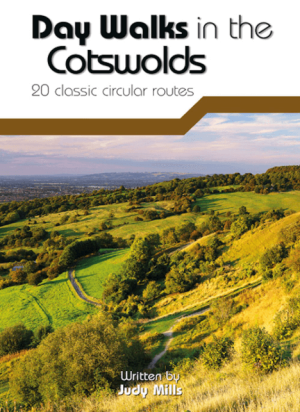
Wandelgids Day Walks in the Cotswolds AONB - Vertebrate Publ. • 9781910240991
Day Walks in the Cotswolds AONB - Vertebrate Productomschrijving: Day Walks in the Cotswolds by Judy Mills features 20 circular routes suitable for hillwalkers of all abilities. Together with stunning photography, each route features Ordnance Survey 1:25,000 maps, easy-to-follow directions, distance and navigation information, refreshment stops and local information. Split across thre…

Wandelkaart 173 Swindon & Devizes- England - OSI • 9780319262719
Wandelkaart Swindon & Devizes- Marlborough England Productbeschrijving: Kaart nummer 173 in de OS Landranger kaart reeks heeft betrekking op de rand van de Cotswold hills AONB en Wiltshire. De Ridgeway Wessex bevindt zich tussen de twee charmante steden in Wiltshire van Swindon en Devizes, ten oosten van de Cotswolds AONB. Het omliggende landschap biedt statige huizen, aantrekkelijke water…