
Wandelkaart 147 Sevenoaks & Tonbridge- Kent - OSI
Omvat 3 de Kent Downs- High Weald & de Surrey Uills
Korte omschrijving
Wandelkaart Sevenoaks & Tonbridge - Kent England Omvat ook: Royal Tunbridge Wells & Westerham. Productbeschrijving: Kaart nummer 147 in de OS Explorer reeks heeft betrekking op drie gebi...

Specificaties
- Uitgever: Ordnance Survey
- ISBN-13: 9780319243404
- HOOFDCATEGORIEËN: Wandelkaart
- Activiteiten: Wandelen, Hiking & Trekking
- Regio: Kent South East England
- Land: England
- AONB - Area of Outstanding Beauty: Kent Downs AONB, Surrey Hills AONB
- Schaal: 1:25000
- Afmeting: 13x23
- Taal: Engels
- Reeks: Explorer Series
Volledige omschrijving
Wandelkaart Sevenoaks & Tonbridge - Kent England
Omvat ook: Royal Tunbridge Wells & Westerham.
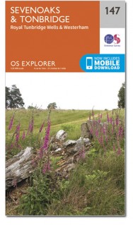
Productbeschrijving: Kaart nummer 147 in de OS Explorer reeks heeft betrekking op drie gebieden van uitzonderlijke natuurlijke schoonheid AONB: de Kent Downs, High Weald en de Surrey Uills. De North Downs Way passeert ten noorden van Sevenoaks. Andere hoogtepunten zijn: Royal Tonbridge Wells, Westerham, de rivieren de Eden en Medway, en Bough Beech Reservoir. Omvat ook Stansted (het dorp, niet de luchthaven!). De OS Explorer kaart voor Sevenoaks & Tonbridge is beschikbaar in zowel de standaard papieren versie als de weerbestendige 'Actief' versie.
Productdiscription: Map sheet number 147 in the OS Explorer series covers three Areas of Outstanding Natural Beauty AONB: the Kent Downs, High Weald and the Surrey Hills. The North Downs Way passes through north of Sevenoaks and other highlights include: Royal Tonbridge Wells, Westerham, the rivers Eden and Medway, and Bough Beech Reservoir. Also includes Stansted (the village, not the Airport!). The OS Explorer map for Sevenoaks & Tonbridge is available in both the standard paper version and weatherproof 'Active' version.
Locatie op kaart
Gekoppelde artikelen

Wandelkaart 147 Sevenoaks & Tonbridge- Kent - OSI • 9780319243404
standaard versieWandelkaart Sevenoaks & Tonbridge - Kent England Omvat ook: Royal Tunbridge Wells & Westerham. Productbeschrijving: Kaart nummer 147 in de OS Explorer reeks heeft betrekking op drie gebieden van uitzonderlijke natuurlijke schoonheid AONB: de Kent Downs, High Weald en de Surrey Uills. De North Downs Way passeert ten noorden van Sevenoaks. Andere hoogtepunten zijn: Royal Tonbridge Wells,…

Wandelkaart 147 Sevenoaks & Tonbridge- Kent SE - England • 9780319470190
weatherproof versieWandelkaart Sevenoaks & Tonbridge - Kent SE England Omvat ook: Royal Tunbridge Wells & Westerham. Productbeschrijving: Kaart nummer 147 in de OS Explorer kaarten reeks heeft betrekking op drie gebieden van uitzonderlijke natuurlijke schoonheid: de Kent Downs AONB, High Weald AONB en de Surrey Hills AONB. De North Downs Way passeert ten noorden van Sevenoaks en andere hoogtepunten zijn…
Overzichtskaarten

Area's of Outstanding Natural Beauty - AONB's UK
Area's of Outstanding Natural Beauty - AONB's UK

Producten op de overzichtskaart
Klik op een product om naar de detailpagina te gaan.
- Wandelgids - Guide to the Cotswolds AONB - AA
- Wandelkaart 24 - Chilterns AONB - AA
- Fietskaart- en Mtb kaart - The Cotswolds - Goldeneye
- Wandelgids - Cotswold classic walks guidebook - Goldeneye
- Wandelkaart - Cotswold South AONB - Goldeneye
- Wandelgids - Exploring the Cotswolds - Goldeneye
- Wandelgids - Cotswold Classic Walks - Goldeneye
- Wandelkaart - Cotswolds- Malverns & Forest of Dean - Goldeneye
- Wandelgids - The Cotswold Way 30 classic routes - Cicerone
- Wandelgids - Kent walking guide - Cicerone
- Wandelgids - North Downs Way Nat. trail - Cicerone
- Wandelgids - Chilterns walking guide - Cicerone
- Wandelgids - Suffolk coast & Heaths walks - Cicerone
- Wandelgids - North Downs Way - Map Booklet - Cicerone
- Wandelgids - North Pennines AONB walking guide - Cicerone
- Wandelgids - Ridgeway National Trail - Cicerone
- Wandelgids - Forest of Bowland & Pendle - Cicerone
- Wandelgids - Hampshire's Test Way walking guide - Cicerone
- Wandelgids & Fietsgids - The Cotswold AONB - Cicerone
- Wandelgids - Walking on the Gower - Cicerone
- Wandelgids - North Wessex Downs - Cicerone Press
- Wandelgids - Walking on the North Wessex Downs - Cicerone
- Wandelgids - Silverdale & Arnside AONB - Cicerone
- Wandelgids - The Kennet and Avon Canal walking guide - Cicerone
- Wandelgids - North Downs Way- 246 km - Trailblazer
- Wandelkaart OL2 - Yorkshire Dales- Southern & Western Areas - OSI
- Wandelkaart OL19 - Howgill Fells and Upper Eden Valley - OSI
- Wandelkaart OL21 - South Pennines - Yorkshire - OSI
- Wandelkaart OL31 - North Pennines- Teesdale & Weardale - OSI
- Wandelkaart OL40 - The Broads - OSI
- Wandelkaart OL41 - Forest of Bowland & Ribblesdale - OSI
- Wandelkaart OL45 - The Cotswolds AONB- Gloucestershire - OSI
- Wandelkaart 108 - Lower Tamer Valley & Plymouth- Cornwall- OSI
- Wandelkaart 115 - Exmouth & Sidmouth- Devon - OSI
- Wandelkaart 137 - Ashford- Kent downs AONB- England - OSI
- Wandelkaart 140 - Quantock Hills AONB- Somerset - OSI
- Wandelkaart 140 - Quantock Hills AONB & Bridgwater- Devon - OSI
- Wandelkaart 147 - Sevenoaks & Tonbridge- Kent - OSI
- Wandelkaart 164 - Gower AONB & Gwyr- South Wales - OSI
- Wandelkaart 164 - Gower AONB & Gwyr- Wales - OSI
- Wandelkaart 171 - Chiltern Hills West & Henley-on-Thames OSI
- Wandelkaart 171 - Chiltern Hills West AONB- Wycombe - OSI
- Wandelkaart 172 - Chiltern Hills East AONB- Wycombe - OSI
- Wandelkaart 181 - Chiltern Hills AONB North- England - OSI
- Wandelkaart 181 - Chiltern Hills North AONB- Wycombe - OSI
- Wandelkaart 190 - Malvern Hills & Bredon Hill - OSI
- Wandelkaart 190 - Malvern Hills AONB & Bredon Hill - OSI
- Wandelkaart 203 - Ludlow- Shropshire Hills AONB - OSI
- Wandelkaart 217 - Long Mynd & Wenlock Edge- Schropshire- OSI
- Wandelkaart 254 - Lleyn Peninsular East- North Wales - OSI
- Wandelkaart 261 - Boston- Lincolnshire AONB - OSI
- Wandelkaart 262 - Anglesey West- Wales AONB - OSI
- Wandelkaart 263 - Anglesey East AONB- Wales - OSI
- Wandelkaart 273 - Lincolnshire Wolds South AONB - OSI
- Wandelkaart 282 - Lincolnshire Wolds North AONB - OSI
- Wandelkaart 298 - Nidderdale AONB- Yorkshire - OSI
- Wandelkaart 298 - Nidderdale AONB North Yorkshire - OSI
- Wandelkaart 300 - Howardian Hills AONB - OSI
- Wandelkaart 300 - Howardian Hills AONB & Malton - OSI
- Wandelkaart - Mourne Mountains N. Ireland - Harvey maps
- Wandelkaart - Fietskaart Forest of Bowland - Harvey maps
- Wandelkaart XT40 - Anglesey Coastal Path N. Wales - Harvey Maps
- Wandelkaart XT40 - Pennine Way Noord - Harvey Maps
- Wandelkaart XT40 - Pennine Way Zuid - Harvey Maps
- Wandelgids Cotswold - Way Two-way trekking guide - Knife Edge
- Reisgids Oxford & the Cotswolds AONB - Edicola
- Reisgids Cotswolds England - Rough Guides
- Reisgids Go Slow- Sussex & the South Downs- Weald & Coast - Bradt
- Travelguide Oxford & The Cotswolds pocket guide - Lonely Planet
- Wandelgids - The Ridgeway National trail - Trailblazer

OSI Explorer & Explorer Active - Zuid England
OSI Explorer & Explorer Active - Zuid England

Producten op de overzichtskaart
Klik op een product om naar de detailpagina te gaan.
- Wandelkaart 117 Cerne Abbas & Bere Regis - Dorset - OSI
- Wandelkaart 118 Shaftesbury & Cranbourne Chase - OSI
- Wandelkaart 129 Yeovil & Sherborne - Somerset - OSI
- Wandelkaart 130 Salisburry & Stonehenge- Wiltshire - OSI
- Wandelkaart 131 Romsey & Andover - Hampshire - OSI
- Wandelkaart 135 Ashdown Forest - East Sussex - OSI
- Wandelkaart 141 Cheddar Gorge & Mendip Hills - OSI
- Wandelkaart 142 Shepton Mallet & Mendip Hills - OSI
- Wandelkaart 143 Warminster & Trowbridge - Wiltshire - OSI
- Wandelkaart 144 Basingstoke - Alton & Whitchurch - OSI
- Wandelkaart 145 Guildford & Farnham- Surrey - OSI
- Wandelkaart 146 Dorking- Box Hill & Reigate- Surrey - OSI
- Wandelkaart 147 Sevenoaks & Tonbridge- Kent - OSI
- Wandelkaart 154 Bristol West & Portishead- Bristol - OSI
- Wandelkaart 155 Bristol & Bath & Bristol Area - OSI
- Wandelkaart 156 Chippenham & Bradford-on-Avon - OSI
- Wandelkaart 157 Marlborough & Savernake Forest - OSI
- Wandelkaart 158 Newbury & Hungerford- Berkshire - OSI
- Wandelkaart 159 Reading- S.E. England - OSI
- Wandelkaart 160 Windsor- Weybridge & Bracknell - OSI
- Wandelkaart 161 London South - OSI
- Wandelkaart 162 Greenwich & Gravesend - OSI
- Wandelkaart 167 Thornbury- Dursley & Yate - England- OSI
- Wandelkaart 168 Stroud- Tetbury & Malmesbury - OSI
- Wandelkaart 169 Cirencester & Swindon - England - OSI
- Wandelkaart 170 Abingdon & Wantage - Oxfordshire - OSI
- Wandelkaart 171 Chiltern Hills West AONB - Wycombe - OSI
- Wandelkaart 172 Chiltern Hills East AONB - Wycombe - OSI
- Wandelkaart 173 London North- England - OSI
- Wandelkaart 174 Epping Forest & Lee Valley- Essex - OSI
- Wandelkaart 179 Gloucester- Cheltenham & Stroud - OSI
- Wandelkaart 180 Oxford- England - OSI
- Wandelkaart 181 Chiltern Hills North AONB- Wycombe - OSI
- Wandelkaart 182 St-Albans & Hatfield- Hertfordshire - OSI
- Wandelkaart OL22 New Forest- Southampton & Ringwood - OSI
- Wandelkaart OL32 Winchester & New Alresford - OSI
- Wandelkaart OL33 Haslemere- Petersfield & Midhurst - OSI
- Wandelkaart OL34 Crawley- Horsham & Cranleigh - OSI
- Wandelkaart OL29 Isle of Wight & Cowes - OSI
- Wandelkaart OL3 Meon Valley- Portsmouth & Gosport - OSI
- Wandelkaart OL3 Meon Valley- Portsmouth & Gosport - OSI
- Wandelkaart OL11 Brighton & Hove - Ordnance Survey
- Wandelkaart OL25 Eastbourne & Beachy Head - OSI
- Wandelkaart OL8 Chichester South Harting- England - OSI
Artikelen uit dezelfde regio

Wandelkaart 163 Gravesend & Rochester - OSI • 9780319243565
Wandelkaart Gravesend & Rochester - Kent England Omvat ook: Hoo Peninsula Productomschrijving: Kaart nummer 163 in de OS Explorer kaarten reeks beslaat een gebied in Noord Kent langs de monding van de rivier de Theems. Ontdek een deel van de Kent Downs AONB door te wandelen langs de Wealdway en North Downs Way, round Gravesend en Rochester. Andere hoogtepunten van het gebied zijn: Gill…

Wandelkaart 135 Ashdown Forest Royal Tunbridge Wells - OSI • 9780319470077
Wandelkaart Ashdown Forest- Royal Tunbridge Wells - Kent England Productbeschrijving: Kaart nummer 135 in de OS Explorer kaarten reeks omvat Ashdown Forest, Royal Tunbridge Wells, East Grinstead, Haywards Heath, Crowborough, Uckfield, Heathfield en de High Weald. De OS Explorer kaart voor Ashdown Forest is beschikbaar in zowel als de standaard papieren versie en weerbestendige 'Actief' ve…

Wandelkaart 163 Gravesend & Rochester- Kent - OSI • 9780319470350
Wandelkaart Gravesend & Rochester - Kent England Omvat ook: Hoo Peninsula. Productbeschrijving: Kaart nummer 163 in de OS Explorer reeks beslaat een gebied in Noord Kent langs de monding van de rivier de Thaims. Ontdek een deel van de Kent Downs AONB door van de Wealdway en North Downs Way, round Gravesend en Rochester te wandelen. Andere hoogtepunten van het gebied zijn: Gillingham, C…

Wandelkaart 149 Sittingbourne & Faversham- Kent - OSI • 9780319243428
Wandelkaart Sittingbourne & Faversham - Kent England Omvat ook: Isle of Sheppey Productbeschrijving: OS Explorer Kaart 149 omvat de Kent Downs AONB en het eiland Sheppey. Dit laaggelegen gebied heeft een aantal natuurreservaten, plus de Swale Heritage Trail. De OS Explorer kaart voor Sittingbourne & Faversham is beschikbaar in zowel de standaard papieren versie als de weerbestendige 'A…

Wandelkaart 138 Dover Folkstone & Hythe Kent - OSI • 9780319243312
Wandelkaart Dover- Folkstone & Hythe - Kent - OSI Productomschrijving: Grotendeels gekend voor zijn aankomst van de ferries zoals townsend Torisson, en andere rederijen. Maar Dover is uiteraard ook een dorp, en gelegen naast Folkstone, die samen een prachtige kustlijn bevatten. 138 / Dover, Folkstone & Hythe, Kent, England - In het verre zuidoosten van Engeland op grens van Dover en F…