

Wandelkaart 146 Dorking- Box Hill & Reigate- Surrey - OSI
Omvat Reigate- Leatherhead- Caterham- Dorking & Redhill


Korte omschrijving
Wandelkaarten Surrey South England van Ordnance Survey. Ideaal voor tochten in England.
Wandelkaart Dorking- Box Hill & Reigate - Surrey England Productbeschrijving: Leatherhead & Caterham. 146 / Dorking, Box Hill & Reigate, Surrey, England - Kaart nummer 146 in de OS Explo...

Specificaties
- Uitgever: Ordnance Survey
- ISBN-13: 9780319243398
- HOOFDCATEGORIEËN: Wandelkaart
- Activiteiten: Wandelen, Hiking & Trekking
- Regio: Surrey South England
- Land: England
- TOPO's & Stafkaarten: Topografisch wandelen
- Schaal: 1:25000
- Taal: Engels
- Reeks/Serie: Explorer Series OS
- De Engelse Graafschappen: Surrey
Volledige omschrijving
Wandelkaart Dorking- Box Hill & Reigate - Surrey England
Productbeschrijving: Leatherhead & Caterham.
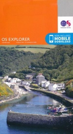
146 / Dorking, Box Hill & Reigate, Surrey, England - Kaart nummer 146 in de OS Explorer reeks omvat Reigate, Leatherhead, Caterham, Dorking, Gatwick Airport, Redhill, Horley, Box Hill, Warlingham en Couldson. Hoogtepunten van het gebied zijn onder andere: Surrey Hills AONB, het E2-pad en de North Downs Way. De OS Explorer kaart voor Dorking, Box Hill & Reigate is beschikbaar in zowel de standaard papieren versie als de weerbestendige 'Actief' versie.
146 / Dorking, Box Hill & Reigate, Surrey, England - Map sheet number 146 in the OS Explorer series covers Reigate, Leatherhead, Caterham, Dorking, Gatwick Airport, Redhill, Horley, Box Hill, Warlingham and Couldson. Highlights of the area include: Surrey Hills AONB, the E2 Path and the North Downs Way. The OS Explorer map for Dorking, Box Hill & Reigate is available in both the standard paper version and weatherproof 'Active' version.
Locatie op kaart
Gekoppelde artikelen

Wandelkaart 146 Dorking- Box Hill & Reigate- Surrey - OSI • 9780319243398
standaard versieWandelkaart Dorking- Box Hill & Reigate - Surrey England Productbeschrijving: Leatherhead & Caterham. 146 / Dorking, Box Hill & Reigate, Surrey, England - Kaart nummer 146 in de OS Explorer reeks omvat Reigate, Leatherhead, Caterham, Dorking, Gatwick Airport, Redhill, Horley, Box Hill, Warlingham en Couldson. Hoogtepunten van het gebied zijn onder andere: Surrey Hills AONB, het E2-pad …

Wandelkaart 146 Dorking Box Hill & Reigate Surrey - OSI • 9780319470183
weatherproof versieWandelkaart Dorking- Box Hill & Reigate - Surrey S. England Omvat ook: Leatherhead & Caterham. Productbeschrijving: Kaart nummer 146 in de OS Explorer reeks omvat Reigate, Leatherhead, Caterham, Dorking, Gatwick Airport, Redhill, Horley, Box Hill, Warlingham en Couldson. Hoogtepunten van het gebied zijn onder andere: Surrey Hills AONB, & het E2-pad en de North Downs Way. De OS Explorer…
Overzichtskaarten

OSI Explorer & Explorer Active - Zuid England
OSI Explorer & Explorer Active - Zuid England

Producten op de overzichtskaart
Klik op een product om naar de detailpagina te gaan.
- Wandelkaart 117 Cerne Abbas & Bere Regis - Dorset - OSI
- Wandelkaart 118 Shaftesbury & Cranbourne Chase - OSI
- Wandelkaart 129 Yeovil & Sherborne - Somerset - OSI
- Wandelkaart 130 Salisburry & Stonehenge- Wiltshire - OSI
- Wandelkaart 131 Romsey & Andover - Hampshire - OSI
- Wandelkaart 135 Ashdown Forest - East Sussex - OSI
- Wandelkaart 141 Cheddar Gorge & Mendip Hills - OSI
- Wandelkaart 142 Shepton Mallet & Mendip Hills - OSI
- Wandelkaart 143 Warminster & Trowbridge - Wiltshire - OSI
- Wandelkaart 144 Basingstoke - Alton & Whitchurch - OSI
- Wandelkaart 145 Guildford & Farnham- Surrey - OSI
- Wandelkaart 146 Dorking- Box Hill & Reigate- Surrey - OSI
- Wandelkaart 147 Sevenoaks & Tonbridge- Kent - OSI
- Wandelkaart 154 Bristol West & Portishead- Bristol - OSI
- Wandelkaart 155 Bristol & Bath & Bristol Area - OSI
- Wandelkaart 156 Chippenham & Bradford-on-Avon - OSI
- Wandelkaart 157 Marlborough & Savernake Forest - OSI
- Wandelkaart 158 Newbury & Hungerford- Berkshire - OSI
- Wandelkaart 159 Reading- S.E. England - OSI
- Wandelkaart 160 Windsor- Weybridge & Bracknell - OSI
- Wandelkaart 161 London South - OSI
- Wandelkaart 162 Greenwich & Gravesend - OSI
- Wandelkaart 167 Thornbury- Dursley & Yate - England- OSI
- Wandelkaart 168 Stroud- Tetbury & Malmesbury - OSI
- Wandelkaart 169 Cirencester & Swindon - England - OSI
- Wandelkaart 170 Abingdon & Wantage - Oxfordshire - OSI
- Wandelkaart 171 Chiltern Hills West AONB - Wycombe - OSI
- Wandelkaart 172 Chiltern Hills East AONB - Wycombe - OSI
- Wandelkaart 173 London North- England - OSI
- Wandelkaart 174 Epping Forest & Lee Valley- Essex - OSI
- Wandelkaart 179 Gloucester- Cheltenham & Stroud - OSI
- Wandelkaart 180 Oxford- England - OSI
- Wandelkaart 181 Chiltern Hills North AONB- Wycombe - OSI
- Wandelkaart 182 St-Albans & Hatfield- Hertfordshire - OSI
- Wandelkaart OL03 Meon Valley Portsmouth - OS
- Wandelkaart OL08 Chichester- South Harting & Selsey - OS
- Wandelkaart OL10 Arundel- Pulborough & Worthing - OS
- Wandelkaart OL11 Brighton- Hove & South Downs NP - OS
- Wandelkaart OL22 New Forest National Park - OS
- Wandelkaart OL25 Eastbourne & Beachy Head - OS
- Wandelkaart OL29 Isle of Wight South East England - OS
- Wandelkaart OL32 Winchester, New Alresford & East Meon - OS
- Wandelkaart OL33 Haslemere & Petersfield - OS
- Wandelkaart OL34 Crawley & Horsham - Ordnance Survey

OSI Explorer & Explorer Active - Zuid Oost England - Kent & London
OSI Explorer & Explorer Active - Zuid Oost England - Kent & London

Producten op de overzichtskaart
Klik op een product om naar de detailpagina te gaan.
- Wandelkaart OL03 Meon Valley Portsmouth - OS
- Wandelkaart OL08 Chichester- South Harting & Selsey - OS
- Wandelkaart OL10 Arundel- Pulborough & Worthing - OS
- Wandelkaart OL11 Brighton- Hove & South Downs NP - OS
- Wandelkaart OL22 New Forest National Park - OS
- Wandelkaart OL25 Eastbourne & Beachy Head - OS
- Wandelkaart OL32 Winchester, New Alresford & East Meon - OS
- Wandelkaart OL29 Isle of Wight & Cowes - OSI
- Wandelkaart OL29 Isle of Wight South East England - OS
- Wandelkaart OL33 Haslemere & Petersfield - OS
- Wandelkaart OL33 Haslemere & Petersfield - OS
- Wandelkaart OL45 The Cotswolds AONB - OS
- Wandelkaart 118 Shaftesbury & Cranbourne Chase - OSI
- Wandelkaart 124 Hastings & Bexhill East Sussex - OSI
- Wandelkaart 124 Hastings & Bexhill East Sussex - OSI
- Wandelkaart 125 Romney Marsh Rye & Winchelsea - OSI
- Wandelkaart 130 Salisburry & Stonehenge- Wiltshire - OSI
- Wandelkaart 131 Romsey & Andover - Hampshire - OSI
- Wandelkaart 135 Ashdown Forest - East Sussex - OSI
- Wandelkaart 136 High Weald Royal Tunbridge Wells - OSI
- Wandelkaart 137 Ashford, Kent England - OSI
- Wandelkaart 138 Dover Folkstone & Hythe Kent - OSI
- Wandelkaart 144 Basingstoke - Alton & Whitchurch - OSI
- Wandelkaart 145 Guildford & Farnham- Surrey - OSI
- Wandelkaart 146 Dorking- Box Hill & Reigate- Surrey - OSI
- Wandelkaart 147 Sevenoaks & Tonbridge- Kent - OSI
- Wandelkaart 148 Maidstone & Medway Towns Kent - OSI
- Wandelkaart 149 Sittingbourne & Faversham- Kent - OSI
- Wandelkaart 150 Canterbury & Isle of Thanet- Kent - OSI
- Wandelkaart 157 Marlborough & Savernake Forest - OSI
- Wandelkaart 158 Newbury & Hungerford- Berkshire - OSI
- Wandelkaart 159 Reading- S.E. England - OSI
- Wandelkaart 160 Windsor- Weybridge & Bracknell - OSI
- Wandelkaart 161 London South - OSI
- Wandelkaart 162 Greenwich & Gravesend - OSI
- Wandelkaart 163 Gravesend & Rochester - OSI
- Wandelkaart 169 Cirencester & Swindon - England - OSI
- Wandelkaart 170 Abingdon & Wantage - Oxfordshire - OSI
- Wandelkaart 171 Chiltern Hills West AONB - Wycombe - OSI
- Wandelkaart 172 Chiltern Hills East AONB - Wycombe - OSI
- Wandelkaart 173 London North- England - OSI
- Wandelkaart 174 Epping Forest & Lee Valley- Essex - OSI
- Wandelkaart 175 Southend-on-Sea & Basildon Essex - OSI
- Wandelkaart 176 Blackwater Estuary- Essex- England - OSI
- Wandelkaart 180 Oxford- England - OSI
- Wandelkaart 181 Chiltern Hills North AONB- Wycombe - OSI
- Wandelkaart 182 St-Albans & Hatfield- Hertfordshire - OSI
- Wandelkaart 183 Chelmsford & the Rodings- Essex - OSI
- Wandelkaart 191 Banbury- Bicester & Chipping Norton- OSI
- Wandelkaart 192 Buckingham & Milton Keynes - OSI
- Wandelkaart 193 Luton & Stevenage- Bedfordshire - OSI
- Wandelkaart 194 Dorchester & Weymouth Dorset - OSI
- Wandelkaart 195 Braintree & Saffron Walden Essex - OSI
- Wandelkaart 196 Sudbury Hadleigh & Dedham Vale - OSI
- Wandelkaart 197 Ipswich Felixstowe & Harwich - OSI
- Wandelkaart 205 Stratford-upon-Avon & Evesham - OSI
- Wandelkaart 206 Edge Hill & Fenny Compton - OSI
- Wandelkaart 207 Newport Pagnell & Northampton - OSI
- Wandelkaart 208 Bedford & St Neots- Bedforeshire - OSI
- Wandelkaart 209 Cambridge - England - OSI
- Wandelkaart 210 Newmarket- Haverhill & Barrow - OSI
Artikelen uit dezelfde regio

Wandelkaart OL33 Haslemere & Petersfield - OS • 9780319242728
Wandelkaart Haslemere & Petersfield - OS Productomschrijving: Haslemere, Petersfield, Midhurt & Selborne. Omvat: Haslemere, Petersfield, Midhurst and Selborne, South Downs National Park, Surrey Hills and the Sussex Border Path, Greensand Way, Hangers Way, the River Rother and New Lipchis Way Ontdek de OL-serie van Ordnance Survey: De OL-serie (Outdoor Leisure) van Ordnance Surve…
Wandelkaart 145 Guildford & Farnham- Surrey - OSI • 9780319243381
Wandelkaart Guildford & Farnham- Surrey England Productbeschrijving: Guildford & Farnham- Surrey zijn plaatsen in het bestuurlijke gebied Guildford, in het Engelse graafschap Surrey. 145 / Guildford & Farnham, Surrey, England - Kaart nummer 145 is een all purpose kaart vol gepakt met informatie om u het gebied te helpen leren kennen. De 204 Landranger-kaarten bestrijken het land. Elke …

Reisgids Kent, Sussex & Surrey - Rough Guides • 9781835290088
Reisgids Kent, Sussex & Surrey Productomschrijving: The brand-new, full-colour Rough Guide to Kent, Sussex & Surrey is the ultimate guide to this beautiful corner of England, with clear maps and lively accounts of both the big cultural attractions and the smaller, quirkier sights, and full coverage of vibrant Brighton and historic Canterbury. The region is fast gaining a reputation as …

Wandelkaart OL33 Haslemere- Petersfield & Midhurst - OSI • 9780319469514
Wandelkaart Haslemere- Petersfield & Midhurst - Surrey England Omvat ook: Midhurst & Selborne Productbeschrijving: Kaart nummer OL 33 omvat Haslemere, Petersfield, Midhurst en Selborne. Hoogtepunten zijn het Nationaal Park South Downs, de Surrey Hills en de Sussex border path. Andere hoogtepunten van het gebied zijn Greensand way, Hangers way, de rivier Rother en nieuwe Lipchis way Dez…

Fietsgids Cycling in Surrey England - Bradt Travel guides • 9781804691359
Cycling in Surrey - Bradt Travel guides Productomschrijving: De nieuwe fietsgids voor Surrey - is onderdeel van een groeiende serie ontworpen voor in de zadeltas - biedt 21 routes, elk inclusief uitgebreide routebeschrijvingen plus contextuele verkenning van geschiedenis, natuur en cultuur, geschreven door fervent fietser en historicus Ross Hamilton. Elke route is gekoppeld aan OS Explorer…