
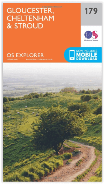
Wandelkaart 179 Gloucester Cheltenham & Stroud - OSI
Omvat de omgeving van Gloucester & Cheltenham
Korte omschrijving
Wandelkaart Gloucester- Cheltenham & Stroud - Gloucestershire Productbeschrijving: Gloucester & Cheltenham 179 / Gloucester, Cheltenham & Stroud, Gloucestershire, England - Kaart nummer ...

Specificaties
- Uitgever: Ordnance Survey
- ISBN-13: 9780319243725
- HOOFDCATEGORIEËN: Wandelkaart
- Activiteiten: Wandelen, Hiking & Trekking
- Regio: Gloucestershire, Egland
- Land: England
- Schaal: 1:25000
- Afmeting: 13x23
- Taal: Engels
- Reeks: Explorer Series
Volledige omschrijving
Wandelkaart Gloucester- Cheltenham & Stroud - Gloucestershire
Productbeschrijving: Gloucester & Cheltenham
179 / Gloucester, Cheltenham & Stroud, Gloucestershire, England - Kaart nummer 179 in de OS Explorer reeks heeft betrekking op de omgeving van Gloucester, Cheltenham, Stroud. Hoogtepunten van het gebied zijn onder meer: The Cotswolds AONB gebied van uitzonderlijke natuurlijke schoonheid AONB Vale van Gloucester, rivier de Severn en de wijze van de Cotswolds. De OS Explorer kaart voor Gloucester, Cheltenham & Stroud is beschikbaar in zowel de standaard papieren versie als de weerbestendige 'Actief' versie.
179 / Gloucester, Cheltenham & Stroud, Gloucestershire, England - Map sheet number 179 in the OS Explorer series covers the area around Gloucester, Cheltenham, Stroud. Highlights of the area include: Cotswolds Area of Outstanding Natural Beauty AONB, Vale of Gloucester, River Severn and the Cotswolds Way. The OS Explorer map for Gloucester, Cheltenham & Stroud is available in both the standard paper version and weatherproof 'Active' version.
.png)
Locatie op kaart
Gekoppelde artikelen

Wandelkaart 179 Gloucester Cheltenham & Stroud - OSI • 9780319243725
standaard versieWandelkaart Gloucester- Cheltenham & Stroud - Gloucestershire Productbeschrijving: Gloucester & Cheltenham 179 / Gloucester, Cheltenham & Stroud, Gloucestershire, England - Kaart nummer 179 in de OS Explorer reeks heeft betrekking op de omgeving van Gloucester, Cheltenham, Stroud. Hoogtepunten van het gebied zijn onder meer: The Cotswolds AONB gebied van uitzonderlijke natuurlijke scho…

Wandelkaart 179 Gloucester Cheltenham & Stroud - OSI • 9780319470510
weatherproof versieWandelkaart Gloucester- Cheltenham & Stroud - S.W. England Productbeschrijving: Kaart nummer 179 in de OS Explorer reeks heeft betrekking op de omgeving van Gloucester, Cheltenham, Stroud. Hoogtepunten van het gebied zijn onder andere: Cotswolds AONB gebied van uitzonderlijke natuurlijke schoonheid AONB, Vale van Gloucester, rivier de Severn en de Cotswolds way. De OS Explorer kaart voor G…
Overzichtskaarten

OSI Explorer & Explorer Active - Midden Engeland - Midlands
OSI Explorer & Explorer Active - Midden Engeland - Midlands

Producten op de overzichtskaart
Klik op een product om naar de detailpagina te gaan.
- Wandelkaart 179 Gloucester- Cheltenham & Stroud - OSI
- Wandelkaart 180 Oxford- England - OSI
- Wandelkaart 181 Chiltern Hills North AONB- Wycombe - OSI
- Wandelkaart 182 St-Albans & Hatfield- Hertfordshire - OSI
- Wandelkaart 189 Hereford & Ross-on-Wye- England - OSI
- Wandelkaart 190 Malvern Hills AONB & Bredon Hill - OSI
- Wandelkaart 191 Banbury- Bicester & Chipping Norton- OSI
- Wandelkaart 192 Buckingham & Milton Keynes - OSI
- Wandelkaart 193 Luton & Stevenage- Bedfordshire - OSI
- Wandelkaart 194 Hertford & Bishop's Stortford - OSI
- Wandelkaart 202 Leominster & Bromyard Hererfordshire - OSI
- Wandelkaart 203 Ludlow & Shropshire Hills AONB - OSI
- Wandelkaart 204 Worcester & Droitwich Spa - OSI
- Wandelkaart 205 Stratford-upon-Avon & Evesham - OSI
- Wandelkaart 206 Edge Hill & Fenny Compton - OSI
- Wandelkaart 207 Newport Pagnell & Northampton - OSI
- Wandelkaart 208 Bedford & St Neots- Bedforeshire - OSI
- Wandelkaart 209 Cambridge - England - OSI
- Wandelkaart 217 Long Mynd & Wenlock Edge - OSI
- Wandelkaart 218 Kidderminster & Wyre Forest - OSI
- Wandelkaart 219 Wolverhampton & Dudley - OSI
- Wandelkaart 220 Birmingham- West Midlands - OSI
- Wandelkaart 221 Coventry & Warwickshire - OSI
- Wandelkaart 222 Rugby & Daventry- Warwickshire - OSI
- Wandelkaart 223 Northampton & Market Harborough - OSI
- Wandelkaart 224 Corby- Kettering & Wellingborough - OSI
- Wandelkaart 225 Huntingdon & St Ives - OSI
- Wandelkaart 227 Peterborough- Cambridgeshire England - OSI
- Wandelkaart 228 March- Ely- Chatteris & Littleport - OSI
- Wandelkaart 232 Nuneaton & Tamworth- Warwickshire - OSI
- Wandelkaart 233 Leicester & Hinckley England - OSI
- Wandelkaart 234 Rutland Water & Stamford- Oakham - OSI
- Wandelkaart 235 Wisbech & Peterborough North - OSI
- Wandelkaart 241 Shrewsbury- shropshire England - OSI
- Wandelkaart 242 Telford- Ironbridge & the Wrekin - OSI
- Wandelkaart 243 Market Drayton- Schropshire - OSI
- Wandelkaart 244 Cannock Chase & Chasewater- Severn - OSI
- Wandelkaart 245 National Forest- Burton-upon-Trent - OSI
- Wandelkaart 245 National Forest - OSI
- Wandelkaart 246 Loughborough- Leicestershire England - OSI
- Wandelkaart 247 Grantham- Lincolnshire - OSI
- Wandelkaart 248 Bourne & Heckington- lincolnshire - OSI
- Wandelkaart 249 Spalding & Holbeach- Lincolnshire - OSI
- Wandelkaart 257 Crewe & Nantwich & Cheshire East - OSI
- Wandelkaart 258 Stoke-on-Trent & Newcastle-under-Lyme- OSI
- Wandelkaart 259 Derby & Utoxeter- Derbyshire - OSI
- Wandelkaart 260 Nottingham & Vale of Belvoir - OSI
- Wandelkaart 261 Boston & Lincolnshire- England - OSI
- Wandelkaart 267 Northwich & Delamere Forest - OSI
- Wandelkaart 268 Wilmslow- Macclesfield & Congleton - OSI
- Wandelkaart 269 Chesterfield & Alfreton- Derbyshire- OSI
- Wandelkaart 270 Sherwood Forest- Nottinghamshire - OSI
- Wandelkaart 271 Newark-on-Trent- Nottinghampshire - OSI
- Wandelkaart 272 Lincoln- England - OSI
- Wandelkaart 273 Lincolnshire Wolds South- England - OSI
- Wandelkaart 274 Skegness- Alford & Spilsby - OSI
- Wandelkaart 275 Liverpool- South West England - OSI
- Wandelkaart 276 Bolton- Wigan & Warrington- Machester - OSI
- Wandelkaart 277 Manchester & Salford - OSI
- Wandelkaart 278 Sheffield & Barnsley- South Yorkshire - OSI
- Wandelkaart 279 Doncaster- South Yorkshire - OSI
- Wandelkaart 280 Isle of Axholme- Lincolnshire - OSI
- Wandelkaart 281 Ancholme Valley- Lincolnshire - OSI
- Wandelkaart 282 Lincolnshire Wolds North- England - OSI
- Wandelkaart 283 Louth & Mablethorpe- Lincolnshire - OSI
- Wandelkaart 284 Grimsby- Cleethorpes & Immingham - OSI

OSI Explorer & Explorer Active - Z.W. England Devon - Cornwall
OSI Explorer & Explorer Active - Z.W. England Devon - Cornwall

Producten op de overzichtskaart
Klik op een product om naar de detailpagina te gaan.
- Wandelkaart 102 Land's End - OSI
- Wandelkaart 102 Land's End - OSI
- Wandelkaart 103 The Lizard- Cornwall England - OSI
- Wandelkaart 103 The Lizard- Cornwall England - OSI
- Wandelkaart 104 Redruth & St Agnes- Cornwall - OSI
- Wandelkaart 104 Redruth & St Agnes- Cornwall - OSI
- Wandelkaart 105 Falmouth & Mevagissey - Cornawall - OSI
- Wandelkaart 105 Falmouth & Mevagissey - Cornawall - OSI
- Wandelkaart 106 Newquay & Padstow - Cornwall - OSI
- Wandelkaart 106 Newquay & Padstow- Cornwall - OSI
- Wandelkaart 107 St-Austell & Liskeard- Cornwall - OSI
- Wandelkaart 107 St-Austell & Liskeard & Fowey- Cornwall - OSI
- Wandelkaart 108 Lower Tamar Valley & Plymouth - OSI
- Wandelkaart 108 Lower Tamer Valley & Plymouth- Cornwall - OSI
- Wandelkaart 109 Bodmin Moor- Cornwal - OSI
- Wandelkaart 109 Bodmin Moor- Cornwal - OSI
- Wandelkaart 111 Bude- Boscastle & Tintagel- Devon - OSI
- Wandelkaart 111 Bude- Boscastle & Tintagel- Devon - OSI
- Wandelkaart 112 Launceston & Holsworthy- Devon - OSI
- Wandelkaart 112 Launceston & Holsworthy- Devon - OSI
- Wandelkaart 113 Okehampton- Devon England - OSI
- Wandelkaart 113 Okehampton- Devon England - OSI
- Wandelkaart 114 Exeter & Exe Valley- Devon - OSI
- Wandelkaart 114 Exeter & Exe Valley- Devon - OSI
- Wandelkaart 115 Exmouth & Sidmouth- Devon - OSI
- Wandelkaart 115 Exmouth & Sidmouth- Devon - OSI
- Wandelkaart 116 Lyme regis & Bridport- Devon - OSI
- Wandelkaart 116 Lyme Regis & Bridport- Dorset - OSI
- Wandelkaart 117 Cerne Abbas & Bere Regis - Dorset - OSI
- Wandelkaart 117 Cerne Abbas & Bere Regis - Dorset - OSI
- Wandelkaart OL15 Purbeck- South Dorset & Poole - OSI
- Wandelkaart 118 Shaftesbury & Cranbourne Chase - OSI
- Wandelkaart 118 Shaftesbury & Cranbourne Chase - OSI
- Wandelkaart 129 Yeovil & Sherborne- Somerset - OSI
- Wandelkaart 129 Yeovil & Sherborne- Somerset - OSI
- Wandelkaart 140 Quantock Hills AONB & Bridgwater- Devon - OSI
- Wandelkaart 140 Quantock Hills AONB- Somerset - OSI
- Wandelkaart 141 Cheddar Gorge & Mendip Hills - OSI
- Wandelkaart 141Shepton Mallet & Mendip Hills East - OSI
- Wandelkaart 142 Shepton Mallet & Mendip Hills - OSI
- Wandelkaart 142 Shepton Mallet & Mendip Hills - OSI
- Wandelkaart 143 Warminster & Trowbridge- Wiltshire - OSI
- Wandelkaart 143 Warminster & Trowbridge- Wiltshire - OSI
- Wandelkaart 130 Salisburry & Stonehenge- Wiltshire - OSI
- Wandelkaart 130 Salisburry & Stonehenge- Wiltshire - OSI
- Wandelkaart 131 Romsey- Andover & Test Valley- Hampshire
- Wandelkaart 131 Romsey & Andover - Hampshire - OSI
- Wandelkaart 153 Weston-super-Mare & Bleadon Hill - OSI
- Wandelkaart 153 Weston-Super-Mare & Bleadon Hill - OSI
- Wandelkaart 154 Bristol West & Portishead- Bristol - OSI
- Wandelkaart 154 Bristol West & Portishead- Bristol area
- Wandelkaart 155 Bristol & Bath Keynsham & Marshfield - OSI
- Wandelkaart 155 Bristol & Bath- Bristol Area - OSI
- Wandelkaart 156 Chippenham & Bradford-on-Avon - OSI
- Wandelkaart 156 Chippenham & Bradford-on-Avon- Wiltshire - OSI
- Wandelkaart 157 Marlborough & Savernake Forest - OSI
- Wandelkaart 157 Marlborough & Savernake Forest - OSI
- Wandelkaart 158 Newbury & Hungerford- Berkshire - OSI
- Wandelkaart 158 Newbury & Hungerford- West Berkshire - OSI
- Wandelkaart 167 Thornbury- Dursley & Yate - England- OSI
- Wandelkaart 167 Thornbury- Dursley & Yate - England- OSI
- Wandelkaart 168 Stroud- Tetbury & Malmesbury - OSI
- Wandelkaart 168 Stroud- Tetbury & Malmesbury - OSI
- Wandelkaart 169 Cirencester & Swindon - England - OSI
- Wandelkaart 169 Cirencester & Swindon - England - OSI
- Wandelkaart 170 Abingdon & Wantage - Oxfordshire - OSI
- Wandelkaart 170 Abingdon- Wantage & Vale - OSI
- Wandelkaart 179 Gloucester- Cheltenham & Stroud - OSI
- Wandelkaart 179 Gloucester- Cheltenham & Stroud - OSI
- Wandelkaart OL45 The Cotswolds AONB- Gloucestershire - OSI
- Wandelkaart 190 Malvern Hills AONB & Bredon Hill - OSI
- Wandelkaart 190 Malvern Hills AONB & Bredon Hill - OSI
- Wandelkaart 205 Stratford-upon-Avon & Evesham - OSI
- Wandelkaart 205 Stratford-upon-Avon & Evesham - OSI
- Wandelkaart 206 Edge Hill & Fenny Compton - OSI
- Wandelkaart 206 Edge Hill & Fenny Compton - OSI

OSI Explorer & Explorer Active - Zuid England
OSI Explorer & Explorer Active - Zuid England

Producten op de overzichtskaart
Klik op een product om naar de detailpagina te gaan.
- Wandelkaart 117 Cerne Abbas & Bere Regis - Dorset - OSI
- Wandelkaart 118 Shaftesbury & Cranbourne Chase - OSI
- Wandelkaart 129 Yeovil & Sherborne - Somerset - OSI
- Wandelkaart 130 Salisburry & Stonehenge- Wiltshire - OSI
- Wandelkaart 131 Romsey & Andover - Hampshire - OSI
- Wandelkaart 135 Ashdown Forest - East Sussex - OSI
- Wandelkaart 141 Cheddar Gorge & Mendip Hills - OSI
- Wandelkaart 142 Shepton Mallet & Mendip Hills - OSI
- Wandelkaart 143 Warminster & Trowbridge - Wiltshire - OSI
- Wandelkaart 144 Basingstoke - Alton & Whitchurch - OSI
- Wandelkaart 145 Guildford & Farnham- Surrey - OSI
- Wandelkaart 146 Dorking- Box Hill & Reigate- Surrey - OSI
- Wandelkaart 147 Sevenoaks & Tonbridge- Kent - OSI
- Wandelkaart 154 Bristol West & Portishead- Bristol - OSI
- Wandelkaart 155 Bristol & Bath & Bristol Area - OSI
- Wandelkaart 156 Chippenham & Bradford-on-Avon - OSI
- Wandelkaart 157 Marlborough & Savernake Forest - OSI
- Wandelkaart 158 Newbury & Hungerford- Berkshire - OSI
- Wandelkaart 159 Reading- S.E. England - OSI
- Wandelkaart 160 Windsor- Weybridge & Bracknell - OSI
- Wandelkaart 161 London South - OSI
- Wandelkaart 162 Greenwich & Gravesend - OSI
- Wandelkaart 167 Thornbury- Dursley & Yate - England- OSI
- Wandelkaart 168 Stroud- Tetbury & Malmesbury - OSI
- Wandelkaart 169 Cirencester & Swindon - England - OSI
- Wandelkaart 170 Abingdon & Wantage - Oxfordshire - OSI
- Wandelkaart 171 Chiltern Hills West AONB - Wycombe - OSI
- Wandelkaart 172 Chiltern Hills East AONB - Wycombe - OSI
- Wandelkaart 173 London North- England - OSI
- Wandelkaart 174 Epping Forest & Lee Valley- Essex - OSI
- Wandelkaart 179 Gloucester- Cheltenham & Stroud - OSI
- Wandelkaart 180 Oxford- England - OSI
- Wandelkaart 181 Chiltern Hills North AONB- Wycombe - OSI
- Wandelkaart 182 St-Albans & Hatfield- Hertfordshire - OSI
- Wandelkaart OL22 New Forest- Southampton & Ringwood - OSI
- Wandelkaart OL32 Winchester & New Alresford - OSI
- Wandelkaart OL33 Haslemere- Petersfield & Midhurst - OSI
- Wandelkaart OL34 Crawley- Horsham & Cranleigh - OSI
- Wandelkaart OL29 Isle of Wight & Cowes - OSI
- Wandelkaart OL3 Meon Valley- Portsmouth & Gosport - OSI
- Wandelkaart OL3 Meon Valley- Portsmouth & Gosport - OSI
- Wandelkaart OL11 Brighton & Hove - Ordnance Survey
- Wandelkaart OL25 Eastbourne & Beachy Head - OSI
- Wandelkaart OL8 Chichester South Harting- England - OSI
Artikelen uit dezelfde regio

Wandelkaart XT Malvern Hills AONB England - Harvey map • 9781851376056
Wandelkaart - Malvern Hills AONB England - Harvey map Productomschrijving: Deze Mavern Hills zijn een samenstelling van heuvels in de Engelse counties, Worcestershire, Herefordshire, en een klein deel van Gloucestershire, en domineren de volledige regio rond deze counties van het district van Alvern Hills. Het hoogst gelegen punt van deze regio biedt een panorama van de Severn vallei met d…

Wandelgids The Cotswold Way - Cicerone • 9781786312105
The Cotswold Way - Cicerone Productomschrijving: Wandelgids over de Cotswold Way Nationale route. Tussen Chipping Campden en Bath verkent de 164 km lange route door de Cotswolds AONB (Area of Outstanding Natural Beauty). Beschreven in beide richtingen over 13 etappes. De Cotswold Way kan het hele jaar door belopen worden, en is geschikt voor beginnende wandelaars. Inclusief apart OS 1:25.0…

Wandelkaart 168 Stroud- Tetbury & Malmesbury - OSI • 9780319470404
Wandelkaart Stroud- Tetbury & Malmesbury - England Productbeschrijving: Kaart nummer 168 in de OS Explorer kaarten reeks omvat Stroud, Tetbury, Malmesbury en Nailsworth. Hoogtepunten van het gebied zijn onder meer: Cotswolds AONB, Cotswold Way, Monarch Way en de Thames Path. De OS Explorer kaart voor Stroud, Tetbury & Malmesbury is beschikbaar in zowel de standaard papieren versie als de w…
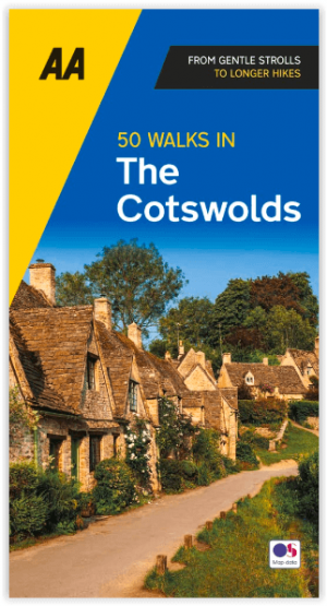
Wandelgids Cotswolds AONB 50 walks guide - AA Publishing • 9780749583224
Cotswolds AONB - 50 walks guide - AA Publishing Productomschrijving: Wandelen is een van de favoriete vrijetijdsbestedingen van Groot-Brittannië. AA 50 Walks in the Cotswolds bevat een verscheidenheid aan uitgestippelde wandelingen van 3 tot 12 km, geschikt voor alle niveaus. Het boek bevat alle praktische details die u nodig hebt, vergezeld van boeiende achtergrondinformatie over de gesch…

Fotoboek Cotswold - The landscape of Britain - Goldeneye • 9781859652312
Fotoboek Cotswold Collection - The landscape of Britain Productomschrijving: Dit prachtig geproduceerde boek van fotografie vangt de essentie van de Cotswolds op, van de huiselijke dorpen, de kerken en de landhuizen, naar de betoverende wildernis van de zachte riviervalleien en glooiende heuvels - een vertrouwd landschap gevangen op een unieke en opvallende manier. De foto's werden sa…