

Wandelkaart 167 Thornbury- Dursley & Yate - England- OSI
Omvat de Cotswold Way- Offa's Dyke Path & de Jubilee Way

Korte omschrijving
Wandelkaarten Gloucestershire, Egland van Ordnance Survey. Ideaal voor tochten in England.
Wandelkaart Thornbury- Dursley & Yate - Gloucestershire Omvat ook: Berkeley & Wotton-under-Edge. Productbeschrijving: Kaart nummer 167 in de OS Explorer-reeks omvat het gebied ten noorde...

Specificaties
- Uitgever: Ordnance Survey
- ISBN-13: 9780319470398
- HOOFDCATEGORIEËN: Wandelkaart
- Activiteiten: Wandelen, Hiking & Trekking
- Regio: Gloucestershire, Egland
- Land: England
- Waterafstotende kaart: Ordnance Survey ACTIVE Explorer Weatherproof Maps
- TOPO's & Stafkaarten: Topografisch wandelen
- Schaal: 1:25000
- Taal: Engels
- Reeks/Serie: Explorer ACTIVE Series OSI
Volledige omschrijving
Wandelkaart Thornbury- Dursley & Yate - Gloucestershire
Omvat ook: Berkeley & Wotton-under-Edge.
Productbeschrijving: Kaart nummer 167 in de OS Explorer-reeks omvat het gebied ten noorden van Bristol langs de rivier de Severn tussen Engeland en Wales. Hoogtepunten van het gebied zijn ondermeer: Forest of Avon, de Cotswolds en de Wye Valley, met inbegrip van de Cotswold Way Offa's Dyke Path en de Jubilee Way. Steden die zijn opgenomen in het gebied zijn Thornbury, Yate, Dursley, Wotton-under-Edge, Berkeley en Chepstow. De OS Explorer kaart voor Thornbury, Dursley & Yate is beschikbaar in zowel de standaard papieren versie als de weerbestendige 'Actief' versie.
Productdiscription: Map sheet number 167 in the OS Explorer series covers the area north of Bristol along the River Severn between England and Wales. Highlights of the area include: Forest of Avon, Cotswolds and Wye Valley, including the Cotswold Way, Offa's Dyke Path and Jubilee Way. Towns included in the area covered are Thornbury, Yate, Dursley, Wotton-under-Edge, Berkeley and Chepstow. The OS Explorer map for Thornbury, Dursley & Yate is available in both the standard paper version and weatherproof 'Active' version.
Locatie op kaart
Gekoppelde artikelen

Wandelkaart 167 Thornbury- Dursley & Yate - England- OSI • 9780319243602
standaard versieWandelkaart Thornbury- Dursley & Yate - Gloucestershire Omvat ook: Berkeley & Wotton-under-Edge Productomschrijving: Kaart nummer 167 in de OS Explorer kaarten reeks omvat het gebied ten noorden van Bristol langs de rivier de Severn tussen Engeland en Wales. Hoogtepunten van het gebied: forest of Avon, de Cotswolds en de Wye Valley, met inbegrip van de Cotswold way, Offa's Dyke Path en…

Wandelkaart 167 Thornbury- Dursley & Yate - England- OSI • 9780319470398
weatherproof versieWandelkaart Thornbury- Dursley & Yate - Gloucestershire Omvat ook: Berkeley & Wotton-under-Edge. Productbeschrijving: Kaart nummer 167 in de OS Explorer-reeks omvat het gebied ten noorden van Bristol langs de rivier de Severn tussen Engeland en Wales. Hoogtepunten van het gebied zijn ondermeer: Forest of Avon, de Cotswolds en de Wye Valley, met inbegrip van de Cotswold Way Offa's Dyke …
Overzichtskaarten

OSI Explorer & Explorer Active - Z.W. England Devon - Cornwall
OSI Explorer & Explorer Active - Z.W. England Devon - Cornwall

Producten op de overzichtskaart
Klik op een product om naar de detailpagina te gaan.
- Wandelkaart 102 Land's End - OSI
- Wandelkaart 102 Land's End - OSI
- Wandelkaart 103 The Lizard- Cornwall England - OSI
- Wandelkaart 103 The Lizard- Cornwall England - OSI
- Wandelkaart 104 Redruth & St Agnes- Cornwall - OSI
- Wandelkaart 104 Redruth & St Agnes- Cornwall - OSI
- Wandelkaart 105 Falmouth & Mevagissey - Cornawall - OSI
- Wandelkaart 106 Newquay & Padstow - Cornwall - OSI
- Wandelkaart 107 St-Austell & Liskeard- Cornwall - OSI
- Wandelkaart 108 Lower Tamar Valley & Plymouth - OSI
- Wandelkaart 109 Bodmin Moor- Cornwal - OSI
- Wandelkaart 111 Bude- Boscastle & Tintagel- Devon - OSI
- Wandelkaart 112 Launceston & Holsworthy- Devon - OSI
- Wandelkaart 113 Okehampton- Devon England - OSI
- Wandelkaart 113 Okehampton- Devon England - OSI
- Wandelkaart 114 Exeter & Exe Valley- Devon - OSI
- Wandelkaart 114 Exeter & Exe Valley- Devon - OSI
- Wandelkaart 115 Exmouth & Sidmouth- Devon - OSI
- Wandelkaart 115 Exmouth & Sidmouth- Devon - OSI
- Wandelkaart 116 Lyme regis & Bridport- Devon - OSI
- Wandelkaart 116 Lyme Regis & Bridport- Dorset - OSI
- Wandelkaart 117 Cerne Abbas & Bere Regis - Dorset - OSI
- Wandelkaart 117 Cerne Abbas & Bere Regis - Dorset - OSI
- Wandelkaart OL15 Purbeck- South Dorset & Poole - OSI
- Wandelkaart 118 Shaftesbury & Cranbourne Chase - OSI
- Wandelkaart 118 Shaftesbury & Cranbourne Chase - OSI
- Wandelkaart 129 Yeovil & Sherborne- Somerset - OSI
- Wandelkaart 129 Yeovil & Sherborne- Somerset - OSI
- Wandelkaart 140 Quantock Hills AONB & Bridgwater- Devon - OSI
- Wandelkaart 140 Quantock Hills AONB- Somerset - OSI
- Wandelkaart 141 Cheddar Gorge & Mendip Hills - OSI
- Wandelkaart 141 Shepton Mallet & Mendip Hills East - OSI
- Wandelkaart 142 Shepton Mallet & Mendip Hills - OSI
- Wandelkaart 142 Shepton Mallet & Mendip Hills - OSI
- Wandelkaart 143 Warminster & Trowbridge- Wiltshire - OSI
- Wandelkaart 143 Warminster & Trowbridge- Wiltshire - OSI
- Wandelkaart 130 Salisburry & Stonehenge- Wiltshire - OSI
- Wandelkaart 130 Salisburry & Stonehenge- Wiltshire - OSI
- Wandelkaart 131 Romsey- Andover & Test Valley- Hampshire
- Wandelkaart 131 Romsey & Andover - Hampshire - OSI
- Wandelkaart 153 Weston-super-Mare & Bleadon Hill - OSI
- Wandelkaart 153 Weston-Super-Mare & Bleadon Hill - OSI
- Wandelkaart 154 Bristol West & Portishead- Bristol - OSI
- Wandelkaart 154 Bristol West & Portishead- Bristol area
- Wandelkaart 155 Bristol & Bath Keynsham & Marshfield - OSI
- Wandelkaart 155 Bristol & Bath- Bristol Area - OSI
- Wandelkaart 156 Chippenham & Bradford-on-Avon - OSI
- Wandelkaart 156 Chippenham & Bradford-on-Avon- Wiltshire - OSI
- Wandelkaart 157 Marlborough & Savernake Forest - OSI
- Wandelkaart 157 Marlborough & Savernake Forest - OSI
- Wandelkaart 158 Newbury & Hungerford- Berkshire - OSI
- Wandelkaart 158 Newbury & Hungerford- West Berkshire - OSI
- Wandelkaart 167 Thornbury- Dursley & Yate - England- OSI
- Wandelkaart 167 Thornbury- Dursley & Yate - England- OSI
- Wandelkaart 168 Stroud- Tetbury & Malmesbury - OSI
- Wandelkaart 168 Stroud- Tetbury & Malmesbury - OSI
- Wandelkaart 169 Cirencester & Swindon - England - OSI
- Wandelkaart 169 Cirencester & Swindon - England - OSI
- Wandelkaart 170 Abingdon & Wantage - Oxfordshire - OSI
- Wandelkaart 170 Abingdon- Wantage & Vale - OSI
- Wandelkaart 179 Gloucester- Cheltenham & Stroud - OSI
- Wandelkaart 205 Stratford-upon-Avon & Evesham - OSI
- Wandelkaart 205 Stratford-upon-Avon & Evesham - OSI
- Wandelkaart 206 Edge Hill & Fenny Compton - OSI
- Wandelkaart 206 Edge Hill & Fenny Compton - OSI
- Wandelkaart OL09 Exmoor NP Devon England - OS
- Wandelkaart OL15 Purbeck & South Dorset - OS
- Wandelkaart OL20 South Devon & Dartmoor NP - OS
- Wandelkaart OL22 New Forest National Park - OS
- Wandelkaart OL28 Dartmoor National Park - OS
- Wandelkaart OL45 The Cotswolds AONB - OS
Artikelen uit dezelfde regio

Wandelgids The Offa's Dyke Path - England & Wales - Cicerone • 9781852847760
Wandelgids The Offa's Dyke Path - Wales - Cicerone Productomschrijving: Deze gids beschrijft het Offa's Dyke Path National Trail, een langeafstandswandeling van 283 km langs de Engels-Welshe grens tussen Sedbury (bij Chepstow) en Prestatyn. De gids is opgedeeld in 12 etappes met suggesties voor het plannen van alternatieve routes. Met 1:25K OSI (Ordnance Servey) kaart boekje. Engelse o…
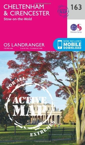
Wandelkaart 163 Cheltenham & Cirencester- England - OSI • 9780319474860
Wandelkaart Cheltenham & Cirencester - Gloucestershire England Productbeschrijving: De way of the Cotswold, Thames path en de Europese lange afstand pad, doorsnijden allemaal de op de OS Landranger vallende regio E2 kaart 163, waardoor het een fantastische locatie is om te wandelen en het landschap op te nemen. Cheltenham, het Cultuurcentrum vernoemd naar de Cotswolds, is een historische s…

Wandelgids & Fietsgids - The Cotswold AONB - Cicerone • 9781852847067
Wandelgids & Fietsgids - The Cotswold AONB - Cicerone Productomschrijving: De Cotswolds is de thuisbasis van mooie honing-hued stenen dorpen in een glooiende landschap. De dramatische 100-mijl lange kalkstenen helling biedt een adembenemend uitzicht, terwijl het netwerk van rustige wegen, fietsvriendelijke kanaalwegen, sporen en ruiterpaden perfect is voor verkenning op een fiets. De Cotwo…

Wandelkaart 168 Stroud- Tetbury & Malmesbury - OSI • 9780319470404
Wandelkaart Stroud- Tetbury & Malmesbury - England Productbeschrijving: Kaart nummer 168 in de OS Explorer kaarten reeks omvat Stroud, Tetbury, Malmesbury en Nailsworth. Hoogtepunten van het gebied zijn onder meer: Cotswolds AONB, Cotswold Way, Monarch Way en de Thames Path. De OS Explorer kaart voor Stroud, Tetbury & Malmesbury is beschikbaar in zowel de standaard papieren versie als de w…

Wandelkaart Offa's Dyke Path- Route Map Booklet - Cicerone • 9781852848941
Wandelkaart boekje - Offa's Dyke Path - Cicerone Productomschrijving: Kaartboekje van het 177 mijl (283 km) lange Offa's Dyke Path National Trail, tussen Sedbury (bij Chepstow) en Prestatyn. Het pad is in 2 weken te lopen en is geschikt voor wandelaars van alle ervaringsniveaus. Dit compacte boekje met OS 1:25,000 kaarten toont de volledige route en biedt alle kaarten die u nodig heeft, e…