

Wandelkaart 114 Anglesey & Ynys Môn- N.W. Wales - OSI
Anglesey & Ynys Môn- een unieke wandelplaats

Korte omschrijving
Wandelkaarten Wales van Ordnance Survey. Ideaal voor tochten in Wales.
Wandelkaart Anglesey & Ynys Môn North West Wales - OSI Productbeschrijving: Kaart nummer 114 is een all purpose kaart vol gepakt met informatie om u het gebied te helpen leren kennen. De 20...

Specificaties
- Uitgever: Ordnance Survey
- ISBN-13: 9780319262122
- HOOFDCATEGORIEËN: Wandelkaart
- Activiteiten: Wandelen, Hiking & Trekking
- Regio: Wales
- Land: Wales
- TOPO's & Stafkaarten: Topografisch wandelen
- Schaal: 1:50000
- Taal: Engels
- Reeks/Serie: Landranger Series OSI
Volledige omschrijving
Wandelkaart Anglesey & Ynys Môn North West Wales - OSI
Productbeschrijving: Kaart nummer 114 is een all purpose kaart vol gepakt met informatie om u het gebied te helpen leren kennen. De 204 Landranger-kaarten bestrijken het land. Elke kaart heeft een oppervlakte van 40 km door 40 km (25 mijl door 25 mijl) en zoals andere kaarten van Ordnance Survey, National Grid-vierkanten worden verstrekt zodat elke functie een unieke referentienummer kan worden gegeven.
Anglesey, is een eiland en bestuurlijk graafschap aan de noordwestkust van Wales. Het vormt een onderdeel van het ceremoniële behouden graafschap Gwynedd en is tevens een historisch graafschap.
Productdiscription: The OS Landranger Map series covers Great Britain with 204 detailed maps, perfect for day trips and short breaks. Each map provides all the information you need to get to know your local area and includes places of interest, tourist information, picnic areas and camp sites, plus Rights of Way information for England and Wales. OS Landranger now includes a digital version of the paper map, accessed through the OS smartphone app, OS Maps.
Locatie op kaart
Gekoppelde artikelen

Wandelkaart 114 Anglesey & Ynys Môn- N.W. Wales - OSI • 9780319262122
standaard versieWandelkaart Anglesey & Ynys Môn North West Wales - OSI Productbeschrijving: Kaart nummer 114 is een all purpose kaart vol gepakt met informatie om u het gebied te helpen leren kennen. De 204 Landranger-kaarten bestrijken het land. Elke kaart heeft een oppervlakte van 40 km door 40 km (25 mijl door 25 mijl) en zoals andere kaarten van Ordnance Survey, National Grid-vierkanten worden verstr…

Wandelkaart 114 Anglesey- North West Wales - OSI • 9780319474372
weatherproof versieWandelkaart Anglesey - North West Wales - OSI Productbeschrijving: Kaart nummer 114 in de reeks van de OS Landranger kaarten bestrijkt het platteland Welsh eiland Anglesey. Het is omringd door zandstranden en rotsachtige grotten, met het binnenland dat deel is van het eiland wordt meestal landbouw geteelt. Anglesey is briljant geschikt voor toeristen met een ruime keuze aan accommodatie en…
Overzichtskaarten

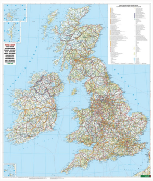
OSI Landranger & Landranger Active - Wales
OSI Landranger & Landranger Active - Wales

Producten op de overzichtskaart
Klik op een product om naar de detailpagina te gaan.
- Wandelkaart 108 Liverpool & Southport - England - OSI
- Wandelkaart 108 Liverpool- Merseyside England - OSI
- Wandelkaart 109 Greater Manchester England - OSI
- Wandelkaart 109 Manchester- Bolton & Warrington - OSI
- Wandelkaart 114 Anglesey & Ynys Môn- N.W. Wales - OSI
- Wandelkaart 114 Anglesey- North West Wales - OSI
- Wandelkaart 115 Snowdon & Caernarfon- Snowdonia NP - OSI
- Wandelkaart 115 Snowdon & Yr Wyddfa - Snowdonia NP - OSI
- Wandelkaart 116 Denbigh & Colwyn Bay - North Wales - OSI
- Wandelkaart 116 Denbigh & Colwyn Bay - North Wales - OSI
- Wandelkaart 117 Chester & Wrexham - Ellesmere Port - OSI
- Wandelkaart 117 Chester & Wrexham - West Cheshire - OSI
- Wandelkaart 118 Stoke-on-Trent & Macclesfield - OSI
- Wandelkaart 118 Stoke-on-Trent & Macclesfield - OSI
- Wandelkaart 123 Lleyn Peninsula - North Wales - OSI
- Wandelkaart 123 Lleyn Peninsula - North Wales - OSI
- Wandelkaart 124 Porthmadog & Dolgellau - N. Wales - OSI
- Wandelkaart 124 Porthmadog & Dolgellau - N. Wales - OSI
- Wandelkaart 125 Bala & Lake Vyrnwy- N. Wales - OSI
- Wandelkaart 125 Bala & Lake Vyrnwy- Gwynedd - OSI
- Wandelkaart 126 Shrewsbury & Oswestry - England - OSI
- Wandelkaart 126 Shrewsbury & Oswestry - England - OSI
- Wandelkaart 127 Stafford & Telford - Ironbridge England - OSI
- Wandelkaart 127 Stafford & Telford - Staffordshire England - OSI
- Wandelkaart 135 Aberystwyth & Machynlleth Wales - OSI
- Wandelkaart 135 Aberystwyth & Machynlleth Wales - OSI
- Wandelkaart 136 Newtown & Lllanidloes Wales - OSI
- Wandelkaart 136 Newtown & Llanidloes - OSI
- Wandelkaart 137 Ludlow & Church Stretton - England - OSI
- Wandelkaart 137 Ludlow & Church Stretton - England - OSI
- Wandelkaart 138 Kidderminster & Wyre Forest - OSI
- Wandelkaart 138 Kidderminster & Wyre Forest - OSI
- Wandelkaart 145 Cardigan & Mynydd Preseli - OSI
- Wandelkaart 145 Cardigan & Mynydd Preseli - OSI
- Wandelkaart 146 Lampeter & Llandovery - Ceredigion - OSI
- Wandelkaart 146 Lampeter & Llandovery - Ceredigion - OSI
- Wandelkaart 147 Elan valley & Builth Wells - Wales - OSI
- Wandelkaart 147 Elan Valley & Builth Wells - Wales - OSI
- Wandelkaart 148 Presteigne & Hay-on-Wye - S. Wales - OSI
- Wandelkaart 148 Presteigne & Hay-on-Wye - S. Wales - OSI
- Wandelkaart 149 Hereford & Leominster - England - OSI
- Wandelkaart 149 Hereford & Leominster - England - OSI
- Wandelkaart 150 Worcester & The Malverns - England - OSI
- Wandelkaart 150 Worcester & The Malverns - England - OSI
- Wandelkaart 157 St-David's & Haverfordwest - Wales - OSI
- Wandelkaart 157 St-David's & Haverfordwest - Wales - OSI
- Wandelkaart 158 Tenby & Pembroke - Wales - OSI
- Wandelkaart 158 Tenby & Pembroke - Wales - OSI
- Wandelkaart 159 Swansea & Gower- South Wales - OSI
- Wandelkaart 159 Swansea- Gower & Carmarthen - OSI
- Wandelkaart 160 Brecon Beacons NP - Powys Wales - OSI
- Wandelkaart 160 Brecon Beacons NP - Powys Wales - OSI
- Wandelkaart 161 Black Mountains & Brecon Beacons NP - OSI
- Wandelkaart 161 Black Mountains & Brecon Beacons NP - OSI
- Wandelkaart 162 Gloucester & Forest of Dean - OSI
- Wandelkaart 170 Vale of Glamorgan - Wales- OSI
- Wandelkaart 170 Vale of Glamorgan - Wales - OSI
- Wandelkaart 171 Cardiff & Newport - South Wales - OSI
- Wandelkaart 171 Cardiff & Newport - Pontypool South Wales - OSI
- Wandelkaart 172 Bristol & Bath- S.W. England - OSI
- Wandelkaart 172 Bristol- Bath & Thornbury- S.W. England - OSI

OSI Landranger & Landranger Active - Midden Engeland - Midland's
OSI Landranger & Landranger Active - Midden Engeland - Midland's

Producten op de overzichtskaart
Klik op een product om naar de detailpagina te gaan.
- Wandelkaart 102 Preston & Blackpool- Lancashire - OSI
- Wandelkaart 102 Preston & Blackpool- Lytham - OSI
- Wandelkaart 103 Blackburn & Burnley- N.W. England - OSI
- Wandelkaart 103 Blackburn- Burnley & Clitheroe - OSI
- Wandelkaart 104 Leeds & Bradford & Harrogate - OSI
- Wandelkaart 104 Leeds & Bradford - West Yorkshire - OSI
- Wandelkaart 105 York & Selby- North Yorkshire - OSI
- Wandelkaart 105 York & Selby- North Yorkshire - OSI
- Wandelkaart 106 Market Weighton- East Riding of Yorkshire - OSI
- Wandelkaart 106 Market Weighton- Goole- England - OSI
- Wandelkaart 107 Kingston upon Hull- Beverley - OSI
- Wandelkaart 107 Kingston upon Hull- Yorkshire - OSI
- Wandelkaart 108 Liverpool & Southport - England - OSI
- Wandelkaart 108 Liverpool & Merseyside - England - OSI
- Wandelkaart 109 Greater Manchester England - OSI
- Wandelkaart 109 Manchester- Bolton & Warrington - OSI
- Wandelkaart 110 Sheffield & Huddersfield - Glossop - OSI
- Wandelkaart 110 Sheffield & Huddersfield - Yorkshire - OSI
- Wandelkaart 111 Sheffield & Doncaster- Rotherham - OSI
- Wandelkaart 111 Sheffield & Doncaster England - OSI
- Wandelkaart 112 Scunthorpe & Gainsborough - OSI
- Wandelkaart 112 Scunthorpe & Gainsborough - OSI
- Wandelkaart 113 Grimsby- Louth & Market Rasen - OSI
- Wandelkaart 113 Grimsby- North East Lincolnshire - OSI
- Wandelkaart 114 Anglesey & Ynys Môn- N.W. Wales - OSI
- Wandelkaart 114 Anglesey- North West Wales - OSI
- Wandelkaart 115 Snowdon & Caernarfon- Snowdonia NP - OSI
- Wandelkaart 115 Snowdon & Yr Wyddfa - Snowdonia NP - OSI
- Wandelkaart 116 Denbigh & Colwyn Bay - North Wales - OSI
- Wandelkaart 116 Denbigh & Colwyn Bay - North Wales - OSI
- Wandelkaart 117 Chester & Wrexham - Ellesmere Port - OSI
- Wandelkaart 117 Chester & Wrexham - West Cheshire - OSI
- Wandelkaart 118 Stoke-on-Trent & Macclesfield - OSI
- Wandelkaart 118 Stoke-on-Trent & Macclesfield - OSI
- Wandelkaart 119 Buxton & Matlock- Derbyshire - OSI
- Wandelkaart 119 Buxton- Matlock & Chesterfield - OSI
- Wandelkaart 120 Mansfield & Sherwood Forest - OSI
- Wandelkaart 120 Mansfield - Nottinghamshire - OSI
- Wandelkaart 121 Lincoln & Newark-on-Trent- England - OSI
- Wandelkaart 121 Lincoln & Newark-on-Trent- England - OSI
- Wandelkaart 122 Skegness & Horncastle - England - OSI
- Wandelkaart 122 Skegness & Horncastle - England - OSI
- Wandelkaart 123 Lleyn Peninsula - North Wales - OSI
- Wandelkaart 123 Lleyn Peninsula - North Wales - OSI
- Wandelkaart 124 Porthmadog & Dolgellau - N. Wales - OSI
- Wandelkaart 124 Porthmadog & Dolgellau - N. Wales - OSI
- Wandelkaart 125 Bala & Lake Vyrnwy- Gwynedd - OSI
- Wandelkaart 125 Bala & Lake Vyrnwy- N. Wales - OSI
- Wandelkaart 126 Shrewsbury & Oswestry - England - OSI
- Wandelkaart 126 Shrewsbury & Oswestry - England - OSI
- Wandelkaart 127 Stafford & Telford - Ironbridge England - OSI
- Wandelkaart 127 Stafford & Telford - Staffordshire England - OSI
- Wandelkaart 128 Derby & Burton upon Trent - England - OSI
- Wandelkaart 128 Derby & Burton upon Trent - England - OSI
- Wandelkaart 129 Nottingham & Loughborough - England - OSI
- Wandelkaart 129 Nottingham & Loughborough - England - OSI
- Wandelkaart 130 Grantham- Lincolnshire- England - OSI
- Wandelkaart 130 Grantham- Sleaford & Bourne - OSI
- Wandelkaart 131 Boston & Spalding - England - OSI
- Wandelkaart 131 Boston & Spalding - Lincolshire England - OSI
- Wandelkaart 132 King's Lynn & Fakenham - England - OSI
- Wandelkaart 133 North East Norfolk - OSI
- Wandelkaart 133 North East Norfolk - Cromer - Wroxham - OSI
- Wandelkaart 134 Norwich & The Broads NP - OSI
- Wandelkaart 134 Norwich- The Broads NP & Great Yarmouth - OSI
- Wandelkaart 135 Aberystwyth & Machynlleth Wales - OSI
- Wandelkaart 135 Aberystwyth & Machynlleth Wales - OSI
- Wandelkaart 137 Ludlow & Church Stretton - England - OSI
- Wandelkaart 137 Ludlow & Church Stretton - England - OSI
- Wandelkaart 138 Kidderminster & Wyre Forest - OSI
- Wandelkaart 138 Kidderminster & Wyre Forest - OSI
- Wandelkaart 139 Birmingham & Wolverhampton - OSI
- Wandelkaart 139 Birmingham & Wolverhampton - OSI
- Wandelkaart 140 Leicester- Coventry & Rugby - OSI
- Wandelkaart 140 Leicester- Coventry & Rugby - OSI
- Wandelkaart 140 Kettering & Corby- England - OSI
- Wandelkaart 141 Kettering & Corby- England - OSI
- Wandelkaart 142 Peterborough & Market Deeping - England
- Wandelkaart 142 Peterborough & Market Deeping- England
- Wandelkaart 143 Ely & Wisbech- Cambridgeshire - OSI
- Wandelkaart 143 Ely- Wisbech & Downham - OSI
- Wandelkaart 144 Thetford & Breckland- Norfolk - OSI
- Wandelkaart 144 Thetford- Breckland & Wymondham - OSI
- Wandelkaart 145 Cardigan & Mynydd Preseli - OSI
- Wandelkaart 145 Cardigan & Mynydd Preseli - OSI
- Wandelkaart 146 Lampeter & Llandovery - Ceredigion - OSI
- Wandelkaart 146 Lampeter & Llandovery - Ceredigion - OSI
- Wandelkaart 147 Elan Valley & Builth Wells - Wales - OSI
- Wandelkaart 147 Elan valley & Builth Wells - Wales - OSI
- Wandelkaart 148 Presteigne & Hay-on-Wye - S. Wales - OSI
- Wandelkaart 148 Presteigne & Hay-on-Wye - S. Wales - OSI
- Wandelkaart 149 Hereford & Leominster - England - OSI
- Wandelkaart 149 Hereford & Leominster - England - OSI
- Wandelkaart 150 Worcester & The Malverns - England - OSI
- Wandelkaart 150 Worcester & The Malverns - England - OSI
- Wandelkaart 151 Stratford-upon-Avon & Warwick - OSI
- Wandelkaart 151 Stratford-upon-Avon- England - OSI
- Wandelkaart 152 Northampton & Milton Keynes - OSI
- Wandelkaart 152 Northampton & Milton Keynes - OSI
- Wandelkaart 153 Bedford & Huntingdon- England - OSI
- Wandelkaart 153 Bedford- Huntingdon & St-Neots - OSI
- Wandelkaart 154 Cambridge & Newmarket - England - OSI
- Wandelkaart 154 Cambridge & Newmarket - England - OSI
- Wandelkaart 155 Bury St-Edmunds & Stowmarket - OSI
- Wandelkaart 155 Bury St-Edmunds & Sudbury - OSI
- Wandelkaart 156 Saxmundham & Aldeburgh - OSI
- Wandelkaart 156 Saxmundham- Aldeburgh & Southwold - OSI
- Wandelkaart 157 St-David's & Haverfordwest - Wales - OSI
- Wandelkaart 157 St-David's & Haverfordwest - Wales - OSI
- Wandelkaart 158 Tenby & Pembroke - Wales - OSI
- Wandelkaart 158 Tenby & Pembroke - Wales - OSI
- Wandelkaart 159 Swansea & Gower - South Wales - OSI
- Wandelkaart 159 Swansea- Gower & Carmarthen - OSI
- Wandelkaart 160 Brecon Beacons NP - Powys Wales - OSI
- Wandelkaart 160 Brecon Beacons NP - Powys Wales - OSI
- Wandelkaart 161 Black Mountains & Brecon Beacons NP - OSI
- Wandelkaart 161 Black Mountains & Brecon Beacons NP - OSI
- Wandelkaart 162 Gloucester & Forest of Dean - OSI
- Wandelkaart 163 Cheltenham & Cirencester - England - OSI
- Wandelkaart 163 Cheltenham & Cirencester - England - OSI
- Wandelkaart 164 Oxford & Chipping Norton - England - OSI
- Wandelkaart 164 Oxford & Chipping Norton - England - OSI
- Wandelkaart 165 Aylesbury & Leighton Buzzard - OSI
- Wandelkaart 165 Aylesbury & Leighton Buzzard - OSI
- Wandelkaart 166 Luton- Hertford & Hitchin - OSI
- Wandelkaart 166 Luton- Hertford & Hitchin- Bedfordshire - OSI
- Wandelkaart 167 Chelmsford & Harlow- Essex England - OSI
- Wandelkaart 167 Chelmsford- Harlow & Bishop's - OSI
- Wandelkaart 168 Colchester- Halstead & Maldon - OSI
- Wandelkaart 168 Colchester- Halstead & Maldon- England - OSI
- Wandelkaart 169 Ipswich & The Naze- England - OSI
- Wandelkaart 169 Ipswich & The Naze- England - OSI
Artikelen uit dezelfde regio

Autogids Groot-Brittanië - Uitgeverij Lannoo • 9789020905342
Autogids Groot-Brittanië - Uitgeverij Lannoo Productomschrijving: Lonely Planet laat je actief genieten van het mooiste van Groot-Brittannië. Ontdek Groot-Brittannië op een actieve manier met deze kant-en-klaar uitgestippelde routes van Lonely Planet. Je kiest uit panoramatochten, kustroutes, bergritten, gastronomische circuits en wildlife tours. Tips voor de beste reistijd en de ultieme …

Plano Antieke Wandkaart Engeland & Wales 76 x 91 cm - Nat Geo • 9781597754910
Wandkaart Engeland & Wales 76 x 91 cm - Nat Geo Productomschrijving: England and Wales (Cymru) are presented in exceptional detail in National Geographic's Executive style wall map. As attractive as it is functional, this map features an antique color palette, stunning shaded relief, and a subtle background grid pattern that echoes the cartographic precision that underlies all National Geo…

Wandelgids Big Trails DEEL 1 Great Britain & Ireland - Vertebrate • 9781839810008
Big Trails, Great Britain & Ireland - Vertebrate Productomschrijving: The best long-distance trails Big Trails: Great Britain & Ireland features 25 long-distance trails in England, Scotland, Wales, Northern Ireland and Ireland, and includes a general overview of the trails, specific technical information, overview mapping, key information and stunning photography. Big Trails: Great…
Plano Wandkaart Groot-Brittannië & Ierland - 116 x 99 cm - F&B • 5425013064590
Plano Wandkaart Groot-Brittannië & Ierland Geplastificeerd - F&B Productomschrijving: De plano politieke wandkaarten van Freytag & Berndt brengen elk continent helder in beeld. Grote, duidelijke opgerolde kaart, zonder vouwen. Ideaal om meteen op te hangen in klaslokaal, kantoor of thuis. Landen, hoofdsteden, belangrijke steden en grenzen springen in het oog. Heldere kleuren zorgen voo…

Reisgids Wales - Rough Guides • 9781839059971
Reisgids Wales - Rough Guides Productomschrijving: Discover this beautiful country with the most incisive and entertaining guidebook on the market. Whether you plan to hike through the wilds of Snowdonia, follow in Wordsworth’s footsteps at Tintern Abbey or explore Welsh music and theatre in Swansea, The Rough Guide to Wales will show you the ideal places to sleep, eat, drink and shop alon…