

Wandelkaart 160 Brecon Beacons NP - Powys Wales - OSI
Het iconische landschap van de Brecon Beacons
Korte omschrijving
Wandelkaarten Powys, Wales van Ordnance Survey. Ideaal voor tochten in Wales.
Wandelkaart Brecon Beacons NP - Powys Wales Productbeschrijving: OS Landranger kaart 160 is een al purpose kaart volgepakt met informatie om u een deftige vakantie in het Brecon Beacons Nati...

Specificaties
- Uitgever: Ordnance Survey
- ISBN-13: 9780319474839
- HOOFDCATEGORIEËN: Wandelkaart
- Activiteiten: Wandelen, Hiking & Trekking
- Regio: Powys, Wales
- Land: Wales
- Waterafstotende kaart: Ordnance Survey ACTIVE Landranger Weatherproof Maps
- Nationale parken: Brecon Beacons NP, Wales
- TOPO's & Stafkaarten: Topografisch wandelen
- Schaal: 1:50000
- Taal: Engels
- Reeks/Serie: Landranger ACTIVE series OSI
Volledige omschrijving
Wandelkaart Brecon Beacons NP - Powys Wales
Productbeschrijving: OS Landranger kaart 160 is een al purpose kaart volgepakt met informatie om u een deftige vakantie in het Brecon Beacons National Park in Zuid-Wales te bieden. Het iconische landschap van Brecon Beacons is een thuis voor bossen, watervallen, marktsteden. De hoogste piek in zuidelijk Groot-Brittannië (Pen y Fan) die tot 886 meter stijgt. De regio beschikt over enkele van de mooiste wandel en alpinisme terrein in Groot-Brittannië en u kunt het industrieel erfgoed en landelijke Welsh cultuur verkennen te voet, fiets, boot of paard en ontdek de rijke waaier van geologische kenmerken.
De OS Landranger kaarten reeks heeft betrekking op Groot-Brittannië met 204 gedetailleerde kaarten, perfect voor dagtochten en korte pauzes. Elke kaart bevat alle informatie die u nodig heeft om dit lokaal gebied te leren kennen en omvat plaatsen van belang, toeristische informatie, picknickplaatsen en campings, plus doorgangsrechten informatie voor Engeland en Wales.
Productdiscription: OS Landranger map 160 is an all purpose map packed full of information to help you really get to know and plan a route or holiday in the Brecon Beacons National Park in South Wales. The iconic scenery of Brecon Beacons is home to waterfalls, forests, market towns and the highest peak in southern Britain (Pen y Fan) which rises to 886 meters. The region boasts some of the finest walking and mountaineering terrain in Britain and you can explore the industrial heritage and rural Welsh culture by foot, bike, boat or horseback and discover the rich array of geological features.
The OS Landranger Map series covers Great Britain with 204 detailed maps, perfect for day trips and short breaks. Each map provides all the information you need to get to know your local area and includes places of interest, tourist information, picnic areas and camp sites, plus Rights of Way information for England and Wales.
Locatie op kaart
Gekoppelde artikelen
Wandelkaart 160 Brecon Beacons NP - Powys Wales - OSI • 9780319262580
standaard versieWandelkaart Brecon Beacons NP - Powys Wales Productbeschrijving: OS Landranger kaart 160 is een all purpose kaart volgepakt met informatie om u het gebied Brecon Beacons National Park in Zuid-Wales te helpen leren kennen. Het iconische landschap van Brecon Beacons staat vol bossen, watervallen, en de hoogste piek in zuidelijk Groot-Brittannië (Pen y Fan) die tot 886 meter stijgt. De regio …
Wandelkaart 160 Brecon Beacons NP - Powys Wales - OSI • 9780319474839
weatherproof versieWandelkaart Brecon Beacons NP - Powys Wales Productbeschrijving: OS Landranger kaart 160 is een al purpose kaart volgepakt met informatie om u een deftige vakantie in het Brecon Beacons National Park in Zuid-Wales te bieden. Het iconische landschap van Brecon Beacons is een thuis voor bossen, watervallen, marktsteden. De hoogste piek in zuidelijk Groot-Brittannië (Pen y Fan) die tot 886 me…
Overzichtskaarten

OSI Landranger & Landranger Active - Wales
OSI Landranger & Landranger Active - Wales

Producten op de overzichtskaart
Klik op een product om naar de detailpagina te gaan.
- Wandelkaart 108 Liverpool & Southport - England - OSI
- Wandelkaart 108 Liverpool- Merseyside England - OSI
- Wandelkaart 109 Greater Manchester England - OSI
- Wandelkaart 109 Manchester- Bolton & Warrington - OSI
- Wandelkaart 114 Anglesey & Ynys Môn- N.W. Wales - OSI
- Wandelkaart 114 Anglesey- North West Wales - OSI
- Wandelkaart 115 Snowdon & Caernarfon- Snowdonia NP - OSI
- Wandelkaart 115 Snowdon & Yr Wyddfa - Snowdonia NP - OSI
- Wandelkaart 116 Denbigh & Colwyn Bay - North Wales - OSI
- Wandelkaart 116 Denbigh & Colwyn Bay - North Wales - OSI
- Wandelkaart 117 Chester & Wrexham - Ellesmere Port - OSI
- Wandelkaart 117 Chester & Wrexham - West Cheshire - OSI
- Wandelkaart 118 Stoke-on-Trent & Macclesfield - OSI
- Wandelkaart 118 Stoke-on-Trent & Macclesfield - OSI
- Wandelkaart 123 Lleyn Peninsula - North Wales - OSI
- Wandelkaart 123 Lleyn Peninsula - North Wales - OSI
- Wandelkaart 124 Porthmadog & Dolgellau - N. Wales - OSI
- Wandelkaart 124 Porthmadog & Dolgellau - N. Wales - OSI
- Wandelkaart 125 Bala & Lake Vyrnwy- N. Wales - OSI
- Wandelkaart 125 Bala & Lake Vyrnwy- Gwynedd - OSI
- Wandelkaart 126 Shrewsbury & Oswestry - England - OSI
- Wandelkaart 126 Shrewsbury & Oswestry - England - OSI
- Wandelkaart 127 Stafford & Telford - Ironbridge England - OSI
- Wandelkaart 127 Stafford & Telford - Staffordshire England - OSI
- Wandelkaart 135 Aberystwyth & Machynlleth Wales - OSI
- Wandelkaart 135 Aberystwyth & Machynlleth Wales - OSI
- Wandelkaart 136 Newtown & Lllanidloes Wales - OSI
- Wandelkaart 136 Newtown & Llanidloes - OSI
- Wandelkaart 137 Ludlow & Church Stretton - England - OSI
- Wandelkaart 137 Ludlow & Church Stretton - England - OSI
- Wandelkaart 138 Kidderminster & Wyre Forest - OSI
- Wandelkaart 138 Kidderminster & Wyre Forest - OSI
- Wandelkaart 145 Cardigan & Mynydd Preseli - OSI
- Wandelkaart 145 Cardigan & Mynydd Preseli - OSI
- Wandelkaart 146 Lampeter & Llandovery - Ceredigion - OSI
- Wandelkaart 146 Lampeter & Llandovery - Ceredigion - OSI
- Wandelkaart 147 Elan valley & Builth Wells - Wales - OSI
- Wandelkaart 147 Elan Valley & Builth Wells - Wales - OSI
- Wandelkaart 148 Presteigne & Hay-on-Wye - S. Wales - OSI
- Wandelkaart 148 Presteigne & Hay-on-Wye - S. Wales - OSI
- Wandelkaart 149 Hereford & Leominster - England - OSI
- Wandelkaart 149 Hereford & Leominster - England - OSI
- Wandelkaart 150 Worcester & The Malverns - England - OSI
- Wandelkaart 150 Worcester & The Malverns - England - OSI
- Wandelkaart 157 St-David's & Haverfordwest - Wales - OSI
- Wandelkaart 157 St-David's & Haverfordwest - Wales - OSI
- Wandelkaart 158 Tenby & Pembroke - Wales - OSI
- Wandelkaart 158 Tenby & Pembroke - Wales - OSI
- Wandelkaart 159 Swansea & Gower- South Wales - OSI
- Wandelkaart 159 Swansea- Gower & Carmarthen - OSI
- Wandelkaart 160 Brecon Beacons NP - Powys Wales - OSI
- Wandelkaart 160 Brecon Beacons NP - Powys Wales - OSI
- Wandelkaart 161 Black Mountains & Brecon Beacons NP - OSI
- Wandelkaart 161 Black Mountains & Brecon Beacons NP - OSI
- Wandelkaart 162 Gloucester & Forest of Dean - OSI
- Wandelkaart 170 Vale of Glamorgan - Wales- OSI
- Wandelkaart 170 Vale of Glamorgan - Wales - OSI
- Wandelkaart 171 Cardiff & Newport - South Wales - OSI
- Wandelkaart 171 Cardiff & Newport - Pontypool South Wales - OSI
- Wandelkaart 172 Bristol & Bath- S.W. England - OSI
- Wandelkaart 172 Bristol- Bath & Thornbury- S.W. England - OSI

OSI Landranger & Landranger Active - Midden Engeland - Midland's
OSI Landranger & Landranger Active - Midden Engeland - Midland's

Producten op de overzichtskaart
Klik op een product om naar de detailpagina te gaan.
- Wandelkaart 102 Preston & Blackpool- Lancashire - OSI
- Wandelkaart 102 Preston & Blackpool- Lytham - OSI
- Wandelkaart 103 Blackburn & Burnley- N.W. England - OSI
- Wandelkaart 103 Blackburn- Burnley & Clitheroe - OSI
- Wandelkaart 104 Leeds & Bradford & Harrogate - OSI
- Wandelkaart 104 Leeds & Bradford - West Yorkshire - OSI
- Wandelkaart 105 York & Selby- North Yorkshire - OSI
- Wandelkaart 105 York & Selby- North Yorkshire - OSI
- Wandelkaart 106 Market Weighton- East Riding of Yorkshire - OSI
- Wandelkaart 106 Market Weighton- Goole- England - OSI
- Wandelkaart 107 Kingston upon Hull- Beverley - OSI
- Wandelkaart 107 Kingston upon Hull- Yorkshire - OSI
- Wandelkaart 108 Liverpool & Southport - England - OSI
- Wandelkaart 108 Liverpool & Merseyside - England - OSI
- Wandelkaart 109 Greater Manchester England - OSI
- Wandelkaart 109 Manchester- Bolton & Warrington - OSI
- Wandelkaart 110 Sheffield & Huddersfield - Glossop - OSI
- Wandelkaart 110 Sheffield & Huddersfield - Yorkshire - OSI
- Wandelkaart 111 Sheffield & Doncaster- Rotherham - OSI
- Wandelkaart 111 Sheffield & Doncaster England - OSI
- Wandelkaart 112 Scunthorpe & Gainsborough - OSI
- Wandelkaart 112 Scunthorpe & Gainsborough - OSI
- Wandelkaart 113 Grimsby- Louth & Market Rasen - OSI
- Wandelkaart 113 Grimsby- North East Lincolnshire - OSI
- Wandelkaart 114 Anglesey & Ynys Môn- N.W. Wales - OSI
- Wandelkaart 114 Anglesey- North West Wales - OSI
- Wandelkaart 115 Snowdon & Caernarfon- Snowdonia NP - OSI
- Wandelkaart 115 Snowdon & Yr Wyddfa - Snowdonia NP - OSI
- Wandelkaart 116 Denbigh & Colwyn Bay - North Wales - OSI
- Wandelkaart 116 Denbigh & Colwyn Bay - North Wales - OSI
- Wandelkaart 117 Chester & Wrexham - Ellesmere Port - OSI
- Wandelkaart 117 Chester & Wrexham - West Cheshire - OSI
- Wandelkaart 118 Stoke-on-Trent & Macclesfield - OSI
- Wandelkaart 118 Stoke-on-Trent & Macclesfield - OSI
- Wandelkaart 119 Buxton & Matlock- Derbyshire - OSI
- Wandelkaart 119 Buxton- Matlock & Chesterfield - OSI
- Wandelkaart 120 Mansfield & Sherwood Forest - OSI
- Wandelkaart 120 Mansfield - Nottinghamshire - OSI
- Wandelkaart 121 Lincoln & Newark-on-Trent- England - OSI
- Wandelkaart 121 Lincoln & Newark-on-Trent- England - OSI
- Wandelkaart 122 Skegness & Horncastle - England - OSI
- Wandelkaart 122 Skegness & Horncastle - England - OSI
- Wandelkaart 123 Lleyn Peninsula - North Wales - OSI
- Wandelkaart 123 Lleyn Peninsula - North Wales - OSI
- Wandelkaart 124 Porthmadog & Dolgellau - N. Wales - OSI
- Wandelkaart 124 Porthmadog & Dolgellau - N. Wales - OSI
- Wandelkaart 125 Bala & Lake Vyrnwy- Gwynedd - OSI
- Wandelkaart 125 Bala & Lake Vyrnwy- N. Wales - OSI
- Wandelkaart 126 Shrewsbury & Oswestry - England - OSI
- Wandelkaart 126 Shrewsbury & Oswestry - England - OSI
- Wandelkaart 127 Stafford & Telford - Ironbridge England - OSI
- Wandelkaart 127 Stafford & Telford - Staffordshire England - OSI
- Wandelkaart 128 Derby & Burton upon Trent - England - OSI
- Wandelkaart 128 Derby & Burton upon Trent - England - OSI
- Wandelkaart 129 Nottingham & Loughborough - England - OSI
- Wandelkaart 129 Nottingham & Loughborough - England - OSI
- Wandelkaart 130 Grantham- Lincolnshire- England - OSI
- Wandelkaart 130 Grantham- Sleaford & Bourne - OSI
- Wandelkaart 131 Boston & Spalding - England - OSI
- Wandelkaart 131 Boston & Spalding - Lincolshire England - OSI
- Wandelkaart 132 King's Lynn & Fakenham - England - OSI
- Wandelkaart 133 North East Norfolk - OSI
- Wandelkaart 133 North East Norfolk - Cromer - Wroxham - OSI
- Wandelkaart 134 Norwich & The Broads NP - OSI
- Wandelkaart 134 Norwich- The Broads NP & Great Yarmouth - OSI
- Wandelkaart 135 Aberystwyth & Machynlleth Wales - OSI
- Wandelkaart 135 Aberystwyth & Machynlleth Wales - OSI
- Wandelkaart 137 Ludlow & Church Stretton - England - OSI
- Wandelkaart 137 Ludlow & Church Stretton - England - OSI
- Wandelkaart 138 Kidderminster & Wyre Forest - OSI
- Wandelkaart 138 Kidderminster & Wyre Forest - OSI
- Wandelkaart 139 Birmingham & Wolverhampton - OSI
- Wandelkaart 139 Birmingham & Wolverhampton - OSI
- Wandelkaart 140 Leicester- Coventry & Rugby - OSI
- Wandelkaart 140 Leicester- Coventry & Rugby - OSI
- Wandelkaart 140 Kettering & Corby- England - OSI
- Wandelkaart 141 Kettering & Corby- England - OSI
- Wandelkaart 142 Peterborough & Market Deeping - England
- Wandelkaart 142 Peterborough & Market Deeping- England
- Wandelkaart 143 Ely & Wisbech- Cambridgeshire - OSI
- Wandelkaart 143 Ely- Wisbech & Downham - OSI
- Wandelkaart 144 Thetford & Breckland- Norfolk - OSI
- Wandelkaart 144 Thetford- Breckland & Wymondham - OSI
- Wandelkaart 145 Cardigan & Mynydd Preseli - OSI
- Wandelkaart 145 Cardigan & Mynydd Preseli - OSI
- Wandelkaart 146 Lampeter & Llandovery - Ceredigion - OSI
- Wandelkaart 146 Lampeter & Llandovery - Ceredigion - OSI
- Wandelkaart 147 Elan Valley & Builth Wells - Wales - OSI
- Wandelkaart 147 Elan valley & Builth Wells - Wales - OSI
- Wandelkaart 148 Presteigne & Hay-on-Wye - S. Wales - OSI
- Wandelkaart 148 Presteigne & Hay-on-Wye - S. Wales - OSI
- Wandelkaart 149 Hereford & Leominster - England - OSI
- Wandelkaart 149 Hereford & Leominster - England - OSI
- Wandelkaart 150 Worcester & The Malverns - England - OSI
- Wandelkaart 150 Worcester & The Malverns - England - OSI
- Wandelkaart 151 Stratford-upon-Avon & Warwick - OSI
- Wandelkaart 151 Stratford-upon-Avon- England - OSI
- Wandelkaart 152 Northampton & Milton Keynes - OSI
- Wandelkaart 152 Northampton & Milton Keynes - OSI
- Wandelkaart 153 Bedford & Huntingdon- England - OSI
- Wandelkaart 153 Bedford- Huntingdon & St-Neots - OSI
- Wandelkaart 154 Cambridge & Newmarket - England - OSI
- Wandelkaart 154 Cambridge & Newmarket - England - OSI
- Wandelkaart 155 Bury St-Edmunds & Stowmarket - OSI
- Wandelkaart 155 Bury St-Edmunds & Sudbury - OSI
- Wandelkaart 156 Saxmundham & Aldeburgh - OSI
- Wandelkaart 156 Saxmundham- Aldeburgh & Southwold - OSI
- Wandelkaart 157 St-David's & Haverfordwest - Wales - OSI
- Wandelkaart 157 St-David's & Haverfordwest - Wales - OSI
- Wandelkaart 158 Tenby & Pembroke - Wales - OSI
- Wandelkaart 158 Tenby & Pembroke - Wales - OSI
- Wandelkaart 159 Swansea & Gower - South Wales - OSI
- Wandelkaart 159 Swansea- Gower & Carmarthen - OSI
- Wandelkaart 160 Brecon Beacons NP - Powys Wales - OSI
- Wandelkaart 160 Brecon Beacons NP - Powys Wales - OSI
- Wandelkaart 161 Black Mountains & Brecon Beacons NP - OSI
- Wandelkaart 161 Black Mountains & Brecon Beacons NP - OSI
- Wandelkaart 162 Gloucester & Forest of Dean - OSI
- Wandelkaart 163 Cheltenham & Cirencester - England - OSI
- Wandelkaart 163 Cheltenham & Cirencester - England - OSI
- Wandelkaart 164 Oxford & Chipping Norton - England - OSI
- Wandelkaart 164 Oxford & Chipping Norton - England - OSI
- Wandelkaart 165 Aylesbury & Leighton Buzzard - OSI
- Wandelkaart 165 Aylesbury & Leighton Buzzard - OSI
- Wandelkaart 166 Luton- Hertford & Hitchin - OSI
- Wandelkaart 166 Luton- Hertford & Hitchin- Bedfordshire - OSI
- Wandelkaart 167 Chelmsford & Harlow- Essex England - OSI
- Wandelkaart 167 Chelmsford- Harlow & Bishop's - OSI
- Wandelkaart 168 Colchester- Halstead & Maldon - OSI
- Wandelkaart 168 Colchester- Halstead & Maldon- England - OSI
- Wandelkaart 169 Ipswich & The Naze- England - OSI
- Wandelkaart 169 Ipswich & The Naze- England - OSI
Artikelen uit dezelfde regio
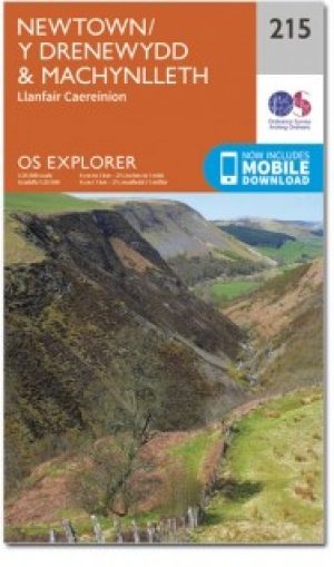
Wandelkaart 215 Newtown Llanfair Caereinion Wales - OSI • 9780319470879
Wandelkaart Newtown- Llanfair Caereinion - Wales Productbeschrijving: OS Explorer kaart blad nummer 215 is een dubbel zijdige kaart die van Machynlleth naar Newtown (Y Drenewydd) loopt en alsook deel uitmaakt van Glyndwr's Way (Llwybr Glynd'r). De meeste paden Volg de valleien, hoewel steilere paden kunnen worden gevonden via de bosgebieden. De OS Explorer kaart voor Newtown & Machynlleth …

Wandelgids Glyndwr's Way Wales - Trailblazer • 9781912716326
Wandelgids Glyndwr's Way - Trailblazer Productomschrijving: Deze nieuwe omvat het 216 km lange National Trail in Wales in de voetsporen van Owain Glyndwr, de Welshe prins die in 1400 een opstand tegen de Engelsen leidde en nu als held in de Welshe geschiedenis is verankerd. Het pad doorkruist een reeks open landbouwgronden en bossen en sluit aan op een ander Nationaal Pad, het Offa's Dyke …

Wandelkaart 148 Presteigne & Hay-on-Wye - S. Wales - OSI • 9780319474716
Wandelkaart Presteigne & Hay-on-Wye - Powys - OSI Productbeschrijving: OS Landranger kaart 148 dekt Presteigne & Hay-on-Wye en omvat ook Norton, Glascwm, Kington, Weobly, Staunton Wye, Leominster en delen van de Offa's Dyke path, de Way of Glyndwrs en het Brecon Beacons National Park. De OS Landranger kaarten reeks heeft betrekking op Groot-Brittannië met 204 gedetailleerde kaarten, perfec…

Wandelkaart 147 Elan Valley & Builth Wells - Wales - OSI • 9780319474709
Wandelkaart Elan Valley & Builth Wells - Powys - OSI Productbeschrijving: De OS Landranger kaarten reeks heeft betrekking op Groot-Brittannië met 204 gedetailleerde kaarten, perfect voor dagtochten en korte pauzes. Elke kaart bevat alle informatie die u nodig heeft om dit lokaal gebied te leren kennen en omvat plaatsen van belang, toeristische informatie, picknickplaatsen en campings, plus…

Wandelkaart 201 Knighton & Presteigne Wales - OSI • 9780319470732
Wandelkaart Knighton & Presteigne- Powys Wales Productbeschrijving: Kaart nummer 201 in de OS Explorer reeks omvat Knighton, Presteigne (Llanandras), Knighton (Tref-y-Clawdd) en Hay-on-Wye. Hoogtepunten van het gebied zijn onder andere: Shropshire Hills gebied van uitzonderlijke natuurlijke schoonheid AONB, rivier Lugg, River Wye, Wye Valley, Brecon Beacons National Park, Brecons, Brecon h…