

Wandelkaart 172 Bristol & Bath- S.W. England - OSI
Omvat Bristol- de Georgische stad Bath & de Cotswolds way

Korte omschrijving
Wandelkaarten South West England van Ordnance Survey. Ideaal voor tochten in England.
Wandelkaart Bristol & Bath - South West England Productbeschrijving: OS Landranger kaart 172 toont Bristol, de rivier de Avon, de Georgische stad Bath en de zuidkant van de Cotswolds way. De...

Specificaties
- Uitgever: Ordnance Survey
- ISBN-13: 9780319262702
- HOOFDCATEGORIEËN: Wandelkaart
- Activiteiten: Wandelen, Hiking & Trekking
- Regio: South West England
- Land: England
- TOPO's & Stafkaarten: Topografisch wandelen
- Schaal: 1:50000
- Taal: Engels
- Reeks/Serie: Landranger Series OSI
Volledige omschrijving
Wandelkaart Bristol & Bath - South West England
Productbeschrijving: OS Landranger kaart 172 toont Bristol, de rivier de Avon, de Georgische stad Bath en de zuidkant van de Cotswolds way. De Romeinse badhuizen zijn het hoogtepunt van de stad, maar niet te missen zijn de diverse voorgestelde wandeltochten die wijzen naar het mooiste van de regio De OS Landranger kaarten reeks heeft betrekking op Groot-Brittannië met 204 gedetailleerde kaarten, perfect voor dagtochten en korte pauzes. Elke kaart bevat alle informatie die u nodig heeft om dit lokaal gebied te leren kennen en omvat plaatsen van belang, toeristische informatie, picknickplaatsen en campings, plus doorgangsrechten informatie voor Engeland en Wales.
Productdiscription: OS Landranger map 172 shows Bristol, the River Avon, the Georgian city of Bath and the southern end of the Cotswolds Way. The Roman Baths in Bath are the highlight of the city, but don't miss some of the elaborate architecture - there are several suggested walking tours that highlight the best. The OS Landranger Map series covers Great Britain with 204 detailed maps, perfect for day trips and short breaks. Each map provides all the information you need to get to know your local area and includes places of interest, tourist information, picnic areas and camp sites, plus Rights of Way information for England and Wales.
Locatie op kaart
Gekoppelde artikelen

Wandelkaart 172 Bristol & Bath- S.W. England - OSI • 9780319262702
standaard versieWandelkaart Bristol & Bath - South West England Productbeschrijving: OS Landranger kaart 172 toont Bristol, de rivier de Avon, de Georgische stad Bath en de zuidkant van de Cotswolds way. De Romeinse badhuizen zijn het hoogtepunt van de stad, maar niet te missen zijn de diverse voorgestelde wandeltochten die wijzen naar het mooiste van de regio De OS Landranger kaarten reeks heeft betrekki…

Wandelkaart 172 Bristol- Bath & Thornbury- S.W. England - OSI • 9780319474952
weatherproof versieWandelkaart Bristol- Bath & Thornbury - South West England Productbeschrijving: OS Landranger kaart 172 toont Bristol, de rivier de Avon, de Georgische stad Bath en de zuidkant van de Cotswolds way. De Roman Baths in Bad zijn het hoogtepunt van de stad, maar niet missen sommige van de uitgebreide architectuur - er zijn dat diverse voorgesteld wandeltochten die wijzen op de beste. De OS…
Overzichtskaarten

OSI Landranger & Landranger Active - Zuid Engeland & London
OSI Landranger & Landranger Active - Zuid Engeland & London

Producten op de overzichtskaart
Klik op een product om naar de detailpagina te gaan.
- Wandelkaart 194 Dorchester & Weymouth- Dorset - OSI
- Wandelkaart 194 Dorchester & Weymouth- Dorset - OSI
- Wandelkaart 195 Bournemouth & Purbeck - OSI
- Wandelkaart 195 Bournemouth & Purbeck- SW England - OSI
- Wandelkaart 196 The Solent & Isle of Wight - OSI
- Wandelkaart 196 The Solent & Isle of Wight - OSI
- Wandelkaart 197 Chichester & The South Downs NP - OSI
- Wandelkaart 197 Chichester & The South Downs NP - OSI
- Wandelkaart 198 Brighton & Lewes- Sussex England - OSI
- Wandelkaart 198 Brighton & Lewes & Haywards Heath - OSI
- Wandelkaart 199 Eastbourne & Hastings- Sussex - OSI
- Wandelkaart 199 Eastbourne & Hastings- Battle - OSI
- Wandelkaart 183 Yeovil & Frome- Somerset England - OSI
- Wandelkaart 183 Yeovil & Frome- Somerset England - OSI
- Wandelkaart 184 Salisbury & The Plain- Wiltshire England - OSI
- Wandelkaart 184 Salisbury & The Plain- Wiltshire England - OSI
- Wandelkaart 185 Winchester & Basingstoke - England - OSI
- Wandelkaart 185 Winchester & Basingstoke - England - OSI
- Wandelkaart 186 Aldershot & Guildford - England - OSI
- Wandelkaart 186 Aldershot & Guildford - England - OSI
- Wandelkaart 187 Dorking & Reigate- Surrey England - OSI
- Wandelkaart 187 Dorking- Reigate & Crawley - OSI
- Wandelkaart 188 Maidstone & Royal Tunbridge Wells - OSI
- Wandelkaart 188 Maidstone & Royal Tunbridge Wells - OSI
- Wandelkaart 189 Ashford & Romney Marsh - England - OSI
- Wandelkaart 189 Ashford & Romney Marsh - Kent - OSI
- Wandelkaart 172 Bristol & Bath- S.W. England - OSI
- Wandelkaart 172 Bristol- Bath & Thornbury- S.W. England - OSI
- Wandelkaart 173 Swindon & Devizes- England - OSI
- Wandelkaart 173 Swindon- Devizes & Marlborough - OSI
- Wandelkaart 174 Newbury & Wantage- England - OSI
- Wandelkaart 174 Newbury- Wantage & Hungerford - OSI
- Wandelkaart 175 Reading & Windsor- S.E. England - OSI
- Wandelkaart 175 Reading- Windsor & Bracknell - OSI
- Wandelkaart 176 West London & Rickmansworth - OSI
- Wandelkaart 176 West London & Rickmansworth - OSI
- Wandelkaart 177 Billericay East London & Gravesend - OSI
- Wandelkaart 178 Thames Estuary & Rochester - OSI
- Wandelkaart 178 Thames Estuary- Medway London - OSI
- Wandelkaart 179 Canterbury & East Kent - England - OSI
- Wandelkaart 179 Canterbury & East Kent - England - OSI
- Wandelkaart 162 Gloucester & Forest Dean - OSI
- Wandelkaart 163 Cheltenham & Cirencester- England - OSI
- Wandelkaart 163 Cheltenham & Cirencester- England - OSI
- Wandelkaart 164 Oxford & Chipping Norton - OSI
- Wandelkaart 164 Oxford & Chipping Norton- England - OSI
- Wandelkaart 165 Aylesbury & Leighton Buzzard - OSI
- Wandelkaart 165 Aylesbury & Leighton Buzzard - OSI
- Wandelkaart 166 Luton- Hertford & Hitchin - OSI
- Wandelkaart 166 Luton- Hertford & Hitchin- Bedfordshire - OSI
- Wandelkaart 167 Chelmsford & Harlow- Essex England - OSI
- Wandelkaart 167 Chelmsford- Harlow & Bishop's - OSI
- Wandelkaart 168 Colchester- Halstead & Maldon - OSI
- Wandelkaart 168 Colchester- Halstead & Maldon- England - OSI
- Wandelkaart 169 Ipswich & The Naze- England - OSI
- Wandelkaart 169 Ipswich & The Naze- England - OSI
- Wandelkaart 149 Hereford & Leominster- England - OSI
- Wandelkaart 149 Hereford & Leominster- England - OSI
- Wandelkaart 150 Worcester & The Malverns - OSI
- Wandelkaart 150 Worcester & The Malverns- England - OSI
- Wandelkaart 151 Stratford-upon-Avon & Warwick - England - OSI
- Wandelkaart 151 Stratford-upon-Avon- England - OSI
- Wandelkaart 152 Northampton & Milton Keynes - OSI
- Wandelkaart 152 Northampton & Milton Keynes - OSI
- Wandelkaart 153 Bedford & Huntingdon- England - OSI
- Wandelkaart 153 Bedford- Huntingdon & St-Neots- England - OSI
- Wandelkaart 154 Cambridge & Newmarket - OSI
- Wandelkaart 154 Cambridge & Newmarket- England - OSI
- Wandelkaart 155 Bury St Edmunds & Stowmarket - OSI
- Wandelkaart 155 Bury St Edmunds & Sudbury - OSI

OSI Landranger & Landranger Active - Wales
OSI Landranger & Landranger Active - Wales

Producten op de overzichtskaart
Klik op een product om naar de detailpagina te gaan.
- Wandelkaart 108 Liverpool & Southport - England - OSI
- Wandelkaart 108 Liverpool- Merseyside England - OSI
- Wandelkaart 109 Greater Manchester England - OSI
- Wandelkaart 109 Manchester- Bolton & Warrington - OSI
- Wandelkaart 114 Anglesey & Ynys Môn- N.W. Wales - OSI
- Wandelkaart 114 Anglesey- North West Wales - OSI
- Wandelkaart 115 Snowdon & Caernarfon- Snowdonia NP - OSI
- Wandelkaart 115 Snowdon & Yr Wyddfa - Snowdonia NP - OSI
- Wandelkaart 116 Denbigh & Colwyn Bay - North Wales - OSI
- Wandelkaart 116 Denbigh & Colwyn Bay - North Wales - OSI
- Wandelkaart 117 Chester & Wrexham - Ellesmere Port - OSI
- Wandelkaart 117 Chester & Wrexham - West Cheshire - OSI
- Wandelkaart 118 Stoke-on-Trent & Macclesfield - OSI
- Wandelkaart 118 Stoke-on-Trent & Macclesfield - OSI
- Wandelkaart 123 Lleyn Peninsula - North Wales - OSI
- Wandelkaart 123 Lleyn Peninsula - North Wales - OSI
- Wandelkaart 124 Porthmadog & Dolgellau - N. Wales - OSI
- Wandelkaart 124 Porthmadog & Dolgellau - N. Wales - OSI
- Wandelkaart 125 Bala & Lake Vyrnwy- N. Wales - OSI
- Wandelkaart 125 Bala & Lake Vyrnwy- Gwynedd - OSI
- Wandelkaart 126 Shrewsbury & Oswestry - England - OSI
- Wandelkaart 126 Shrewsbury & Oswestry - England - OSI
- Wandelkaart 127 Stafford & Telford - Ironbridge England - OSI
- Wandelkaart 127 Stafford & Telford - Staffordshire England - OSI
- Wandelkaart 135 Aberystwyth & Machynlleth Wales - OSI
- Wandelkaart 135 Aberystwyth & Machynlleth Wales - OSI
- Wandelkaart 136 Newtown & Lllanidloes Wales - OSI
- Wandelkaart 136 Newtown & Llanidloes - OSI
- Wandelkaart 137 Ludlow & Church Stretton - England - OSI
- Wandelkaart 137 Ludlow & Church Stretton - England - OSI
- Wandelkaart 138 Kidderminster & Wyre Forest - OSI
- Wandelkaart 138 Kidderminster & Wyre Forest - OSI
- Wandelkaart 145 Cardigan & Mynydd Preseli - OSI
- Wandelkaart 145 Cardigan & Mynydd Preseli - OSI
- Wandelkaart 146 Lampeter & Llandovery - Ceredigion - OSI
- Wandelkaart 146 Lampeter & Llandovery - Ceredigion - OSI
- Wandelkaart 147 Elan valley & Builth Wells - Wales - OSI
- Wandelkaart 147 Elan Valley & Builth Wells - Wales - OSI
- Wandelkaart 148 Presteigne & Hay-on-Wye - S. Wales - OSI
- Wandelkaart 148 Presteigne & Hay-on-Wye - S. Wales - OSI
- Wandelkaart 149 Hereford & Leominster - England - OSI
- Wandelkaart 149 Hereford & Leominster - England - OSI
- Wandelkaart 150 Worcester & The Malverns - England - OSI
- Wandelkaart 150 Worcester & The Malverns - England - OSI
- Wandelkaart 157 St-David's & Haverfordwest - Wales - OSI
- Wandelkaart 157 St-David's & Haverfordwest - Wales - OSI
- Wandelkaart 158 Tenby & Pembroke - Wales - OSI
- Wandelkaart 158 Tenby & Pembroke - Wales - OSI
- Wandelkaart 159 Swansea & Gower- South Wales - OSI
- Wandelkaart 159 Swansea- Gower & Carmarthen - OSI
- Wandelkaart 160 Brecon Beacons NP - Powys Wales - OSI
- Wandelkaart 160 Brecon Beacons NP - Powys Wales - OSI
- Wandelkaart 161 Black Mountains & Brecon Beacons NP - OSI
- Wandelkaart 161 Black Mountains & Brecon Beacons NP - OSI
- Wandelkaart 162 Gloucester & Forest of Dean - OSI
- Wandelkaart 170 Vale of Glamorgan - Wales- OSI
- Wandelkaart 170 Vale of Glamorgan - Wales - OSI
- Wandelkaart 171 Cardiff & Newport - South Wales - OSI
- Wandelkaart 171 Cardiff & Newport - Pontypool South Wales - OSI
- Wandelkaart 172 Bristol & Bath- S.W. England - OSI
- Wandelkaart 172 Bristol- Bath & Thornbury- S.W. England - OSI
Artikelen uit dezelfde regio

Wandelkaart 201 Plymouth & Launceston England - OSI • 9780319262993
Wandelkaart Plymouth & Launceston - SE England Productbeschrijving: Kaart nummer 201 in de OS Landranger kaarten reeks, is de ideale kaart om te gebruiken bij het plannen van excursies naar Plymouth, Launceston, Tavistock en Looe. Plymouth houdt vele attracties met zijn rijke maritieme geschiedenis en het aantrekkelijke landschap eromheen. Hoogtepunten van het gebied zijn onder andere: het…

Wandelgids Part 3 SWCP Map Booklet PLymouth to pool - Cicerone • 9781786312006
Map booklet South West Coast Path - Cicerone Productomschrijving: Kaart van een deel van het zuidelijke deel van het 630 mijl (1014 km) lange South West Coast Path National Trail. Omvat het pad van Plymouth naar Poole langs de kustlijn van Devon en Dorset. Dit handige en compacte boekje met Ordnance Survey 1:25.000 kaarten toont de route en biedt alle kaarten die je nodig hebt om het pad i…
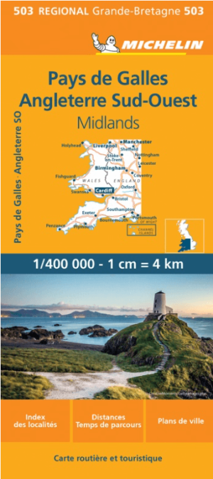
Landkaart Wegenkaart 503 Wales, Midlands & Engeland ZW - Michelin • 9782067183285
Regionale Wegenkaart Wales, Midlands & Engeland ZW - Michelin Productomschrijving: De volledig bijgewerkte MICHELIN kaart van Engeland Zuidwest Wales biedt u alle weg- en toeristische informatie die u nodig heeft om het meeste uit uw reis te halen: een INDEX VAN LOCATIES en een TABEL VAN AFSTANDEN en REISTIJDEN. De schaal van 1:400.000, d.w.z. 1 cm = 4 km, maakt het gemakkelijk om zowel d…
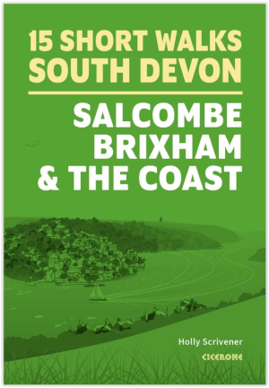
Wandelgids South Devon 15 short walks - Cicerone Press • 9781786312532
Wandelgids South Devon 15 short walks - Cicerone Productomschrijving: Would you like to explore the best of Salcombe, Brixham and the coast? This guidebook covers 15 of the best short walks in South Devon (all under three hours), including Start Point, Bigbury-on-Sea, Hope Cove and Bolberry Down, Brixham and Berry Head and Dartmouth Castle. Why choose this guidebook? - Easy to mode…
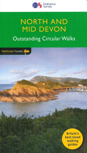
Wandelgids 068 Pathfinder guides Devon North & Mid - OS • 9780319090756
Wandelgids North & Mid Devon - OS Productomschrijving: A must-have for a day trip to North Devon, this Jarrold Pathfinder Guide maps out 28 walks that are ideal for exploring new regions and beautiful scenery. Ideal for planning a weekend walk with the family, this handy walking guide from Jarrold lets you explore with extended strolls and exhilarating hikes for young and old. - Featu…