

Wandelkaart 245 National Forest - OSI
North Leicestershire - South Derbyshire - S.E Staffordshire


Korte omschrijving
Wandelkaarten Leicestershire, England, Derbyshire & Peak District, England en Staffordshire, England van Ordnance Survey. Ideaal voor tochten in England.
Wandelkaart National Forest - OSI Productomschrijving: The National Forest is een milieuproject in Midden-Engeland dat wordt beheerd door The National Forest Company. U kunt deze wel zeer sp...

Specificaties
- Uitgever: Ordnance Survey
- ISBN-13: 9780319475461
- HOOFDCATEGORIEËN: Wandelkaart
- Activiteiten: Wandelen, Hiking & Trekking
- Regio: Derbyshire & Peak District, England, Leicestershire, England, Staffordshire, England
- Land: England
- Waterafstotende kaart: Ordnance Survey ACTIVE Explorer Weatherproof Maps
- TOPO's & Stafkaarten: Topografisch wandelen
- Schaal: 1:25000
- Taal: Engels
- Reeks/Serie: Explorer ACTIVE Series OSI
Volledige omschrijving
Wandelkaart National Forest - OSI
Productomschrijving: The National Forest is een milieuproject in Midden-Engeland dat wordt beheerd door The National Forest Company. U kunt deze wel zeer speciale plaats terug vinden in- en rond de gehuchten van north Leicestershire, south Derbyshire and southeast Staffordshire.
Engelse omschrijving: The National Forest is an environmental project in central England run by The National Forest Company. You can find it in the area's of north Leicestershire, south Derbyshire and southeast Staffordshire.

Locatie op kaart
Overzichtskaarten

OSI Explorer & Explorer Active - Midden Engeland - Midlands
OSI Explorer & Explorer Active - Midden Engeland - Midlands

Producten op de overzichtskaart
Klik op een product om naar de detailpagina te gaan.
- Wandelkaart 180 Oxford- England - OSI
- Wandelkaart 181 Chiltern Hills North AONB- Wycombe - OSI
- Wandelkaart 182 St-Albans & Hatfield- Hertfordshire - OSI
- Wandelkaart 189 Hereford & Ross-on-Wye- England - OSI
- Wandelkaart 190 Malvern Hills AONB & Bredon Hill - OSI
- Wandelkaart 191 Banbury- Bicester & Chipping Norton- OSI
- Wandelkaart 192 Buckingham & Milton Keynes - OSI
- Wandelkaart 193 Luton & Stevenage- Bedfordshire - OSI
- Wandelkaart 194 Hertford & Bishop's Stortford - OSI
- Wandelkaart 202 Leominster & Bromyard Hererfordshire - OSI
- Wandelkaart 203 Ludlow & Shropshire Hills AONB - OSI
- Wandelkaart 204 Worcester & Droitwich Spa - OSI
- Wandelkaart 205 Stratford-upon-Avon & Evesham - OSI
- Wandelkaart 206 Edge Hill & Fenny Compton - OSI
- Wandelkaart 207 Newport Pagnell & Northampton - OSI
- Wandelkaart 208 Bedford & St Neots- Bedforeshire - OSI
- Wandelkaart 209 Cambridge - England - OSI
- Wandelkaart 217 Long Mynd & Wenlock Edge - OSI
- Wandelkaart 218 Kidderminster & Wyre Forest - OSI
- Wandelkaart 219 Wolverhampton & Dudley - OSI
- Wandelkaart 220 Birmingham- West Midlands - OSI
- Wandelkaart 221 Coventry & Warwickshire - OSI
- Wandelkaart 222 Rugby & Daventry- Warwickshire - OSI
- Wandelkaart 223 Northampton & Market Harborough - OSI
- Wandelkaart 224 Corby- Kettering & Wellingborough - OSI
- Wandelkaart 225 Huntingdon & St Ives - OSI
- Wandelkaart 227 Peterborough- Cambridgeshire England - OSI
- Wandelkaart 228 March- Ely- Chatteris & Littleport - OSI
- Wandelkaart 232 Nuneaton & Tamworth- Warwickshire - OSI
- Wandelkaart 233 Leicester & Hinckley England - OSI
- Wandelkaart 234 Rutland Water & Stamford- Oakham - OSI
- Wandelkaart 235 Wisbech & Peterborough North - OSI
- Wandelkaart 241 Shrewsbury- shropshire England - OSI
- Wandelkaart 242 Telford- Ironbridge & the Wrekin - OSI
- Wandelkaart 243 Market Drayton- Schropshire - OSI
- Wandelkaart 244 Cannock Chase & Chasewater- Severn - OSI
- Wandelkaart 245 National Forest- Burton-upon-Trent - OSI
- Wandelkaart 245 National Forest - OSI
- Wandelkaart 246 Loughborough- Leicestershire England - OSI
- Wandelkaart 247 Grantham- Lincolnshire - OSI
- Wandelkaart 248 Bourne & Heckington- lincolnshire - OSI
- Wandelkaart 249 Spalding & Holbeach- Lincolnshire - OSI
- Wandelkaart 257 Crewe & Nantwich & Cheshire East - OSI
- Wandelkaart 258 Stoke-on-Trent & Newcastle-under-Lyme- OSI
- Wandelkaart 259 Derby & Utoxeter- Derbyshire - OSI
- Wandelkaart 260 Nottingham & Vale of Belvoir - OSI
- Wandelkaart 261 Boston & Lincolnshire- England - OSI
- Wandelkaart 267 Northwich & Delamere Forest - OSI
- Wandelkaart 268 Wilmslow- Macclesfield & Congleton - OSI
- Wandelkaart 269 Chesterfield & Alfreton- Derbyshire- OSI
- Wandelkaart 270 Sherwood Forest- Nottinghamshire - OSI
- Wandelkaart 271 Newark-on-Trent- Nottinghampshire - OSI
- Wandelkaart 272 Lincoln- England - OSI
- Wandelkaart 273 Lincolnshire Wolds South- England - OSI
- Wandelkaart 274 Skegness- Alford & Spilsby - OSI
- Wandelkaart 275 Liverpool- South West England - OSI
- Wandelkaart 276 Bolton- Wigan & Warrington- Machester - OSI
- Wandelkaart 277 Manchester & Salford - OSI
- Wandelkaart 278 Sheffield & Barnsley- South Yorkshire - OSI
- Wandelkaart 279 Doncaster- South Yorkshire - OSI
- Wandelkaart 280 Isle of Axholme- Lincolnshire - OSI
- Wandelkaart 281 Ancholme Valley- Lincolnshire - OSI
- Wandelkaart 282 Lincolnshire Wolds North- England - OSI
- Wandelkaart 283 Louth & Mablethorpe- Lincolnshire - OSI
- Wandelkaart 284 Grimsby- Cleethorpes & Immingham - OSI
- Wandelkaart OL01 Peak District NP & Dark Peak area - OS
- Wandelkaart OL13 Brecon Beacons National Parc East - OS
- Wandelkaart OL24 Peak District & White Peak area - OS
- Wandelkaart OL40 The Broads National Park - OS
Artikelen uit dezelfde regio
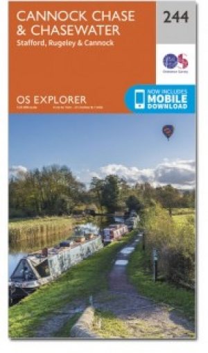
Wandelkaart 244 Cannock Chase & Chasewater- England - OSI • 9780319471166
Wandelkaart Cannock Chase & Chasewater - Staffordshire England Omvat ook: Stafford, Rugeley & Cannock. Productbeschrijving: Met betrekking tot de Cannock Chase AONB, is de OS Explorer kaart 244 ideaal voor het verkennen van dit gebied. Er zijn honderden kleinere routes, plus diverse recreatieve paden, waardoor dit gebied vooral populair is voor mountainbikers. De OS Explorer kaart voor…

Wandelkaart 118 Stoke-on-Trent & Macclesfield - OSI • 9780319262160
Wandelkaart Stoke-on-Trent & Macclesfield - England - OSI Productbeschrijving: Stoke-on-Trent, beroemd om zijn keramiek en aardewerk, is een stad in het graafschap Staffordshire en heeft veel te bieden. Hoogtepunten zijn de 25 aardewerk fabriek winkels, Italiaanse tuinen en de award-winnende musea. De OS Landranger kaarten reeks heeft betrekking op Groot-Brittannië met 204 gedetailleerde k…

Wandelkaart 128 Derby & Burton upon Trent - England - OSI • 9780319474518
Wandelkaart Derby & Burton upon Trent - Staffordshire England Productbeschrijving: De plaatsen vernoemd op OS Landranger 128 zijn een paar fantastische waterwegen, waardoor een ideale locatie voor een boottocht op het kanaal, en is een uitstekende uitvalsbasis voor het verkennen van de nabijgelegen Peak District NP. Bezoek Derby's kathedraal kwartaal voor een cultureel podia of maak een ui…

Mountainbikegids Peak District Mountain Biking - Vertebrate Publ. • 9781906148188
Peak District Mountain Biking - Vertebrate Productomschrijving: Peak District Mountain Biking by Jon Barton features 26 of the best mountain bike rides in the Dark Peak, between 9km and 105km in length, suitable for all levels of mountain bikers. This second edition features Ordnance Survey maps, and is illustrated with action photography. Includes Grenoside Woods and Lady Canning's Planta…

Wandelgids Peak District-Bakewell & The White Peak - Cicerone • 9781786312570
Wandelgids Peak District-Bakewell & The White Peak - Cicerone Productomschrijving: Would you like to explore the best of Bakewell and the White Peak? This guidebook covers 15 of the best short walks in the Peak District (between 4 and 10km, all under three hours), including Taddington, Chatsworth Park, Sheldon and Magpie Mine, Elton and Robin Hood's Stride, and the Monsal Trail. Why c…