

Wandelkaart 273 Lincolnshire Wolds South- England - OSI
Omvat de zuidelijke Lincolnshire Wolds- en de Viking way

Korte omschrijving
Wandelkaarten lincolnshire van Ordnance Survey. Ideaal voor tochten in England.
Wandelkaart Lincolnshire Wolds South - England Omvat ook: Horncastle & Woodhall Spa. Productbeschrijving: OS Explorer kaart 273 heeft betrekking op de zuidelijke Lincolnshire Wolds, en d...

Specificaties
- Uitgever: Ordnance Survey
- ISBN-13: 9780319244708
- HOOFDCATEGORIEËN: Wandelkaart
- Activiteiten: Wandelen, Hiking & Trekking
- Regio: lincolnshire
- Land: England
- TOPO's & Stafkaarten: Topografisch wandelen
- Schaal: 1:25000
- Taal: Engels
- Reeks/Serie: Explorer Series OS
- De Engelse Graafschappen: Lincolnshire
Volledige omschrijving
Wandelkaart Lincolnshire Wolds South - England
Omvat ook: Horncastle & Woodhall Spa.
Productbeschrijving: OS Explorer kaart 273 heeft betrekking op de zuidelijke Lincolnshire Wolds, en de Viking way (deel van de E2 Europese Long Distance pad), evenals de steden Howncastle en Woodhall Spa. De OS Explorer kaart voor Lincolnshire Wolds zuiden is beschikbaar in zowel de standaard papieren versie als de weerbestendige 'Actief' versie.
Productdiscription: OS Explorer map 273 covers the southern Lincolnshire Wolds, and the Viking Way (part of the E2 European Long Distance Path), as well as the towns of Howncastle and Woodhall Spa. The OS Explorer map for Lincolnshire Wolds South is available in both the standard paper version and weatherproof 'Active' version.
Locatie op kaart
Gekoppelde artikelen

Wandelkaart 273 Lincolnshire Wolds South- England - OSI • 9780319244708
standaard versieWandelkaart Lincolnshire Wolds South - England Omvat ook: Horncastle & Woodhall Spa. Productbeschrijving: OS Explorer kaart 273 heeft betrekking op de zuidelijke Lincolnshire Wolds, en de Viking way (deel van de E2 Europese Long Distance pad), evenals de steden Howncastle en Woodhall Spa. De OS Explorer kaart voor Lincolnshire Wolds zuiden is beschikbaar in zowel de standaard papieren …

Wandelkaart 273 - Lincolnshire Wolds South AONB - OSI • 9780319471456
weatherproof versieWandelkaart Lincolnshire Wolds South AONB - Lincolnshire Omvat ook: Horncastle & Woodhall Spa. Productbeschrijving: OS Explorer kaart 273 heeft betrekking op de zuidelijke Lincolnshire Wolds AONB, en de Viking Way (deel van de E2 Europese Long Distance pad), evenals de steden Howncastle en Woodhall Spa. De OS Explorer kaart voor Lincolnshire Wolds zuiden is beschikbaar in zowel de stan…
Overzichtskaarten

OSI Explorer & Explorer Active - Midden Engeland - Midlands
OSI Explorer & Explorer Active - Midden Engeland - Midlands

Producten op de overzichtskaart
Klik op een product om naar de detailpagina te gaan.
- Wandelkaart 180 Oxford- England - OSI
- Wandelkaart 181 Chiltern Hills North AONB- Wycombe - OSI
- Wandelkaart 182 St-Albans & Hatfield- Hertfordshire - OSI
- Wandelkaart 189 Hereford & Ross-on-Wye- England - OSI
- Wandelkaart 190 Malvern Hills AONB & Bredon Hill - OSI
- Wandelkaart 191 Banbury- Bicester & Chipping Norton- OSI
- Wandelkaart 192 Buckingham & Milton Keynes - OSI
- Wandelkaart 193 Luton & Stevenage- Bedfordshire - OSI
- Wandelkaart 194 Hertford & Bishop's Stortford - OSI
- Wandelkaart 202 Leominster & Bromyard Hererfordshire - OSI
- Wandelkaart 203 Ludlow & Shropshire Hills AONB - OSI
- Wandelkaart 204 Worcester & Droitwich Spa - OSI
- Wandelkaart 205 Stratford-upon-Avon & Evesham - OSI
- Wandelkaart 206 Edge Hill & Fenny Compton - OSI
- Wandelkaart 207 Newport Pagnell & Northampton - OSI
- Wandelkaart 208 Bedford & St Neots- Bedforeshire - OSI
- Wandelkaart 209 Cambridge - England - OSI
- Wandelkaart 217 Long Mynd & Wenlock Edge - OSI
- Wandelkaart 218 Kidderminster & Wyre Forest - OSI
- Wandelkaart 219 Wolverhampton & Dudley - OSI
- Wandelkaart 220 Birmingham- West Midlands - OSI
- Wandelkaart 221 Coventry & Warwickshire - OSI
- Wandelkaart 222 Rugby & Daventry- Warwickshire - OSI
- Wandelkaart 223 Northampton & Market Harborough - OSI
- Wandelkaart 224 Corby- Kettering & Wellingborough - OSI
- Wandelkaart 225 Huntingdon & St Ives - OSI
- Wandelkaart 227 Peterborough- Cambridgeshire England - OSI
- Wandelkaart 228 March- Ely- Chatteris & Littleport - OSI
- Wandelkaart 232 Nuneaton & Tamworth- Warwickshire - OSI
- Wandelkaart 233 Leicester & Hinckley England - OSI
- Wandelkaart 234 Rutland Water & Stamford- Oakham - OSI
- Wandelkaart 235 Wisbech & Peterborough North - OSI
- Wandelkaart 241 Shrewsbury- shropshire England - OSI
- Wandelkaart 242 Telford- Ironbridge & the Wrekin - OSI
- Wandelkaart 243 Market Drayton- Schropshire - OSI
- Wandelkaart 244 Cannock Chase & Chasewater- Severn - OSI
- Wandelkaart 245 National Forest- Burton-upon-Trent - OSI
- Wandelkaart 245 National Forest - OSI
- Wandelkaart 246 Loughborough- Leicestershire England - OSI
- Wandelkaart 247 Grantham- Lincolnshire - OSI
- Wandelkaart 248 Bourne & Heckington- lincolnshire - OSI
- Wandelkaart 249 Spalding & Holbeach- Lincolnshire - OSI
- Wandelkaart 257 Crewe & Nantwich & Cheshire East - OSI
- Wandelkaart 258 Stoke-on-Trent & Newcastle-under-Lyme- OSI
- Wandelkaart 259 Derby & Utoxeter- Derbyshire - OSI
- Wandelkaart 260 Nottingham & Vale of Belvoir - OSI
- Wandelkaart 261 Boston & Lincolnshire- England - OSI
- Wandelkaart 267 Northwich & Delamere Forest - OSI
- Wandelkaart 268 Wilmslow- Macclesfield & Congleton - OSI
- Wandelkaart 269 Chesterfield & Alfreton- Derbyshire- OSI
- Wandelkaart 270 Sherwood Forest- Nottinghamshire - OSI
- Wandelkaart 271 Newark-on-Trent- Nottinghampshire - OSI
- Wandelkaart 272 Lincoln- England - OSI
- Wandelkaart 273 Lincolnshire Wolds South- England - OSI
- Wandelkaart 274 Skegness- Alford & Spilsby - OSI
- Wandelkaart 275 Liverpool- South West England - OSI
- Wandelkaart 276 Bolton- Wigan & Warrington- Machester - OSI
- Wandelkaart 277 Manchester & Salford - OSI
- Wandelkaart 278 Sheffield & Barnsley- South Yorkshire - OSI
- Wandelkaart 279 Doncaster- South Yorkshire - OSI
- Wandelkaart 280 Isle of Axholme- Lincolnshire - OSI
- Wandelkaart 281 Ancholme Valley- Lincolnshire - OSI
- Wandelkaart 282 Lincolnshire Wolds North- England - OSI
- Wandelkaart 283 Louth & Mablethorpe- Lincolnshire - OSI
- Wandelkaart 284 Grimsby- Cleethorpes & Immingham - OSI
- Wandelkaart OL01 Peak District NP & Dark Peak area - OS
- Wandelkaart OL13 Brecon Beacons National Parc East - OS
- Wandelkaart OL24 Peak District & White Peak area - OS
- Wandelkaart OL40 The Broads National Park - OS
Artikelen uit dezelfde regio

Wandelkaart 248 Bourne & Heckington- lincolnshire - OSI • 9780319244418
Wandelkaart Bourne & Heckington - lincolnshire England Productbeschrijving: Billingborough & Morton. 248 / Bourne & Heckington, lincolnshire, England - OS Explorer kaart 248 toont de steden Bourne, Morton, Billingborough en Heckington, als deel van de Macmillan way na de rivier Glen. Het is grotendeels zeer laaggelegen, met een groot gebied van Fenlands gekenmerkt door drainage sloten…

Wandelkaart 282 Lincolnshire Wolds North- England - OSI • 9780319244791
Wandelkaart Lincolnshire Wolds North - England Omvat ook: Louth & Market Rasen. Productbeschrijving: Kaart nummer 282 dekt Lincolnshire Woud Noord, Louth en Market Rasen. Hoogtepunten zijn The Wolds, de Viking way en Wanderlust Way. Omvat ook Hainton, Brookenby, Alvingham en Marshchapel. De OS Explorer kaart voor Lincolnshire Wolds Noord is beschikbaar in zowel de standaard papieren ve…
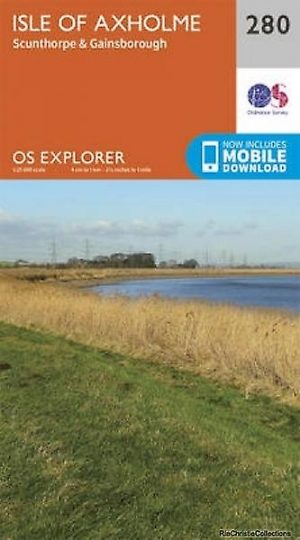
Wandelkaart 280 Isle of Axholme- Lincolnshire - OSI • 9780319244777
Wandelkaart Isle of Axholme - Lincolnshire England Omvat ook: Scunthorpe & Gainsborough Productomschrijving: OS Explorer kaart 280 omvat de Isle van Lincolnshire en de omliggende gebieden, met inbegrip van Scunthorpe & Gainsborough. Ondanks de naam, is het helemaal geen eiland, maar word als zeer vlak gebied doorkruist door verschillende rivieren, met name de Trent en de Idle. U kunt d…

Wandelkaart 284 Grimsby- Cleethorpes & Immingham - OSI • 9780319244814
Wandelkaart Grimsby- Cleethorpes & Immingham - Lincolnshire Productbeschrijving: 284 / Grimsby, Cleethorpes & Immingham, Lincolnshire, England - Deze zeer gedetailleerde kaart omvat alle de administratieve klein grenzen, nederzettingen als geïsoleerde boerderijen, die de navigatie op het platteland veel gemakkelijker maken. Steile hellingen op de wegen worden aangeduid. Diverse beziens…

Wandelkaart 272 Lincoln- England - OSI • 9780319244692
Wandelkaart Lincoln - England Omvat ook: Sleaford, Metheringham & Navenby. Productbeschrijving: Kaart nummer 272 omvat Lincoln en Sleaford. Hoogtepunten zijn Lincoln kasteel en de rivier Witham. Omvat ook Metheringham, Navenby en Noord Hykeham. De OS Explorer kaart voor Lincoln is beschikbaar in zowel de standaard papieren versie als weerbestendige 'Actief' versie. Productdiscripti…