

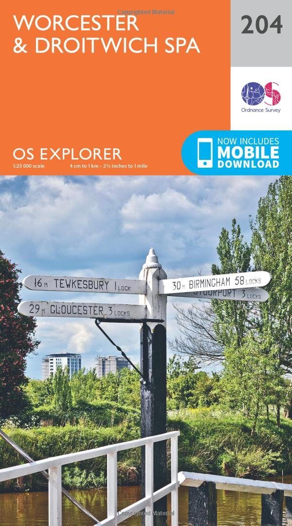
Wandelkaart 204 Worcester & Droitwich Spa - OSI
Met nederzettingen die dateren uit het Neolithicum
Korte omschrijving
Wandelkaarten Worcestershire, West England van Ordnance Survey. Ideaal voor tochten in United Kingdom, Great Britain.
Wandelkaart Worcester & Droitwich Spa - Worcestershire Productbeschrijving: In de buurt van de kruispunten van de rivier Teme en de rivier de Severn, de stad van Worcester en de omliggende s...

Specificaties
- Uitgever: Ordnance Survey
- ISBN-13: 9780319243978
- HOOFDCATEGORIEËN: Wandelkaart
- Activiteiten: Wandelen, Hiking & Trekking
- Regio: Worcestershire, West England
- Land: United Kingdom, Great Britain
- TOPO's & Stafkaarten: Topografisch wandelen
- Schaal: 1:25000
- Taal: Engels
- Reeks/Serie: Explorer Series OS
Volledige omschrijving
Wandelkaart Worcester & Droitwich Spa - Worcestershire
Productbeschrijving: In de buurt van de kruispunten van de rivier Teme en de rivier de Severn, de stad van Worcester en de omliggende steden, vallen onder OS Explorer kaart 204. Dit gebied heeft nederzettingen die dateren uit het Neolithicum, dit gebied huist deel van de Malven Hills, plus een aantal kleinere groene ruimtes om te ontdekken. De OS Explorer kaart voor Worcester & Droitwich Spa is beschikbaar in zowel de standaard papieren versie als de weerbestendige 'Actief' versie.
Productdiscription: Near the junctions of the River Teme and River Severn, the City of Worcester and the surrounding towns and villages are covered by OS Explorer Map 204. With settlements dating back to the Neolithic, this area has par of the Malvern Hills, plus a number of smaller green spaces to discover. The OS Explorer map for Worcester & Droitwich Spa is available in both the standard paper version and weatherproof 'Active' version.
Locatie op kaart
Gekoppelde artikelen

Wandelkaart 204 Worcester & Droitwich Spa - OSI • 9780319243978
standaard versieWandelkaart Worcester & Droitwich Spa - Worcestershire Productbeschrijving: In de buurt van de kruispunten van de rivier Teme en de rivier de Severn, de stad van Worcester en de omliggende steden, vallen onder OS Explorer kaart 204. Dit gebied heeft nederzettingen die dateren uit het Neolithicum, dit gebied huist deel van de Malven Hills, plus een aantal kleinere groene ruimtes om te ontde…

Wandelkaart 204 Worcester & Droitwich Spa - OSI • 9780319470763
weatherproof versieWandelkaart Worcester & Droitwich Spa - England Productbeschrijving: In de buurt van de kruispunten van de rivier Teme en de rivier de Severn, ligt de stad van Worcester, en de omliggende steden en dorpen vallen onder OS Explorer kaart 204. Dit gebied heeft nederzettingen die dateren uit het Neolithicum, en deel van de Malven Hills, plus een aantal kleinere groene ruimtes om te ontdekken. …
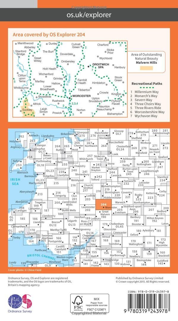
Overzichtskaarten

OSI Explorer & Explorer Active - Midden Engeland - Midlands
OSI Explorer & Explorer Active - Midden Engeland - Midlands

Producten op de overzichtskaart
Klik op een product om naar de detailpagina te gaan.
- Wandelkaart 180 Oxford- England - OSI
- Wandelkaart 181 Chiltern Hills North AONB- Wycombe - OSI
- Wandelkaart 182 St-Albans & Hatfield- Hertfordshire - OSI
- Wandelkaart 189 Hereford & Ross-on-Wye- England - OSI
- Wandelkaart 190 Malvern Hills AONB & Bredon Hill - OSI
- Wandelkaart 191 Banbury- Bicester & Chipping Norton- OSI
- Wandelkaart 192 Buckingham & Milton Keynes - OSI
- Wandelkaart 193 Luton & Stevenage- Bedfordshire - OSI
- Wandelkaart 194 Hertford & Bishop's Stortford - OSI
- Wandelkaart 202 Leominster & Bromyard Hererfordshire - OSI
- Wandelkaart 203 Ludlow & Shropshire Hills AONB - OSI
- Wandelkaart 204 Worcester & Droitwich Spa - OSI
- Wandelkaart 205 Stratford-upon-Avon & Evesham - OSI
- Wandelkaart 206 Edge Hill & Fenny Compton - OSI
- Wandelkaart 207 Newport Pagnell & Northampton - OSI
- Wandelkaart 208 Bedford & St Neots- Bedforeshire - OSI
- Wandelkaart 209 Cambridge - England - OSI
- Wandelkaart 217 Long Mynd & Wenlock Edge - OSI
- Wandelkaart 218 Kidderminster & Wyre Forest - OSI
- Wandelkaart 219 Wolverhampton & Dudley - OSI
- Wandelkaart 220 Birmingham- West Midlands - OSI
- Wandelkaart 221 Coventry & Warwickshire - OSI
- Wandelkaart 222 Rugby & Daventry- Warwickshire - OSI
- Wandelkaart 223 Northampton & Market Harborough - OSI
- Wandelkaart 224 Corby- Kettering & Wellingborough - OSI
- Wandelkaart 225 Huntingdon & St Ives - OSI
- Wandelkaart 227 Peterborough- Cambridgeshire England - OSI
- Wandelkaart 228 March- Ely- Chatteris & Littleport - OSI
- Wandelkaart 232 Nuneaton & Tamworth- Warwickshire - OSI
- Wandelkaart 233 Leicester & Hinckley England - OSI
- Wandelkaart 234 Rutland Water & Stamford- Oakham - OSI
- Wandelkaart 235 Wisbech & Peterborough North - OSI
- Wandelkaart 241 Shrewsbury- shropshire England - OSI
- Wandelkaart 242 Telford- Ironbridge & the Wrekin - OSI
- Wandelkaart 243 Market Drayton- Schropshire - OSI
- Wandelkaart 244 Cannock Chase & Chasewater- Severn - OSI
- Wandelkaart 245 National Forest- Burton-upon-Trent - OSI
- Wandelkaart 245 National Forest - OSI
- Wandelkaart 246 Loughborough- Leicestershire England - OSI
- Wandelkaart 247 Grantham- Lincolnshire - OSI
- Wandelkaart 248 Bourne & Heckington- lincolnshire - OSI
- Wandelkaart 249 Spalding & Holbeach- Lincolnshire - OSI
- Wandelkaart 257 Crewe & Nantwich & Cheshire East - OSI
- Wandelkaart 258 Stoke-on-Trent & Newcastle-under-Lyme- OSI
- Wandelkaart 259 Derby & Utoxeter- Derbyshire - OSI
- Wandelkaart 260 Nottingham & Vale of Belvoir - OSI
- Wandelkaart 261 Boston & Lincolnshire- England - OSI
- Wandelkaart 267 Northwich & Delamere Forest - OSI
- Wandelkaart 268 Wilmslow- Macclesfield & Congleton - OSI
- Wandelkaart 269 Chesterfield & Alfreton- Derbyshire- OSI
- Wandelkaart 270 Sherwood Forest- Nottinghamshire - OSI
- Wandelkaart 271 Newark-on-Trent- Nottinghampshire - OSI
- Wandelkaart 272 Lincoln- England - OSI
- Wandelkaart 273 Lincolnshire Wolds South- England - OSI
- Wandelkaart 274 Skegness- Alford & Spilsby - OSI
- Wandelkaart 275 Liverpool- South West England - OSI
- Wandelkaart 276 Bolton- Wigan & Warrington- Machester - OSI
- Wandelkaart 277 Manchester & Salford - OSI
- Wandelkaart 278 Sheffield & Barnsley- South Yorkshire - OSI
- Wandelkaart 279 Doncaster- South Yorkshire - OSI
- Wandelkaart 280 Isle of Axholme- Lincolnshire - OSI
- Wandelkaart 281 Ancholme Valley- Lincolnshire - OSI
- Wandelkaart 282 Lincolnshire Wolds North- England - OSI
- Wandelkaart 283 Louth & Mablethorpe- Lincolnshire - OSI
- Wandelkaart 284 Grimsby- Cleethorpes & Immingham - OSI
- Wandelkaart OL01 Peak District NP & Dark Peak area - OS
- Wandelkaart OL13 Brecon Beacons National Parc East - OS
- Wandelkaart OL24 Peak District & White Peak area - OS
- Wandelkaart OL40 The Broads National Park - OS
Artikelen uit dezelfde regio
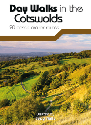
Wandelgids Day Walks in the Cotswolds AONB - Vertebrate Publ. • 9781910240991
Day Walks in the Cotswolds AONB - Vertebrate Productomschrijving: Day Walks in the Cotswolds by Judy Mills features 20 circular routes suitable for hillwalkers of all abilities. Together with stunning photography, each route features Ordnance Survey 1:25,000 maps, easy-to-follow directions, distance and navigation information, refreshment stops and local information. Split across thre…

Reisgids Cotswolds AONB - Rough Guides • 9781839059728
The Cotswolds AONB - Rough Guides Productomschrijving: Deze omvat het Cotswolds gebied in zuid-oost Engeland. Een gebied van uitmuntend natuurschoon, of in andere meer lokalere woorden, een AONB area, of Area of Outstanding Natural Beauty. Bij ons is dat bijvoorbeeld de westhoek, het Zwin, enz... Deze reisgids biedt u deze regio inclusief de locaties van Stratford-Uppon-Avon & Oxford die a…

Wandelkaart 190 - Malvern Hills AONB & Bredon Hill - OSI • 9780319470626
Wandelkaart Malvern Hills AONB & Bredon Hill AONB England Omvat ook: Tewkesbury, Ledbury, Pershore & Upton upon Severn. Productbeschrijving: Kaart nummer 190 in de OS Explorer kaarten reeks heeft betrekking op twee gebieden van uitzonderlijke natuurlijke schoonheid; de Cotswolds AONB en het bestuurlijke gebied Malvern Hills AONB en de nederzettingen van de Great Malvern, Upton op Sever…

Wandelkaart OL45 The Cotswolds AONB - OS • 9780319242841
Wandelkaart The Cotswolds AONB - OS Productomschrijving: Wychwood Community Forest, The Centenary Way, Cotswolds Way, D'Arcy Dalton Way, Diamond Way, E2 European Long Distance Path, Gloucestershire Way, Heart of England Way, Macmillan Way, Monarch's Way, Oxfordshire Way, Thames Path, Shakespeare Way, Warden's Way, Winchcombe Way, Windrush Way & Wychavon Way. Omvat: Burford, Chipping C…

Fietskaart 02 Cotswold AONB cycling map - Goldeneye • 9781859653036
Fietskaart Cotswold cycling map - Goldeneye Productomschrijving: De Cotswolds zijn een AONB regio, een regio van uitmuntend natuurschoon. In Engeland geklasseerd als AONB, Area of Outstanding Natural Beauty. Zo heeft de UK er een pak verdeeld over het land. De Cotswold kun je een beetje vergelijken met Cornwall, maar dan zonder de kustlijnen. Hier vindt je prachtige landschappen en trails …