
Wandelkaart 114 Exeter & Exe Valley Devon - OSI
Omvat de Exe vallei ten noorden van de stad van Exeter
Korte omschrijving
Wandelkaart Exeter & Exe Valley - Devon - OSI Productomschrijving: - Crediton, Tiverton & Dulverton. 114 / Exeter & Exe Valley, Devon, England - Kaart nummer 114 in de OS Explorer reeks ...

Specificaties
- Uitgever: Ordnance Survey
- ISBN-13: 9780319243152
- HOOFDCATEGORIEËN: Wandelkaart
- Activiteiten: Wandelen, Hiking & Trekking
- Regio: Devon, England
- Land: England
- Nationale parken: Dartmoor NP, Devon England, Exmoor NP, Devon England
- Schaal: 1:25000
- Afmeting: 13x23
- Taal: Engels
- Reeks: Explorer Series
Volledige omschrijving
Wandelkaart Exeter & Exe Valley - Devon - OSI
Productomschrijving: - Crediton, Tiverton & Dulverton.
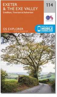
114 / Exeter & Exe Valley, Devon, England - Kaart nummer 114 in de OS Explorer reeks heeft betrekking op de Exe vallei ten noorden van de stad van Exeter in Devon. Secties van Exmoor en Dartmoor nationale parken zijn opgenomen in deze kaart, samen met de Exe Valley Way en two Moors Way. Andere hoogtepunten van het gebied zijn Crediton, Tiverton en Dulverton. De OS Explorer kaart voor Exeter & de Exe-vallei is beschikbaar in zowel de standaard papieren versie als de weerbestendige 'Actief' versie.
114 / Exeter & Exe Valley, Devon, England - Map sheet number 114 in the OS Explorer series covers the Exe Valley around and to the north of the city of Exeter in Devon. Sections of Exmoor and Dartmoor National Parks are included in the map, along with the Exe Valley Way and Two Moors Way. Other highlights of the area include Crediton, Tiverton and Dulverton. The OS Explorer map for Exeter & the Exe Valley is available in both the standard paper version and weatherproof 'Active' version.
Locatie op kaart
Gekoppelde artikelen

Wandelkaart 114 Exeter & Exe Valley Devon - OSI • 9780319243152
standaard versieWandelkaart Exeter & Exe Valley - Devon - OSI Productomschrijving: - Crediton, Tiverton & Dulverton. 114 / Exeter & Exe Valley, Devon, England - Kaart nummer 114 in de OS Explorer reeks heeft betrekking op de Exe vallei ten noorden van de stad van Exeter in Devon. Secties van Exmoor en Dartmoor nationale parken zijn opgenomen in deze kaart, samen met de Exe Valley Way en two Moors Way.…

Wandelkaart 114 Exeter & Exe Valley- Devon - OSI • 9780319469941
weatherproof versieWandelkaart Exeter & The Exe Valley - Devon England - OSI Productbeschrijving: Kaart nummer 114 in de OS Explorer reeks heeft betrekking op de Exeter vallei ten noorden van de stad van Exeter in Devon. Onderdelen van Exmoor en Dartmoor nationale parken zijn opgenomen in de kaart, samen met de Exe Valley way en Two Moors Way. Andere hoogtepunten van het gebied zijn Crediton, Tiverton Tivert…
Overzichtskaarten

OSI Explorer & Explorer Active - Z.W. England Devon - Cornwall
OSI Explorer & Explorer Active - Z.W. England Devon - Cornwall

Producten op de overzichtskaart
Klik op een product om naar de detailpagina te gaan.
- Wandelkaart 102 Land's End - OSI
- Wandelkaart 102 Land's End - OSI
- Wandelkaart 103 The Lizard- Cornwall England - OSI
- Wandelkaart 103 The Lizard- Cornwall England - OSI
- Wandelkaart 104 Redruth & St Agnes- Cornwall - OSI
- Wandelkaart 104 Redruth & St Agnes- Cornwall - OSI
- Wandelkaart 105 Falmouth & Mevagissey - Cornawall - OSI
- Wandelkaart 105 Falmouth & Mevagissey - Cornawall - OSI
- Wandelkaart 106 Newquay & Padstow - Cornwall - OSI
- Wandelkaart 106 Newquay & Padstow- Cornwall - OSI
- Wandelkaart 107 St-Austell & Liskeard- Cornwall - OSI
- Wandelkaart 107 St-Austell & Liskeard & Fowey- Cornwall - OSI
- Wandelkaart 108 Lower Tamar Valley & Plymouth - OSI
- Wandelkaart 108 Lower Tamer Valley & Plymouth- Cornwall - OSI
- Wandelkaart 109 Bodmin Moor- Cornwal - OSI
- Wandelkaart 109 Bodmin Moor- Cornwal - OSI
- Wandelkaart 111 Bude- Boscastle & Tintagel- Devon - OSI
- Wandelkaart 111 Bude- Boscastle & Tintagel- Devon - OSI
- Wandelkaart 112 Launceston & Holsworthy- Devon - OSI
- Wandelkaart 112 Launceston & Holsworthy- Devon - OSI
- Wandelkaart 113 Okehampton- Devon England - OSI
- Wandelkaart 113 Okehampton- Devon England - OSI
- Wandelkaart 114 Exeter & Exe Valley- Devon - OSI
- Wandelkaart 114 Exeter & Exe Valley- Devon - OSI
- Wandelkaart 115 Exmouth & Sidmouth- Devon - OSI
- Wandelkaart 115 Exmouth & Sidmouth- Devon - OSI
- Wandelkaart 116 Lyme regis & Bridport- Devon - OSI
- Wandelkaart 116 Lyme Regis & Bridport- Dorset - OSI
- Wandelkaart 117 Cerne Abbas & Bere Regis - Dorset - OSI
- Wandelkaart 117 Cerne Abbas & Bere Regis - Dorset - OSI
- Wandelkaart OL15 Purbeck- South Dorset & Poole - OSI
- Wandelkaart 118 Shaftesbury & Cranbourne Chase - OSI
- Wandelkaart 118 Shaftesbury & Cranbourne Chase - OSI
- Wandelkaart 129 Yeovil & Sherborne- Somerset - OSI
- Wandelkaart 129 Yeovil & Sherborne- Somerset - OSI
- Wandelkaart 140 Quantock Hills AONB & Bridgwater- Devon - OSI
- Wandelkaart 140 Quantock Hills AONB- Somerset - OSI
- Wandelkaart 141 Cheddar Gorge & Mendip Hills - OSI
- Wandelkaart 141Shepton Mallet & Mendip Hills East - OSI
- Wandelkaart 142 Shepton Mallet & Mendip Hills - OSI
- Wandelkaart 142 Shepton Mallet & Mendip Hills - OSI
- Wandelkaart 143 Warminster & Trowbridge- Wiltshire - OSI
- Wandelkaart 143 Warminster & Trowbridge- Wiltshire - OSI
- Wandelkaart 130 Salisburry & Stonehenge- Wiltshire - OSI
- Wandelkaart 130 Salisburry & Stonehenge- Wiltshire - OSI
- Wandelkaart 131 Romsey- Andover & Test Valley- Hampshire
- Wandelkaart 131 Romsey & Andover - Hampshire - OSI
- Wandelkaart 153 Weston-super-Mare & Bleadon Hill - OSI
- Wandelkaart 153 Weston-Super-Mare & Bleadon Hill - OSI
- Wandelkaart 154 Bristol West & Portishead- Bristol - OSI
- Wandelkaart 154 Bristol West & Portishead- Bristol area
- Wandelkaart 155 Bristol & Bath Keynsham & Marshfield - OSI
- Wandelkaart 155 Bristol & Bath- Bristol Area - OSI
- Wandelkaart 156 Chippenham & Bradford-on-Avon - OSI
- Wandelkaart 156 Chippenham & Bradford-on-Avon- Wiltshire - OSI
- Wandelkaart 157 Marlborough & Savernake Forest - OSI
- Wandelkaart 157 Marlborough & Savernake Forest - OSI
- Wandelkaart 158 Newbury & Hungerford- Berkshire - OSI
- Wandelkaart 158 Newbury & Hungerford- West Berkshire - OSI
- Wandelkaart 167 Thornbury- Dursley & Yate - England- OSI
- Wandelkaart 167 Thornbury- Dursley & Yate - England- OSI
- Wandelkaart 168 Stroud- Tetbury & Malmesbury - OSI
- Wandelkaart 168 Stroud- Tetbury & Malmesbury - OSI
- Wandelkaart 169 Cirencester & Swindon - England - OSI
- Wandelkaart 169 Cirencester & Swindon - England - OSI
- Wandelkaart 170 Abingdon & Wantage - Oxfordshire - OSI
- Wandelkaart 170 Abingdon- Wantage & Vale - OSI
- Wandelkaart 179 Gloucester- Cheltenham & Stroud - OSI
- Wandelkaart 179 Gloucester- Cheltenham & Stroud - OSI
- Wandelkaart OL45 The Cotswolds AONB- Gloucestershire - OSI
- Wandelkaart 190 Malvern Hills AONB & Bredon Hill - OSI
- Wandelkaart 190 Malvern Hills AONB & Bredon Hill - OSI
- Wandelkaart 205 Stratford-upon-Avon & Evesham - OSI
- Wandelkaart 205 Stratford-upon-Avon & Evesham - OSI
- Wandelkaart 206 Edge Hill & Fenny Compton - OSI
- Wandelkaart 206 Edge Hill & Fenny Compton - OSI
Artikelen uit dezelfde regio

Wandelkaart 139 - Bideford & Ilfracombe- Devon - OSI • 9780319243329
Wandelkaart Bideford- Ilfracombe & Barnstaple - Devon England Productbeschrijving: - Woolacombe & Lundy. 139 / Bideford, Ilfracombe & Barnstaple, Devon, England - Kaart nummer 139 in de OS Explorer reeks omvat Ilfracombe, Bideford, Barnstaple, Westward Ho!, Woolacombe, en Lundy Island, en laat een deel van de South West Coast Path zien. De OS Explorer kaart voor Bideford, Ilfracombe & …

Wandelkaart 126 Clovelly & Hartland- Devon England - OSI • 9780319470015
Wandelkaart Clovelly & Hartland - Devon England - OSI Productbeschrijving: Kaart nummer 126 in de OS Explorer reeks omvat Clovelly, Bideford, Hartland, Bradworthy en great Torrington. Hoogtepunten van het gebied zijn onder andere: Noord-Devon en Cornwall AONB, rivier Torridge en Tamar, Hartland punt, Barnstaple en Bideford Bay en Coombe. Ook omvat een deel van de South West Coast Path. De …

Wandelgids South West Coast Path - Cicerone • 9781786312006
Map booklet South West Coast Path - Cicerone Productomschrijving: Kaart van een deel van het zuidelijke deel van het 630 mijl (1014 km) lange South West Coast Path National Trail. Omvat het pad van Plymouth naar Poole langs de kustlijn van Devon en Dorset. Dit handige en compacte boekje met Ordnance Survey 1:25.000 kaarten toont de route en biedt alle kaarten die je nodig hebt om het pad i…

Wandelkaart XT40 Ultra - Dartmoor NP Noord - Harvey Maps • 9781851376322
Wandelkaart XT40 Ultra - Dartmoor NP Noord - Harvey Maps Productomschrijving: Omvat een groot gebied, maar de kaart is wel zeer praktisch en compact en in zakformaat - De kaart omvat gedetailleerde informatie voor lopers en wandelaars van het noordelijk deel van Dartmoor National Park. Omvat eveneens Dartmoor's bekende Tors waaronder Haytor Rocks, Yes Tor & High Willhays. Archaeologisc…

Wandelkaart North Devon coastal walks - Goldeneye • 9781859652534
North Devon coastal walks - Goldeneye Productomschrijving: Devon, evenals Cornwall, hebben elk het zelfde detail gemeen. Ze bevinden zich bijden op het zogenaamde uitsteeksel van Engeland. Een soort "Land's end" van het continent van Groot Brittanië. Deze wandelkaart spitst zich toe op het gedeelte van Devon, en meerbepaald zijn kust wandelroutes. Er zijn er heel wat en ze zijn stuk voor s…