

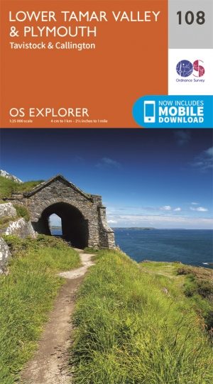
Wandelkaart 108 - Lower Tamer Valley & Plymouth- Cornwall- OSI
Een deel van het Dartmoor National Park en de AONB's

Korte omschrijving
Wandelkaarten Cornwall, England van Ordnance Survey. Ideaal voor tochten in England.
Wandelkaart Lower Tamer Valley & Plymouth - Cornwall England Productbeschrijving: Kaart nummer 108 in de OS Explorer kaarten reeks heeft betrekking op het zuidelijke kust gebied tussen Devon...

Specificaties
- Uitgever: Ordnance Survey
- ISBN-13: 9780319469897
- HOOFDCATEGORIEËN: Wandelkaart
- Activiteiten: Wandelen, Hiking & Trekking
- Regio: Cornwall, England
- Land: England
- Waterafstotende kaart: Ordnance Survey ACTIVE Explorer Weatherproof Maps
- Nationale parken: Dartmoor NP, Devon England
- TOPO's & Stafkaarten: Topografisch wandelen
- AONB - Area of Outstanding Beauty: Tamar Valley AONB
- Schaal: 1:25000
- Taal: Engels
- Reeks/Serie: Explorer ACTIVE Series OSI
- De Engelse Graafschappen: Cornwall
Volledige omschrijving
Wandelkaart Lower Tamer Valley & Plymouth - Cornwall England
Productbeschrijving: Kaart nummer 108 in de OS Explorer kaarten reeks heeft betrekking op het zuidelijke kust gebied tussen Devon en Cornwall rond Plymouth. Samen met een deel van het Dartmoor National Park en de gebieden van uitstekende natuurlijke schoonheid van Cornwall, Zuid-Devon en de Tamar vallei AONB. zijn dit gebieden waar veel te ontdekken valt. Hoogtepunten van het gebied zijn: de steden Tavistock, Callington en Saltash, South West Coast Path, Dartmoor Way en Erme Plym Trail. De OS Explorer kaart voor lagere Tamar Valley & Plymouth is beschikbaar in zowel de standaard papieren versie als de weerbestendige 'Actief' versie.
Productdiscription: Map sheet number 108 in the OS Explorer series covers the south coast area between Devon and Cornwall area around Plymouth. With a section of Dartmoor National Park along with the Areas of Outstanding Natural Beauty of Cornwall, South Devon and the Tamar Valley AONB, this is an area with lots to discover. Highlights of the area include: South West Coast Path, Dartmoor Way, Erme Plym Trail and the towns of Tavistock, Callington and Saltash. The OS Explorer map for Lower Tamar Valley & Plymouth is available in both the standard paper version and weatherproof 'Active' version.
Locatie op kaart
Gekoppelde artikelen
Wandelkaart 108 Lower Tamar Valley & Plymouth - OSI • 9780319243107
standaard versieWandelkaart Lower Tamar Valley & Plymouth - England - OSI Omvat ook: Tavistock & Callington Productbeschrijving: Kaart nummer 108 in de OS Explorer kaarten reeks omvat de zuidkust tussen Devon en Cornwall rond Plymouth. Met een deel van Dartmoor National Park, evenals de gebieden van uitstekende natuurlijke schoonheid AONB. Samen met Cornwall, Zuid-Devon & de Tamar vallei is dit een ge…

Wandelkaart 108 - Lower Tamer Valley & Plymouth- Cornwall- OSI • 9780319469897
weatherproof versieWandelkaart Lower Tamer Valley & Plymouth - Cornwall England Productbeschrijving: Kaart nummer 108 in de OS Explorer kaarten reeks heeft betrekking op het zuidelijke kust gebied tussen Devon en Cornwall rond Plymouth. Samen met een deel van het Dartmoor National Park en de gebieden van uitstekende natuurlijke schoonheid van Cornwall, Zuid-Devon en de Tamar vallei AONB. zijn dit gebieden wa…
Overzichtskaarten

Area's of Outstanding Natural Beauty - AONB's UK
Area's of Outstanding Natural Beauty - AONB's UK

Producten op de overzichtskaart
Klik op een product om naar de detailpagina te gaan.
- Wandelgids - Guide to the Cotswolds AONB - AA
- Wandelkaart 24 - Chilterns AONB - AA
- Wandelgids - Cotswold classic walks guidebook - Goldeneye
- Wandelgids - Cotswold Classic Walks - Goldeneye
- Wandelgids - The Cotswold Way 30 classic routes - Cicerone
- Wandelgids - North Downs Way Nat. trail - Cicerone
- Wandelgids - Chilterns walking guide - Cicerone
- Wandelgids - Suffolk coast & Heaths walks - Cicerone
- Wandelgids - North Downs Way - Map Booklet - Cicerone
- Wandelgids - North Pennines AONB walking guide - Cicerone
- Wandelgids - Ridgeway National Trail - Cicerone
- Wandelgids - Forest of Bowland & Pendle - Cicerone
- Wandelgids - Hampshire's Test Way walking guide - Cicerone
- Wandelgids & Fietsgids - The Cotswold AONB - Cicerone
- Wandelgids - North Wessex Downs - Cicerone Press
- Wandelgids - Walking on the North Wessex Downs - Cicerone
- Wandelgids - Silverdale & Arnside AONB - Cicerone
- Wandelkaart OL2 - Yorkshire Dales- Southern & Western Areas - OSI
- Wandelkaart OL19 - Howgill Fells and Upper Eden Valley - OSI
- Wandelkaart OL21 - South Pennines - Yorkshire - OSI
- Wandelkaart OL31 - North Pennines- Teesdale & Weardale - OSI
- Wandelkaart OL40 - The Broads - OSI
- Wandelkaart OL41 - Forest of Bowland & Ribblesdale - OSI
- Wandelkaart OL45 - The Cotswolds AONB- Gloucestershire - OSI
- Wandelkaart 108 - Lower Tamer Valley & Plymouth- Cornwall- OSI
- Wandelkaart 115 - Exmouth & Sidmouth- Devon - OSI
- Wandelkaart 137 - Ashford- Kent downs AONB- England - OSI
- Wandelkaart 140 - Quantock Hills AONB- Somerset - OSI
- Wandelkaart 140 - Quantock Hills AONB & Bridgwater- Devon - OSI
- Wandelkaart 147 - Sevenoaks & Tonbridge- Kent - OSI
- Wandelkaart 164 - Gower AONB & Gwyr- South Wales - OSI
- Wandelkaart 164 - Gower AONB & Gwyr- Wales - OSI
- Wandelkaart 171 - Chiltern Hills West & Henley-on-Thames OSI
- Wandelkaart 171 - Chiltern Hills West AONB- Wycombe - OSI
- Wandelkaart 172 - Chiltern Hills East AONB- Wycombe - OSI
- Wandelkaart 181 - Chiltern Hills AONB North- England - OSI
- Wandelkaart 181 - Chiltern Hills North AONB- Wycombe - OSI
- Wandelkaart 190 - Malvern Hills & Bredon Hill - OSI
- Wandelkaart 190 - Malvern Hills AONB & Bredon Hill - OSI
- Wandelkaart 203 - Ludlow- Shropshire Hills AONB - OSI
- Wandelkaart 217 - Long Mynd & Wenlock Edge- Schropshire- OSI
- Wandelkaart 254 - Lleyn Peninsular East- North Wales - OSI
- Wandelkaart 261 - Boston- Lincolnshire AONB - OSI
- Wandelkaart 262 - Anglesey West- Wales AONB - OSI
- Wandelkaart 263 - Anglesey East AONB- Wales - OSI
- Wandelkaart 273 - Lincolnshire Wolds South AONB - OSI
- Wandelkaart 282 - Lincolnshire Wolds North AONB - OSI
- Wandelkaart 298 - Nidderdale AONB- Yorkshire - OSI
- Wandelkaart 298 - Nidderdale AONB North Yorkshire - OSI
- Wandelkaart 300 - Howardian Hills AONB - OSI
- Wandelkaart 300 - Howardian Hills AONB & Malton - OSI
- Wandelkaart - Mourne Mountains N. Ireland - Harvey maps
- Wandelkaart - Fietskaart Forest of Bowland - Harvey maps
- Wandelkaart XT40 - Anglesey Coastal Path N. Wales - Harvey Maps
- Wandelkaart XT40 - Pennine Way Noord - Harvey Maps
- Wandelkaart XT40 - Pennine Way Zuid - Harvey Maps
- Wandelgids Cotswold - Way Two-way trekking guide - Knife Edge
- Reisgids Cotswolds England - Rough Guides
Artikelen uit dezelfde regio
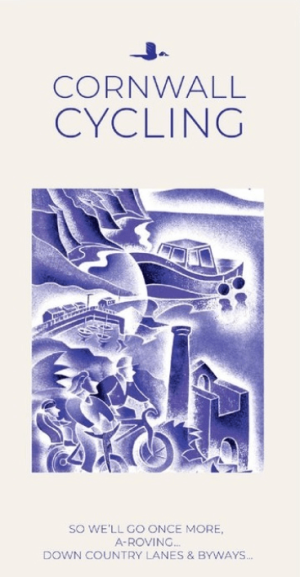
Fietskaart 01 Cornwall cycling map - Goldeneye • 9781859653029
Fietskaart Cornwall cycling map - Goldeneye Productomschrijving: Eén van Engeland's meest afgelegen gebieden, meest bezocht voor zijn vakantie eigenschappen. Met marktjes, pitoreske dorpen, interessante resto's en pub's. Prachtig gelegen terrasjes, havenbootjes, en noem maar op. Een prachtig zeker geen klein gebied om in te vertoeven. Engelse omschrijving: Cornwall is one of England’s …

Wandelgids Cornwall- Newquay & The North Coast - Cicerone • 9781786312471
Wandelgids Cornwall- Newquay & The North Coast Productomschrijving: Would you like to explore the best of Newquay and the North Coast? This guidebook covers 15 of the best short walks in the area (between 3 and 9.6km, all under three hours), including Polly Joke, Watergate Bay, Trevose Head, Padstow, Port Isaac, Camelford and Boscastle. Why choose this guidebook? - Easy to moderat…

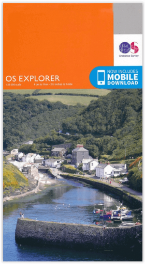
Wandelkaart 105 Falmouth & Mevagissey - Cornawall - OSI • 9780319469866
Wandelkaart Falmouth & Mevagissey - Cornwall - OSI Productbeschrijving: Kaart nummer 105 in de OS Explorer kaart reeks is de ideale kaart voor wandelingen, hikes en ritten rond Falmouth, Mevagissey, Truro and St Mawes. De South West Coast Path is een ideale manier om de kustlijn in dit deel van Cornwall te verkennen. Hoogtepunten van het gebied zijn onder andere: Pendennis Point, Lost Gard…

Stadsplattegrond Cornwall pocket map - Harper Collins • 9780008719159
Stadskaart Cornwall pocket map - Harper Collins Productomschrjving: This handy little full color map of Cornwall is an excellent value and very detailed for its size. Key features include clear mapping at a scale of 8.7 miles to 1 inch; National Tourist Routes showing the best routes through the most scenic areas; Top 100 places of interest; and Park and Ride locations. An ideal companion…
Wandelkaart 102 Land's End - OSI • 9780319263648
Wandelkaart 102 Explorer Land's End - OSI Productomschrijving: Kaart nummer 102 in de OS Explorer kaartenserie is de perfecte kaart voor het ontdekken van het beroemde gebied rond Land's End, Penzance en St Ives. Het gebied staat bekend als het meest extreem zuidwestelijke punt van Groot-Brittannië. Hoogtepunten zijn: Penzance, Land's End, Mousehole, en Cape Cornwall. Inclusief mobiele…