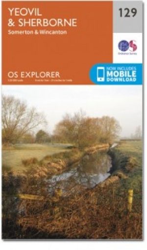
Wandelkaart 129 Yeovil & Sherborne- Somerset - OSI
Beslaat een gebied van Somerton en Wincanton
Korte omschrijving
Wandelkaarten Somerset South West England van Ordnance Survey. Ideaal voor tochten in England.
Wandelkaart Yeovil & Sherborne - Somerset England - OSI Productbeschrijving: Kaart nummer 129 in de OS Explorer kaarten reeks beslaat een gebied van Somerton en Wincanton in het noorden bij ...

Specificaties
- Uitgever: Ordnance Survey
- ISBN-13: 9780319470046
- HOOFDCATEGORIEËN: Wandelkaart
- Activiteiten: Wandelen, Hiking & Trekking
- Regio: Somerset South West England
- Land: England
- Waterafstotende kaart: Ordnance Survey ACTIVE Explorer Weatherproof Maps
- TOPO's & Stafkaarten: Topografisch wandelen
- Schaal: 1:25000
- Taal: Engels
- Reeks/Serie: Explorer ACTIVE Series OSI
- De Engelse Graafschappen: Somerset
Volledige omschrijving
Wandelkaart Yeovil & Sherborne - Somerset England - OSI
Productbeschrijving: Kaart nummer 129 in de OS Explorer kaarten reeks beslaat een gebied van Somerton en Wincanton in het noorden bij Yeovil en Sherborne rond North Dorset en Somerset. Hoogtepunten van het gebied van de Monach Way, Stour Valley Way en Macmillan Way West. De OS Explorer kaart voor Yeovil & Sherborne is beschikbaar in zowel de standaard papieren versie als de weerbestendige 'Actief' versie.
Productdiscription: Map sheet number 129 in the OS Explorer series covers an area from Somerton and Wincanton in the north to Yeovil and Sherbone around North Dorset and Somerset. Highlights of the area include the Monach's Way, Stour Valley Way, and Macmillan Way West. The OS Explorer map for Yeovil & Sherborne is available in both the standard paper version and weatherproof 'Active' version.
Locatie op kaart
Gekoppelde artikelen

Wandelkaart 129 Yeovil & Sherborne - Somerset - OSI • 9780319243251
standaard versieWandelkaart Yeovil & Sherborne - Dorset and Somerset - OSI Omvat ook: Somerton & Wincanton. Productbeschrijving: Kaart nummer 129 in de OS Explorer kaarten reeks beslaat een gebied van Somerton en Wincanton in het noorden van Yeovil en Sherborne rond North Dorset en Somerset. Hoogtepunten van het gebied van de Monach Way, Stour Valley Way en Macmillan Way West. De OS Explorer kaart voo…

Wandelkaart 129 Yeovil & Sherborne- Somerset - OSI • 9780319470046
weatherproof versieWandelkaart Yeovil & Sherborne - Somerset England - OSI Productbeschrijving: Kaart nummer 129 in de OS Explorer kaarten reeks beslaat een gebied van Somerton en Wincanton in het noorden bij Yeovil en Sherborne rond North Dorset en Somerset. Hoogtepunten van het gebied van de Monach Way, Stour Valley Way en Macmillan Way West. De OS Explorer kaart voor Yeovil & Sherborne is beschikbaar in z…
Overzichtskaarten

OSI Explorer & Explorer Active - Z.W. England Devon - Cornwall
OSI Explorer & Explorer Active - Z.W. England Devon - Cornwall

Producten op de overzichtskaart
Klik op een product om naar de detailpagina te gaan.
- Wandelkaart 102 Land's End - OSI
- Wandelkaart 102 Land's End - OSI
- Wandelkaart 103 The Lizard- Cornwall England - OSI
- Wandelkaart 103 The Lizard- Cornwall England - OSI
- Wandelkaart 104 Redruth & St Agnes- Cornwall - OSI
- Wandelkaart 104 Redruth & St Agnes- Cornwall - OSI
- Wandelkaart 105 Falmouth & Mevagissey - Cornawall - OSI
- Wandelkaart 106 Newquay & Padstow - Cornwall - OSI
- Wandelkaart 107 St-Austell & Liskeard- Cornwall - OSI
- Wandelkaart 108 Lower Tamar Valley & Plymouth - OSI
- Wandelkaart 109 Bodmin Moor- Cornwal - OSI
- Wandelkaart 111 Bude- Boscastle & Tintagel- Devon - OSI
- Wandelkaart 112 Launceston & Holsworthy- Devon - OSI
- Wandelkaart 113 Okehampton- Devon England - OSI
- Wandelkaart 113 Okehampton- Devon England - OSI
- Wandelkaart 114 Exeter & Exe Valley- Devon - OSI
- Wandelkaart 114 Exeter & Exe Valley- Devon - OSI
- Wandelkaart 115 Exmouth & Sidmouth- Devon - OSI
- Wandelkaart 115 Exmouth & Sidmouth- Devon - OSI
- Wandelkaart 116 Lyme regis & Bridport- Devon - OSI
- Wandelkaart 116 Lyme Regis & Bridport- Dorset - OSI
- Wandelkaart 117 Cerne Abbas & Bere Regis - Dorset - OSI
- Wandelkaart 117 Cerne Abbas & Bere Regis - Dorset - OSI
- Wandelkaart OL15 Purbeck- South Dorset & Poole - OSI
- Wandelkaart 118 Shaftesbury & Cranbourne Chase - OSI
- Wandelkaart 118 Shaftesbury & Cranbourne Chase - OSI
- Wandelkaart 129 Yeovil & Sherborne- Somerset - OSI
- Wandelkaart 129 Yeovil & Sherborne- Somerset - OSI
- Wandelkaart 140 Quantock Hills AONB & Bridgwater- Devon - OSI
- Wandelkaart 140 Quantock Hills AONB- Somerset - OSI
- Wandelkaart 141 Cheddar Gorge & Mendip Hills - OSI
- Wandelkaart 141 Shepton Mallet & Mendip Hills East - OSI
- Wandelkaart 142 Shepton Mallet & Mendip Hills - OSI
- Wandelkaart 142 Shepton Mallet & Mendip Hills - OSI
- Wandelkaart 143 Warminster & Trowbridge- Wiltshire - OSI
- Wandelkaart 143 Warminster & Trowbridge- Wiltshire - OSI
- Wandelkaart 130 Salisburry & Stonehenge- Wiltshire - OSI
- Wandelkaart 130 Salisburry & Stonehenge- Wiltshire - OSI
- Wandelkaart 131 Romsey- Andover & Test Valley- Hampshire
- Wandelkaart 131 Romsey & Andover - Hampshire - OSI
- Wandelkaart 153 Weston-super-Mare & Bleadon Hill - OSI
- Wandelkaart 153 Weston-Super-Mare & Bleadon Hill - OSI
- Wandelkaart 154 Bristol West & Portishead- Bristol - OSI
- Wandelkaart 154 Bristol West & Portishead- Bristol area
- Wandelkaart 155 Bristol & Bath Keynsham & Marshfield - OSI
- Wandelkaart 155 Bristol & Bath- Bristol Area - OSI
- Wandelkaart 156 Chippenham & Bradford-on-Avon - OSI
- Wandelkaart 156 Chippenham & Bradford-on-Avon- Wiltshire - OSI
- Wandelkaart 157 Marlborough & Savernake Forest - OSI
- Wandelkaart 157 Marlborough & Savernake Forest - OSI
- Wandelkaart 158 Newbury & Hungerford- Berkshire - OSI
- Wandelkaart 158 Newbury & Hungerford- West Berkshire - OSI
- Wandelkaart 167 Thornbury- Dursley & Yate - England- OSI
- Wandelkaart 167 Thornbury- Dursley & Yate - England- OSI
- Wandelkaart 168 Stroud- Tetbury & Malmesbury - OSI
- Wandelkaart 168 Stroud- Tetbury & Malmesbury - OSI
- Wandelkaart 169 Cirencester & Swindon - England - OSI
- Wandelkaart 169 Cirencester & Swindon - England - OSI
- Wandelkaart 170 Abingdon & Wantage - Oxfordshire - OSI
- Wandelkaart 170 Abingdon- Wantage & Vale - OSI
- Wandelkaart 179 Gloucester- Cheltenham & Stroud - OSI
- Wandelkaart 205 Stratford-upon-Avon & Evesham - OSI
- Wandelkaart 205 Stratford-upon-Avon & Evesham - OSI
- Wandelkaart 206 Edge Hill & Fenny Compton - OSI
- Wandelkaart 206 Edge Hill & Fenny Compton - OSI
- Wandelkaart OL09 Exmoor NP Devon England - OS
- Wandelkaart OL15 Purbeck & South Dorset - OS
- Wandelkaart OL20 South Devon & Dartmoor NP - OS
- Wandelkaart OL22 New Forest National Park - OS
- Wandelkaart OL28 Dartmoor National Park - OS
- Wandelkaart OL45 The Cotswolds AONB - OS
Artikelen uit dezelfde regio

Reisgids Bath- Bristol & Somerset - Rough Guides • 9781839059841
Bath- Bristol & Somerset - Rough Guides Productomschrijving: De regio van somerset in Zuid west Engeland, biedt u in deze gids de uitlopers van Exmoor nationaal park, Bath, Bristol en de volledige regio Somerset. Engelse omschrijving: From the genteel Georgian terraces of Bath to the wilderness expanses of Exmoor NP, the fully updated The Rough Guide to Bath, Bristol & Somerset provide…

Wandelgids - Cotswold Classic Walks - Goldeneye • 9781859652916
Cotswold Classic Walks - Goldeneye Productomschrijving: Met 25 rondwandelingen helpt dit boek u een uitvalsbasis te vinden om de auto te ontvluchten en te genieten van een weekend vol frisse lucht en beweging.... Sommige wandelingen bieden verschillende routemogelijkheden en links naar andere wandelingen. Hoe beslist u welke wandeling u gaat doen? - Waar zijn de mooiste uitzichten? - W…

Wandelkaart OL45 The Cotswolds AONB - OS • 9780319242841
Wandelkaart The Cotswolds AONB - OS Productomschrijving: Wychwood Community Forest, The Centenary Way, Cotswolds Way, D'Arcy Dalton Way, Diamond Way, E2 European Long Distance Path, Gloucestershire Way, Heart of England Way, Macmillan Way, Monarch's Way, Oxfordshire Way, Thames Path, Shakespeare Way, Warden's Way, Winchcombe Way, Windrush Way & Wychavon Way. Omvat: Burford, Chipping C…

Reisgids Cotswolds England - Rough Guides • 9780241308752
Reisgids Cotswolds England - Rough Guides Productomschrijving: The Rough Guide to the Cotswolds AONB is your definitive handbook to one of the most beautiful and diverse holiday destinations in the UK. From stately homes and wildlife parks to modern art galleries, country walks and adventure sports, there is a section that introduces all of the regions’ highlights. For every town and v…

Wandelgids & Fietsgids - The Cotswold AONB - Cicerone • 9781852847067
Wandelgids & Fietsgids - The Cotswold AONB - Cicerone Productomschrijving: De Cotswolds is de thuisbasis van mooie honing-hued stenen dorpen in een glooiende landschap. De dramatische 100-mijl lange kalkstenen helling biedt een adembenemend uitzicht, terwijl het netwerk van rustige wegen, fietsvriendelijke kanaalwegen, sporen en ruiterpaden perfect is voor verkenning op een fiets. De Cotwo…


