

Wandelkaart 140 Quantock Hills AONB- Somerset - OSI
Een Area of Outstanding Natural Beauty of AONB

Korte omschrijving
Wandelkaarten Somerset South West England van Ordnance Survey. Ideaal voor tochten in England.
Wandelkaart Quantock Hills AONB & Bridgewater - Somerset Productbeschrijving: Deze zeer gedetailleerde kaarten tonen alle administratieve grenzen & nederzettingen zo klein als geïsoleerde bo...

Specificaties
- Uitgever: Ordnance Survey
- ISBN-13: 9780319243336
- HOOFDCATEGORIEËN: Wandelkaart
- Activiteiten: Wandelen, Hiking & Trekking
- Regio: Somerset South West England
- Land: England
- TOPO's & Stafkaarten: Topografisch wandelen
- AONB - Area of Outstanding Beauty/National Landscape: Quantock Hills AONB
- Schaal: 1:25000
- Taal: Engels
- Reeks/Serie: Explorer Series OS
- De Engelse Graafschappen: Somerset
Volledige omschrijving
Wandelkaart Quantock Hills AONB & Bridgewater - Somerset
Productbeschrijving: Deze zeer gedetailleerde kaarten tonen alle administratieve grenzen & nederzettingen zo klein als geïsoleerde boerderijen. De steile hellingen op de wegen worden aangeduid. Diverse bezienswaardigheden, bijvoorbeeld het elektriciteitsnet, archeologische vindplaatsen, molens, kerken en vuurtorens worden weergegeven.
Productdiscription: These highly detailed maps show all the administrative boundaries, settlements as small as isolated farms, the road network down to unfenced roads and country tracks, and field boundaries (hedges and drystone walls) which make navigation across the countryside much easier. Steep gradients on roads are indicated. Various landmarks, e.g. powerlines, archaeological sites, windmills, churches and lighthouses are shown and additional graphics indicate natural terrain features such as cliffs, scree, mud and vegetation variations. The contour interval is 5 metres in the lower parts of the country and 10 metres in the uplands, and spot heights are marked.
Locatie op kaart
Overzichtskaarten

Area's of Outstanding Natural Beauty - AONB's UK
Area's of Outstanding Natural Beauty - AONB's UK

Producten op de overzichtskaart
Klik op een product om naar de detailpagina te gaan.
- Wandelgids - Guide to the Cotswolds AONB - AA
- Wandelkaart 24 - Chilterns AONB - AA
- Wandelgids - Cotswold classic walks guidebook - Goldeneye
- Wandelgids - Cotswold Classic Walks - Goldeneye
- Wandelgids - The Cotswold Way 30 classic routes - Cicerone
- Wandelgids - North Downs Way Nat. trail - Cicerone
- Wandelgids - Chilterns walking guide - Cicerone
- Wandelgids - Suffolk coast & Heaths walks - Cicerone
- Wandelgids - North Downs Way - Map Booklet - Cicerone
- Wandelgids - North Pennines AONB walking guide - Cicerone
- Wandelgids - Ridgeway National Trail - Cicerone
- Wandelgids - Forest of Bowland & Pendle - Cicerone
- Wandelgids - Hampshire's Test Way walking guide - Cicerone
- Wandelgids & Fietsgids - The Cotswold AONB - Cicerone
- Wandelgids - North Wessex Downs - Cicerone Press
- Wandelgids - Walking on the North Wessex Downs - Cicerone
- Wandelgids - Silverdale & Arnside AONB - Cicerone
- Wandelkaart OL2 - Yorkshire Dales- Southern & Western Areas - OSI
- Wandelkaart OL19 - Howgill Fells and Upper Eden Valley - OSI
- Wandelkaart OL21 - South Pennines - Yorkshire - OSI
- Wandelkaart OL31 - North Pennines- Teesdale & Weardale - OSI
- Wandelkaart OL40 - The Broads - OSI
- Wandelkaart OL41 - Forest of Bowland & Ribblesdale - OSI
- Wandelkaart OL45 - The Cotswolds AONB- Gloucestershire - OSI
- Wandelkaart 108 - Lower Tamer Valley & Plymouth- Cornwall- OSI
- Wandelkaart 115 - Exmouth & Sidmouth- Devon - OSI
- Wandelkaart 137 - Ashford- Kent downs AONB- England - OSI
- Wandelkaart 140 - Quantock Hills AONB- Somerset - OSI
- Wandelkaart 140 - Quantock Hills AONB & Bridgwater- Devon - OSI
- Wandelkaart 147 - Sevenoaks & Tonbridge- Kent - OSI
- Wandelkaart 164 - Gower AONB & Gwyr- South Wales - OSI
- Wandelkaart 164 - Gower AONB & Gwyr- Wales - OSI
- Wandelkaart 171 - Chiltern Hills West & Henley-on-Thames OSI
- Wandelkaart 171 - Chiltern Hills West AONB- Wycombe - OSI
- Wandelkaart 172 - Chiltern Hills East AONB- Wycombe - OSI
- Wandelkaart 181 - Chiltern Hills AONB North- England - OSI
- Wandelkaart 181 - Chiltern Hills North AONB- Wycombe - OSI
- Wandelkaart 190 - Malvern Hills & Bredon Hill - OSI
- Wandelkaart 190 - Malvern Hills AONB & Bredon Hill - OSI
- Wandelkaart 203 - Ludlow- Shropshire Hills AONB - OSI
- Wandelkaart 217 - Long Mynd & Wenlock Edge- Schropshire- OSI
- Wandelkaart 254 - Lleyn Peninsular East- North Wales - OSI
- Wandelkaart 261 - Boston- Lincolnshire AONB - OSI
- Wandelkaart 262 - Anglesey West- Wales AONB - OSI
- Wandelkaart 263 - Anglesey East AONB- Wales - OSI
- Wandelkaart 273 - Lincolnshire Wolds South AONB - OSI
- Wandelkaart 282 - Lincolnshire Wolds North AONB - OSI
- Wandelkaart 298 - Nidderdale AONB- Yorkshire - OSI
- Wandelkaart 298 - Nidderdale AONB North Yorkshire - OSI
- Wandelkaart 300 - Howardian Hills AONB - OSI
- Wandelkaart 300 - Howardian Hills AONB & Malton - OSI
- Wandelkaart - Mourne Mountains N. Ireland - Harvey maps
- Wandelkaart - Fietskaart Forest of Bowland - Harvey maps
- Wandelkaart XT40 - Anglesey Coastal Path N. Wales - Harvey Maps
- Wandelkaart XT40 - Pennine Way Noord - Harvey Maps
- Wandelkaart XT40 - Pennine Way Zuid - Harvey Maps
- Wandelgids Cotswold - Way Two-way trekking guide - Knife Edge
- Reisgids Cotswolds England - Rough Guides

OSI Explorer & Explorer Active - Z.W. England Devon - Cornwall
OSI Explorer & Explorer Active - Z.W. England Devon - Cornwall

Producten op de overzichtskaart
Klik op een product om naar de detailpagina te gaan.
- Wandelkaart 102 Land's End - OSI
- Wandelkaart 102 Land's End - OSI
- Wandelkaart 103 The Lizard- Cornwall England - OSI
- Wandelkaart 103 The Lizard- Cornwall England - OSI
- Wandelkaart 104 Redruth & St Agnes- Cornwall - OSI
- Wandelkaart 104 Redruth & St Agnes- Cornwall - OSI
- Wandelkaart 105 Falmouth & Mevagissey - Cornawall - OSI
- Wandelkaart 106 Newquay & Padstow - Cornwall - OSI
- Wandelkaart 107 St-Austell & Liskeard- Cornwall - OSI
- Wandelkaart 108 Lower Tamar Valley & Plymouth - OSI
- Wandelkaart 109 Bodmin Moor- Cornwal - OSI
- Wandelkaart 111 Bude- Boscastle & Tintagel- Devon - OSI
- Wandelkaart 112 Launceston & Holsworthy- Devon - OSI
- Wandelkaart 113 Okehampton- Devon England - OSI
- Wandelkaart 113 Okehampton- Devon England - OSI
- Wandelkaart 114 Exeter & Exe Valley- Devon - OSI
- Wandelkaart 114 Exeter & Exe Valley- Devon - OSI
- Wandelkaart 115 Exmouth & Sidmouth- Devon - OSI
- Wandelkaart 115 Exmouth & Sidmouth- Devon - OSI
- Wandelkaart 116 Lyme regis & Bridport- Devon - OSI
- Wandelkaart 116 Lyme Regis & Bridport- Dorset - OSI
- Wandelkaart 117 Cerne Abbas & Bere Regis - Dorset - OSI
- Wandelkaart 117 Cerne Abbas & Bere Regis - Dorset - OSI
- Wandelkaart OL15 Purbeck- South Dorset & Poole - OSI
- Wandelkaart 118 Shaftesbury & Cranbourne Chase - OSI
- Wandelkaart 118 Shaftesbury & Cranbourne Chase - OSI
- Wandelkaart 129 Yeovil & Sherborne- Somerset - OSI
- Wandelkaart 129 Yeovil & Sherborne- Somerset - OSI
- Wandelkaart 140 Quantock Hills AONB & Bridgwater- Devon - OSI
- Wandelkaart 140 Quantock Hills AONB- Somerset - OSI
- Wandelkaart 141 Cheddar Gorge & Mendip Hills - OSI
- Wandelkaart 141 Shepton Mallet & Mendip Hills East - OSI
- Wandelkaart 142 Shepton Mallet & Mendip Hills - OSI
- Wandelkaart 142 Shepton Mallet & Mendip Hills - OSI
- Wandelkaart 143 Warminster & Trowbridge- Wiltshire - OSI
- Wandelkaart 143 Warminster & Trowbridge- Wiltshire - OSI
- Wandelkaart 130 Salisburry & Stonehenge- Wiltshire - OSI
- Wandelkaart 130 Salisburry & Stonehenge- Wiltshire - OSI
- Wandelkaart 131 Romsey- Andover & Test Valley- Hampshire
- Wandelkaart 131 Romsey & Andover - Hampshire - OSI
- Wandelkaart 153 Weston-super-Mare & Bleadon Hill - OSI
- Wandelkaart 153 Weston-Super-Mare & Bleadon Hill - OSI
- Wandelkaart 154 Bristol West & Portishead- Bristol - OSI
- Wandelkaart 154 Bristol West & Portishead- Bristol area
- Wandelkaart 155 Bristol & Bath Keynsham & Marshfield - OSI
- Wandelkaart 155 Bristol & Bath- Bristol Area - OSI
- Wandelkaart 156 Chippenham & Bradford-on-Avon - OSI
- Wandelkaart 156 Chippenham & Bradford-on-Avon- Wiltshire - OSI
- Wandelkaart 157 Marlborough & Savernake Forest - OSI
- Wandelkaart 157 Marlborough & Savernake Forest - OSI
- Wandelkaart 158 Newbury & Hungerford- Berkshire - OSI
- Wandelkaart 158 Newbury & Hungerford- West Berkshire - OSI
- Wandelkaart 167 Thornbury- Dursley & Yate - England- OSI
- Wandelkaart 167 Thornbury- Dursley & Yate - England- OSI
- Wandelkaart 168 Stroud- Tetbury & Malmesbury - OSI
- Wandelkaart 168 Stroud- Tetbury & Malmesbury - OSI
- Wandelkaart 169 Cirencester & Swindon - England - OSI
- Wandelkaart 169 Cirencester & Swindon - England - OSI
- Wandelkaart 170 Abingdon & Wantage - Oxfordshire - OSI
- Wandelkaart 170 Abingdon- Wantage & Vale - OSI
- Wandelkaart 179 Gloucester- Cheltenham & Stroud - OSI
- Wandelkaart 205 Stratford-upon-Avon & Evesham - OSI
- Wandelkaart 205 Stratford-upon-Avon & Evesham - OSI
- Wandelkaart 206 Edge Hill & Fenny Compton - OSI
- Wandelkaart 206 Edge Hill & Fenny Compton - OSI
- Wandelkaart OL09 Exmoor NP Devon England - OS
- Wandelkaart OL15 Purbeck & South Dorset - OS
- Wandelkaart OL20 South Devon & Dartmoor NP - OS
- Wandelkaart OL22 New Forest National Park - OS
- Wandelkaart OL28 Dartmoor National Park - OS
- Wandelkaart OL45 The Cotswolds AONB - OS
Artikelen uit dezelfde regio
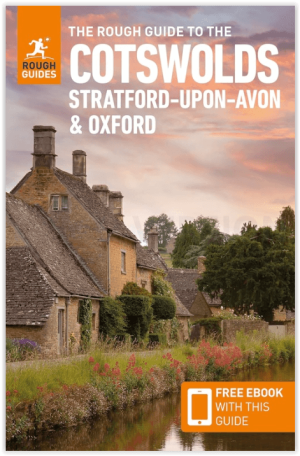
Reisgids Cotswolds AONB - Rough Guides • 9781839059728
The Cotswolds AONB - Rough Guides Productomschrijving: Deze omvat het Cotswolds gebied in zuid-oost Engeland. Een gebied van uitmuntend natuurschoon, of in andere meer lokalere woorden, een AONB area, of Area of Outstanding Natural Beauty. Bij ons is dat bijvoorbeeld de westhoek, het Zwin, enz... Deze reisgids biedt u deze regio inclusief de locaties van Stratford-Uppon-Avon & Oxford die a…

Moutainbike Cotswold Gravel & Mountain AONB - Goldeneye • 9781859653135
Moutainbike map Cotswold - Goldeneye Productomschrijving: Cotswold Gravel & Mountain Bike Routes: The Ultimate Off-Road Experience - Gravel & Mountain Bike Routes 18 (Paperback) When mountainbiking in the Cotswolds, in an Area of Outstanding Natural Beauty of AONB area, a lot of sportsfanatics & MTB fanatics are very interested, and cannot go wrong with this new Goldeneye mountainbiki…

Wandelkaart 153 Weston-super-Mare & Bleadon Hill - OSI • 9780319243466
Wandelkaart Weston-super-Mare & Bleadon - North Somerset Omvat ook: Burnham-on-Sea & Clevedon Productbeschrijving: Kaart nummer 153 omvat Weston-super-Mare, Clevedon en Burnham-on-Sea. Hoogtepunten zijn Mendip Hills, Bleadon Hill, Gordano Round en River Parrett Trail. Omvat ook Highbridge en de rivieren Yeo, Axe en Brue. De OS Explorer kaart voor Weston-super-Mare & Bleadon Hill is bes…

Fietskaart 02 Cotswold AONB cycling map - Goldeneye • 9781859653036
Fietskaart Cotswold cycling map - Goldeneye Productomschrijving: De Cotswolds zijn een AONB regio, een regio van uitmuntend natuurschoon. In Engeland geklasseerd als AONB, Area of Outstanding Natural Beauty. Zo heeft de UK er een pak verdeeld over het land. De Cotswold kun je een beetje vergelijken met Cornwall, maar dan zonder de kustlijnen. Hier vindt je prachtige landschappen en trails …

Wandelkaart 128 Taunton & Blackdown Hills Somerset - OSI • 9780319243244
Wandelkaart Taunton & Blackdown Hills - Somerset England Omvat ook: Wellington & Ilminster. Productbeschrijving: Omvat de Blackdown Hills, alsook het Oosten en het westen van de Deane Way. Deze OS Explorer kaart nummer 128 is het ideale hulpmiddel voor het verkennen van de steden rond Taunton, Wellington, Ilminster en de omliggende dorpen. De OS Explorer kaart voor Taunton & Blackdown …