

Wandelkaart 140 Quantock Hills AONB & Bridgwater- Devon - OSI
Macmillan Way West- Coleridge Way & River Parrett Trail
Korte omschrijving
Wandelkaarten Devon, England van Ordnance Survey. Ideaal voor tochten in England.
Wandelkaart Quantock Hills AONB & Bridgwater - Devon England Productbeschrijving: Kaart nummer 140 in de OS Explorer reeks heeft betrekking op Somerset rond Bridgwater en de Quantock Hills A...

Specificaties
- Uitgever: Ordnance Survey
- ISBN-13: 9780319470121
- HOOFDCATEGORIEËN: Wandelkaart
- Activiteiten: Wandelen, Hiking & Trekking
- Regio: Devon, England
- Land: England
- Waterafstotende kaart: Ordnance Survey ACTIVE Explorer Weatherproof Maps
- TOPO's & Stafkaarten: Topografisch wandelen
- AONB - Area of Outstanding Beauty: Quantock Hills AONB
- Schaal: 1:25000
- Taal: Engels
- Reeks/Serie: Explorer ACTIVE Series OSI
- De Engelse Graafschappen: Devon
Volledige omschrijving
Wandelkaart Quantock Hills AONB & Bridgwater - Devon England
Productbeschrijving: Kaart nummer 140 in de OS Explorer reeks heeft betrekking op Somerset rond Bridgwater en de Quantock Hills AONB. Hoogtepunten van het gebied zijn onder andere: Macmillan Way West, Coleridge Way, River Parrett Trail en de steden van Burnham-on-sea, Highbridge en Bridgwater. De OS Explorer kaart voor Quantock Hills & Bridgwater is beschikbaar in zowel de standaard papieren versie als de weerbestendige 'Actief' versie.
Productdiscription: Map sheet number 140 in the OS Explorer series covers Somerset around Bridgwater and the Quantock Hills AONB. Highlights of the area include: Macmillan Way West, Coleridge Way, River Parrett Trail and the towns of Burnham-on-sea, Highbridge and Bridgwater. The OS Explorer map for Quantock Hills & Bridgwater is available in both the standard paper version and weatherproof 'Active' version.
Locatie op kaart
Gekoppelde artikelen

Wandelkaart 140 Quantock Hills AONB- Somerset - OSI • 9780319243336
standaard versieWandelkaart Quantock Hills AONB & Bridgewater - Somerset Productbeschrijving: Deze zeer gedetailleerde kaarten tonen alle administratieve grenzen & nederzettingen zo klein als geïsoleerde boerderijen. De steile hellingen op de wegen worden aangeduid. Diverse bezienswaardigheden, bijvoorbeeld het elektriciteitsnet, archeologische vindplaatsen, molens, kerken en vuurtorens worden weergegeven…
Wandelkaart 140 Quantock Hills AONB & Bridgwater- Devon - OSI • 9780319470121
weatherproof versieWandelkaart Quantock Hills AONB & Bridgwater - Devon England Productbeschrijving: Kaart nummer 140 in de OS Explorer reeks heeft betrekking op Somerset rond Bridgwater en de Quantock Hills AONB. Hoogtepunten van het gebied zijn onder andere: Macmillan Way West, Coleridge Way, River Parrett Trail en de steden van Burnham-on-sea, Highbridge en Bridgwater. De OS Explorer kaart voor Quantock H…
Overzichtskaarten

Area's of Outstanding Natural Beauty - AONB's UK
Area's of Outstanding Natural Beauty - AONB's UK

Producten op de overzichtskaart
Klik op een product om naar de detailpagina te gaan.
- Wandelgids - Guide to the Cotswolds AONB - AA
- Wandelkaart 24 - Chilterns AONB - AA
- Wandelgids - Cotswold classic walks guidebook - Goldeneye
- Wandelgids - Cotswold Classic Walks - Goldeneye
- Wandelgids - The Cotswold Way 30 classic routes - Cicerone
- Wandelgids - North Downs Way Nat. trail - Cicerone
- Wandelgids - Chilterns walking guide - Cicerone
- Wandelgids - Suffolk coast & Heaths walks - Cicerone
- Wandelgids - North Downs Way - Map Booklet - Cicerone
- Wandelgids - North Pennines AONB walking guide - Cicerone
- Wandelgids - Ridgeway National Trail - Cicerone
- Wandelgids - Forest of Bowland & Pendle - Cicerone
- Wandelgids - Hampshire's Test Way walking guide - Cicerone
- Wandelgids & Fietsgids - The Cotswold AONB - Cicerone
- Wandelgids - North Wessex Downs - Cicerone Press
- Wandelgids - Walking on the North Wessex Downs - Cicerone
- Wandelgids - Silverdale & Arnside AONB - Cicerone
- Wandelkaart OL2 - Yorkshire Dales- Southern & Western Areas - OSI
- Wandelkaart OL19 - Howgill Fells and Upper Eden Valley - OSI
- Wandelkaart OL21 - South Pennines - Yorkshire - OSI
- Wandelkaart OL31 - North Pennines- Teesdale & Weardale - OSI
- Wandelkaart OL40 - The Broads - OSI
- Wandelkaart OL41 - Forest of Bowland & Ribblesdale - OSI
- Wandelkaart OL45 - The Cotswolds AONB- Gloucestershire - OSI
- Wandelkaart 108 - Lower Tamer Valley & Plymouth- Cornwall- OSI
- Wandelkaart 115 - Exmouth & Sidmouth- Devon - OSI
- Wandelkaart 137 - Ashford- Kent downs AONB- England - OSI
- Wandelkaart 140 - Quantock Hills AONB- Somerset - OSI
- Wandelkaart 140 - Quantock Hills AONB & Bridgwater- Devon - OSI
- Wandelkaart 147 - Sevenoaks & Tonbridge- Kent - OSI
- Wandelkaart 164 - Gower AONB & Gwyr- South Wales - OSI
- Wandelkaart 164 - Gower AONB & Gwyr- Wales - OSI
- Wandelkaart 171 - Chiltern Hills West & Henley-on-Thames OSI
- Wandelkaart 171 - Chiltern Hills West AONB- Wycombe - OSI
- Wandelkaart 172 - Chiltern Hills East AONB- Wycombe - OSI
- Wandelkaart 181 - Chiltern Hills AONB North- England - OSI
- Wandelkaart 181 - Chiltern Hills North AONB- Wycombe - OSI
- Wandelkaart 190 - Malvern Hills & Bredon Hill - OSI
- Wandelkaart 190 - Malvern Hills AONB & Bredon Hill - OSI
- Wandelkaart 203 - Ludlow- Shropshire Hills AONB - OSI
- Wandelkaart 217 - Long Mynd & Wenlock Edge- Schropshire- OSI
- Wandelkaart 254 - Lleyn Peninsular East- North Wales - OSI
- Wandelkaart 261 - Boston- Lincolnshire AONB - OSI
- Wandelkaart 262 - Anglesey West- Wales AONB - OSI
- Wandelkaart 263 - Anglesey East AONB- Wales - OSI
- Wandelkaart 273 - Lincolnshire Wolds South AONB - OSI
- Wandelkaart 282 - Lincolnshire Wolds North AONB - OSI
- Wandelkaart 298 - Nidderdale AONB- Yorkshire - OSI
- Wandelkaart 298 - Nidderdale AONB North Yorkshire - OSI
- Wandelkaart 300 - Howardian Hills AONB - OSI
- Wandelkaart 300 - Howardian Hills AONB & Malton - OSI
- Wandelkaart - Mourne Mountains N. Ireland - Harvey maps
- Wandelkaart - Fietskaart Forest of Bowland - Harvey maps
- Wandelkaart XT40 - Anglesey Coastal Path N. Wales - Harvey Maps
- Wandelkaart XT40 - Pennine Way Noord - Harvey Maps
- Wandelkaart XT40 - Pennine Way Zuid - Harvey Maps
- Wandelgids Cotswold - Way Two-way trekking guide - Knife Edge
- Reisgids Cotswolds England - Rough Guides

OSI Explorer & Explorer Active - Z.W. England Devon - Cornwall
OSI Explorer & Explorer Active - Z.W. England Devon - Cornwall

Producten op de overzichtskaart
Klik op een product om naar de detailpagina te gaan.
- Wandelkaart 102 Land's End - OSI
- Wandelkaart 102 Land's End - OSI
- Wandelkaart 103 The Lizard- Cornwall England - OSI
- Wandelkaart 103 The Lizard- Cornwall England - OSI
- Wandelkaart 104 Redruth & St Agnes- Cornwall - OSI
- Wandelkaart 104 Redruth & St Agnes- Cornwall - OSI
- Wandelkaart 105 Falmouth & Mevagissey - Cornawall - OSI
- Wandelkaart 106 Newquay & Padstow - Cornwall - OSI
- Wandelkaart 107 St-Austell & Liskeard- Cornwall - OSI
- Wandelkaart 108 Lower Tamar Valley & Plymouth - OSI
- Wandelkaart 109 Bodmin Moor- Cornwal - OSI
- Wandelkaart 111 Bude- Boscastle & Tintagel- Devon - OSI
- Wandelkaart 112 Launceston & Holsworthy- Devon - OSI
- Wandelkaart 113 Okehampton- Devon England - OSI
- Wandelkaart 113 Okehampton- Devon England - OSI
- Wandelkaart 114 Exeter & Exe Valley- Devon - OSI
- Wandelkaart 114 Exeter & Exe Valley- Devon - OSI
- Wandelkaart 115 Exmouth & Sidmouth- Devon - OSI
- Wandelkaart 115 Exmouth & Sidmouth- Devon - OSI
- Wandelkaart 116 Lyme regis & Bridport- Devon - OSI
- Wandelkaart 116 Lyme Regis & Bridport- Dorset - OSI
- Wandelkaart 117 Cerne Abbas & Bere Regis - Dorset - OSI
- Wandelkaart 117 Cerne Abbas & Bere Regis - Dorset - OSI
- Wandelkaart OL15 Purbeck- South Dorset & Poole - OSI
- Wandelkaart 118 Shaftesbury & Cranbourne Chase - OSI
- Wandelkaart 118 Shaftesbury & Cranbourne Chase - OSI
- Wandelkaart 129 Yeovil & Sherborne- Somerset - OSI
- Wandelkaart 129 Yeovil & Sherborne- Somerset - OSI
- Wandelkaart 140 Quantock Hills AONB & Bridgwater- Devon - OSI
- Wandelkaart 140 Quantock Hills AONB- Somerset - OSI
- Wandelkaart 141 Cheddar Gorge & Mendip Hills - OSI
- Wandelkaart 141 Shepton Mallet & Mendip Hills East - OSI
- Wandelkaart 142 Shepton Mallet & Mendip Hills - OSI
- Wandelkaart 142 Shepton Mallet & Mendip Hills - OSI
- Wandelkaart 143 Warminster & Trowbridge- Wiltshire - OSI
- Wandelkaart 143 Warminster & Trowbridge- Wiltshire - OSI
- Wandelkaart 130 Salisburry & Stonehenge- Wiltshire - OSI
- Wandelkaart 130 Salisburry & Stonehenge- Wiltshire - OSI
- Wandelkaart 131 Romsey- Andover & Test Valley- Hampshire
- Wandelkaart 131 Romsey & Andover - Hampshire - OSI
- Wandelkaart 153 Weston-super-Mare & Bleadon Hill - OSI
- Wandelkaart 153 Weston-Super-Mare & Bleadon Hill - OSI
- Wandelkaart 154 Bristol West & Portishead- Bristol - OSI
- Wandelkaart 154 Bristol West & Portishead- Bristol area
- Wandelkaart 155 Bristol & Bath Keynsham & Marshfield - OSI
- Wandelkaart 155 Bristol & Bath- Bristol Area - OSI
- Wandelkaart 156 Chippenham & Bradford-on-Avon - OSI
- Wandelkaart 156 Chippenham & Bradford-on-Avon- Wiltshire - OSI
- Wandelkaart 157 Marlborough & Savernake Forest - OSI
- Wandelkaart 157 Marlborough & Savernake Forest - OSI
- Wandelkaart 158 Newbury & Hungerford- Berkshire - OSI
- Wandelkaart 158 Newbury & Hungerford- West Berkshire - OSI
- Wandelkaart 167 Thornbury- Dursley & Yate - England- OSI
- Wandelkaart 167 Thornbury- Dursley & Yate - England- OSI
- Wandelkaart 168 Stroud- Tetbury & Malmesbury - OSI
- Wandelkaart 168 Stroud- Tetbury & Malmesbury - OSI
- Wandelkaart 169 Cirencester & Swindon - England - OSI
- Wandelkaart 169 Cirencester & Swindon - England - OSI
- Wandelkaart 170 Abingdon & Wantage - Oxfordshire - OSI
- Wandelkaart 170 Abingdon- Wantage & Vale - OSI
- Wandelkaart 179 Gloucester- Cheltenham & Stroud - OSI
- Wandelkaart 205 Stratford-upon-Avon & Evesham - OSI
- Wandelkaart 205 Stratford-upon-Avon & Evesham - OSI
- Wandelkaart 206 Edge Hill & Fenny Compton - OSI
- Wandelkaart 206 Edge Hill & Fenny Compton - OSI
- Wandelkaart OL09 Exmoor NP Devon England - OS
- Wandelkaart OL15 Purbeck & South Dorset - OS
- Wandelkaart OL20 South Devon & Dartmoor NP - OS
- Wandelkaart OL22 New Forest National Park - OS
- Wandelkaart OL28 Dartmoor National Park - OS
- Wandelkaart OL45 The Cotswolds AONB - OS
Artikelen uit dezelfde regio
Wandelkaart 108 Lower Tamar Valley & Plymouth - OSI • 9780319243107
Wandelkaart Lower Tamar Valley & Plymouth - England - OSI Omvat ook: Tavistock & Callington Productbeschrijving: Kaart nummer 108 in de OS Explorer kaarten reeks omvat de zuidkust tussen Devon en Cornwall rond Plymouth. Met een deel van Dartmoor National Park, evenals de gebieden van uitstekende natuurlijke schoonheid AONB. Samen met Cornwall, Zuid-Devon & de Tamar vallei is dit een ge…
Wandelkaart 126 Clovelly & Hartland- Devon England - OSI • 9780319470015
Wandelkaart Clovelly & Hartland - Devon England - OSI Productbeschrijving: Kaart nummer 126 in de OS Explorer reeks omvat Clovelly, Bideford, Hartland, Bradworthy en great Torrington. Hoogtepunten van het gebied zijn onder andere: Noord-Devon en Cornwall AONB, rivier Torridge en Tamar, Hartland punt, Barnstaple en Bideford Bay en Coombe. Ook omvat een deel van de South West Coast Path. De …
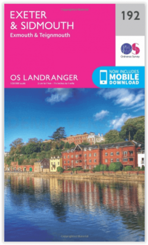
Wandelkaart 192 Exeter & Sidmouth- Devon - OSI • 9780319262900
Wandelkaart Exeter & Sidmouth - Devon England Productbeschrijving: Kaart nummer 192 in de OS Landranger kaarten reeks, is de ideale kaart voor de planning van dagexcursies en vakanties naar Exeter en Sidmouth. Verken het oosten van Devon, met inbegrip van de stad van Exeter en de steden van Honiton, Exmouth, Sidmouth, Teignmouth, Seaton en Budleigh Salterton. De OS Landranger kaarten r…

Wandelkaart 191 Okehampton & North Dartmoor NP - OSI • 9780319262894
Wandelkaart Okehampton & North Dartmoor NP - England Productbeschrijving: Kaart nummer 191 in de OS Landranger kaarten reeks, is de perfecte kaart om te gebruiken bij het plannen van een reis naar het Okehampton gebied van Devon. Het gebied heeft veel te bieden voor vakantiegangers en dagjesmensen die uitstekend wandel- en landschappen willen beleven. Hoogtepunten van het gebied zijn onde…

Reisgids Time Out Devon & Cornwall - Crimson Pub. • 9781846702433
Reisgids - Time Out Devon & Cornwall - Crimson Pub. Productomschrijving: Devon en Cornwall zijn uniek, glorieus mooi en rijk aan geschiedenis en dieren in het wild. Ze bieden alles van traditionele vissersdorpen en zandstranden tot wandelingen in de wildernis en kastelen. Accommodaties variëren van campings en huisjes tot boerderijen en boetiekhotels. Of het nu gaat om gezinsvriendelijke o…