
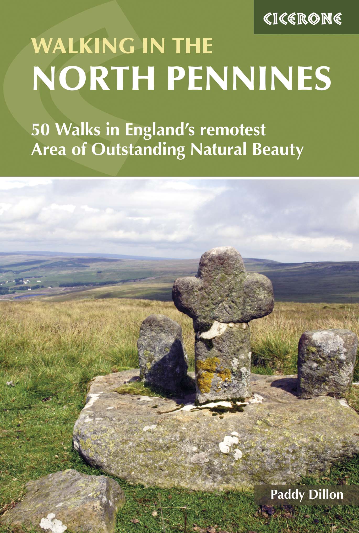
Wandelgids North Pennines AONB walking guide - Cicerone
50 dag wandelingen over de Noordelijke Pennines AONB
Korte omschrijving
Wandelgids - North Pennines AONB walking guide - Cicerone Omschrijving: Deze handige gids beschrijft 50 dag wandelingen over de Noordelijke Pennines AONB met routes geschikt voor alle leefti...

Specificaties
- Uitgever: CICERONE Press
- ISBN-13: 9781852849054
- HOOFDCATEGORIEËN: Wandelgids
- Activiteiten: Wandelen, Hiking & Trekking
- Regio: North East England
- Land: England
- AONB - Area of Outstanding Beauty: Northern Pennines AONB
- Blz.: 256
- Afmeting: 12x17
- Editie: 3
- Taal: Engels
Volledige omschrijving
Wandelgids - North Pennines AONB walking guide - Cicerone
Omschrijving: Deze handige gids beschrijft 50 dag wandelingen over de Noordelijke Pennines AONB met routes geschikt voor alle leeftijden. Zij omvatten een scala aan verschillend terrein van zachte rivier ballades tot ruige Heide wandelingen. De selectie van routes zijn voornamelijk circulaire met een paar lineaire routes, en variëren van 8km tot 23km. Perfect voor degenen die de wilde Pennines willen verkennen.
Product description: This handy guidebook describes 50 day walks across the North Pennines AONB with routes suitable for all abilities. They cover a variety of terrain from gentle riverside strolls to rugged moorland walks. The selection of routes are mainly circular with some linear trails and range from 8km to 23km. Perfect for those seeking to explore the wild Pennines.
Seasons:
All year round - region famous for its bleak and blustery weather!Centres CentresHexham, Consett, Barnard Castle, Kirkby Stephen, Appleby and Brampton.
Difficulty:
A variety of terrain from riverside strolls and old railway trackbeds to rugged moorland; walks up to 14 miles (23km) in length but nothing difficult; ability to navigate essential because of changing weather conditions.
Must See:
England's last wilderness; Area of Outstanding Natural Beauty; Vale of Eden; fascinating geology eg the Whin Sill (first Geopark in England in 2003); rich industrial heritage (eg Killhope lead-mining museum).
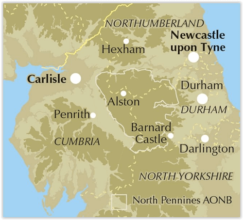
Locatie op kaart
Overzichtskaarten

Area's of Outstanding Natural Beauty - AONB's UK
Area's of Outstanding Natural Beauty - AONB's UK

Producten op de overzichtskaart
Klik op een product om naar de detailpagina te gaan.
- Wandelgids - Guide to the Cotswolds AONB - AA
- Wandelkaart 24 - Chilterns AONB - AA
- Fietskaart- en Mtb kaart - The Cotswolds - Goldeneye
- Wandelgids - Cotswold classic walks guidebook - Goldeneye
- Wandelkaart - Cotswold South AONB - Goldeneye
- Wandelgids - Exploring the Cotswolds - Goldeneye
- Wandelgids - Cotswold Classic Walks - Goldeneye
- Wandelkaart - Cotswolds- Malverns & Forest of Dean - Goldeneye
- Wandelgids - The Cotswold Way 30 classic routes - Cicerone
- Wandelgids - Kent walking guide - Cicerone
- Wandelgids - North Downs Way Nat. trail - Cicerone
- Wandelgids - Chilterns walking guide - Cicerone
- Wandelgids - Suffolk coast & Heaths walks - Cicerone
- Wandelgids - North Downs Way - Map Booklet - Cicerone
- Wandelgids - North Pennines AONB walking guide - Cicerone
- Wandelgids - Ridgeway National Trail - Cicerone
- Wandelgids - Forest of Bowland & Pendle - Cicerone
- Wandelgids - Hampshire's Test Way walking guide - Cicerone
- Wandelgids & Fietsgids - The Cotswold AONB - Cicerone
- Wandelgids - Walking on the Gower - Cicerone
- Wandelgids - North Wessex Downs - Cicerone Press
- Wandelgids - Walking on the North Wessex Downs - Cicerone
- Wandelgids - Silverdale & Arnside AONB - Cicerone
- Wandelgids - The Kennet and Avon Canal walking guide - Cicerone
- Wandelgids - North Downs Way- 246 km - Trailblazer
- Wandelkaart OL2 - Yorkshire Dales- Southern & Western Areas - OSI
- Wandelkaart OL19 - Howgill Fells and Upper Eden Valley - OSI
- Wandelkaart OL21 - South Pennines - Yorkshire - OSI
- Wandelkaart OL31 - North Pennines- Teesdale & Weardale - OSI
- Wandelkaart OL40 - The Broads - OSI
- Wandelkaart OL41 - Forest of Bowland & Ribblesdale - OSI
- Wandelkaart OL45 - The Cotswolds AONB- Gloucestershire - OSI
- Wandelkaart 108 - Lower Tamer Valley & Plymouth- Cornwall- OSI
- Wandelkaart 115 - Exmouth & Sidmouth- Devon - OSI
- Wandelkaart 137 - Ashford- Kent downs AONB- England - OSI
- Wandelkaart 140 - Quantock Hills AONB- Somerset - OSI
- Wandelkaart 140 - Quantock Hills AONB & Bridgwater- Devon - OSI
- Wandelkaart 147 - Sevenoaks & Tonbridge- Kent - OSI
- Wandelkaart 164 - Gower AONB & Gwyr- South Wales - OSI
- Wandelkaart 164 - Gower AONB & Gwyr- Wales - OSI
- Wandelkaart 171 - Chiltern Hills West & Henley-on-Thames OSI
- Wandelkaart 171 - Chiltern Hills West AONB- Wycombe - OSI
- Wandelkaart 172 - Chiltern Hills East AONB- Wycombe - OSI
- Wandelkaart 181 - Chiltern Hills AONB North- England - OSI
- Wandelkaart 181 - Chiltern Hills North AONB- Wycombe - OSI
- Wandelkaart 190 - Malvern Hills & Bredon Hill - OSI
- Wandelkaart 190 - Malvern Hills AONB & Bredon Hill - OSI
- Wandelkaart 203 - Ludlow- Shropshire Hills AONB - OSI
- Wandelkaart 217 - Long Mynd & Wenlock Edge- Schropshire- OSI
- Wandelkaart 254 - Lleyn Peninsular East- North Wales - OSI
- Wandelkaart 261 - Boston- Lincolnshire AONB - OSI
- Wandelkaart 262 - Anglesey West- Wales AONB - OSI
- Wandelkaart 263 - Anglesey East AONB- Wales - OSI
- Wandelkaart 273 - Lincolnshire Wolds South AONB - OSI
- Wandelkaart 282 - Lincolnshire Wolds North AONB - OSI
- Wandelkaart 298 - Nidderdale AONB- Yorkshire - OSI
- Wandelkaart 298 - Nidderdale AONB North Yorkshire - OSI
- Wandelkaart 300 - Howardian Hills AONB - OSI
- Wandelkaart 300 - Howardian Hills AONB & Malton - OSI
- Wandelkaart - Mourne Mountains N. Ireland - Harvey maps
- Wandelkaart - Fietskaart Forest of Bowland - Harvey maps
- Wandelkaart XT40 - Anglesey Coastal Path N. Wales - Harvey Maps
- Wandelkaart XT40 - Pennine Way Noord - Harvey Maps
- Wandelkaart XT40 - Pennine Way Zuid - Harvey Maps
- Wandelgids Cotswold - Way Two-way trekking guide - Knife Edge
- Reisgids Oxford & the Cotswolds AONB - Edicola
- Reisgids Cotswolds England - Rough Guides
- Reisgids Go Slow- Sussex & the South Downs- Weald & Coast - Bradt
- Travelguide Oxford & The Cotswolds pocket guide - Lonely Planet
- Wandelgids - The Ridgeway National trail - Trailblazer
Artikelen uit dezelfde regio

Wandelkaart 316 Newcastle upon Tyne England - OSI • 9780319471883
Wandelkaart Newcastle upon Tyne - North East England Omvat ook: Gateshead, South Shields, Prudhoe, Ponteland, Cramlington & Whitley Bay. Productbeschrijving: Kaart 316 in de OS Explorer reeks behandelt de levendige en bruisende stad van Newcastle-upon-Tyne en het omringende gebied. Hoogtepunten van het gebied: de rivier de Tyne, Tyne Valley, Wylam, Stocksfield, Heddon-on-the-Wall, het …

Fietsgids Hadrian's Cycleway - Cicerone • 9781786310422
Fietsgids - Hadrian's Cycleway - Cicerone Productomschrijving: Hadrian's Cycleway, een dikke 250 km lange kust tot kust fietsroute over noordelijk Engeland, die de route volgt voor zover mogelijk natuurlijk, langs de bekende Hadrian's Wall World Heritage Site. Deze route loopt van Ravenglass in Cumbria doorheen Northumberland to South Shields aan de oostkust van Engeland, met een eventuele…

Wandelgids Hadrian's Wall Path short walks - Cicerone • 9781786311573
Hadrian's Wall Path - short walks - Cicerone Productomschrijving: Mark Richards heeft 15 van de beste korte wandelingen rond Hadrian's Wall voor je uitgezocht. Onze gids is voorzien van goed leesbare Ordnance Survey-kaarten en duidelijke routebeschrijvingen, perfect als je voor het eerst gaat wandelen of iets zoekt waar je met het hele gezin van kunt genieten. We hebben informati…

Wandelgids Durham County walking guide - Cicerone • 9781786311375
Wandelgids Durham County walking guide - Cicerone Productomschrijving: Gids met gedetailleerde beschrijvingen van 40 dagwandelingen door het graafschap Durham. De wandelingen variëren van 5 tot 24 km en laten de geschiedenis en natuurlijke wonderen van de regio zien. Het terrein beslaat veldwegen en open heidevelden, van de Noordzee tot de hoge Pennines. Engelse omschrijving: Guidebook…

Wandelkaart 306 Middlesbrough & Hartlepool - OSI • 9780319471784
WandelkaartMiddlesbrough & Hartlepool - North East England Omvat ook: Stockton-on-Tees & Redcar. Productbeschrijving: OS Explorer kaart 306 omvat het gebied rond Middlesbrough in het noordoosten van Engeland, deze kaart behandelt Hartlepool en Redcar, Stockton-on-Tees en de rivier de Tees. Hoogtepunten van het gebied zijn de Tees Forest, Teesdale Way, Tees Link en delen van de Clevelan…