

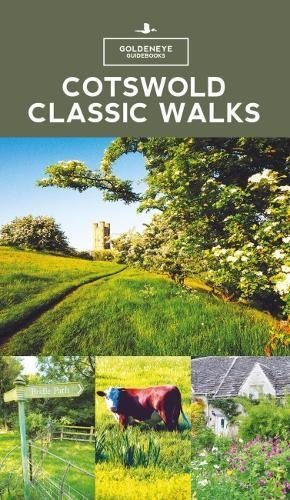
Wandelgids - Cotswold classic walks guidebook - Goldeneye
In eerste instantie is dit wat de Engelsen een AONB noemen
Korte omschrijving
Wandelgidsen Somerset South West England, Warwickshire, West Midlands, Wiltshire, West England en Oxfordshire west England van Goldeneye. Ideaal voor tochten in England.
Wandelgids Cotswold classic walks guidebook Productomschrijving: In eerste instantie is dit wat de engelsen noemen een AONB, een "Area of Outstanding Natural Beauty" die in deze versie versp...

Specificaties
- Uitgever: Goldeneye
- ISBN-13: 9781859652602
- HOOFDCATEGORIEËN: Wandelgids
- Activiteiten: Wandelen, Hiking & Trekking
- Auteur: William Fricker
- Regio: Oxfordshire west England, Somerset South West England, Warwickshire, West Midlands, Wiltshire, West England
- Land: England
- AONB - Area of Outstanding Beauty: Cotswolds AONB
- Editie: 3
- Taal: Engels
Volledige omschrijving
Wandelgids Cotswold classic walks guidebook
Productomschrijving: In eerste instantie is dit wat de engelsen noemen een AONB, een "Area of Outstanding Natural Beauty" die in deze versie verspreidt word over verschillende regio's aangezien zijn grote. Deze plaats van subliem natuurschoon, ligt deel is, Somerset, deels in wawickshire, deels in Wiltshire, deels in Oxfordshire en is de meest bewandelde versie van alle AONB's verspreidt over het engels Schotse landschap.
Het grootste deel ervan ligt in Gloucestershire, op zich ook een mooie Britse regio. De Cotswolds zijn idd een sublieme regio, beetje te vergelijken met Yorkshire, beetje zeg ik maar, want je vind er heel andere soorten troeven dan in Yorkshire. Om te wandelen is deze uiteraard een zeer goede keuze. Zo worden er vele verschillende wandelroutes uit de doeken gedaan, om u de beste mogelijke beleving te kunnen bieden.
Engese omschrijving: With 25 circular walks, this book will help you find a base to escape from your car and enjoy a weekend of fresh air and exercise.... Some walks offer various route options and links to other walks. How do you decide which walk to undertake? Where are the best views? Where to find solitude? This book will guide you to find a walk that suits you, whether it be a pushchair, family, dog, woodland, bluebell or a pub crawl. The maps are clear, and even if you find maps difficult to read, the instructions will get you round the walk.
.png)
Locatie op kaart
Overzichtskaarten

Area's of Outstanding Natural Beauty - AONB's UK
Area's of Outstanding Natural Beauty - AONB's UK

Producten op de overzichtskaart
Klik op een product om naar de detailpagina te gaan.
- Wandelgids - Guide to the Cotswolds AONB - AA
- Wandelkaart 24 - Chilterns AONB - AA
- Wandelgids - Cotswold classic walks guidebook - Goldeneye
- Wandelgids - Cotswold Classic Walks - Goldeneye
- Wandelgids - The Cotswold Way 30 classic routes - Cicerone
- Wandelgids - North Downs Way Nat. trail - Cicerone
- Wandelgids - Chilterns walking guide - Cicerone
- Wandelgids - Suffolk coast & Heaths walks - Cicerone
- Wandelgids - North Downs Way - Map Booklet - Cicerone
- Wandelgids - North Pennines AONB walking guide - Cicerone
- Wandelgids - Ridgeway National Trail - Cicerone
- Wandelgids - Forest of Bowland & Pendle - Cicerone
- Wandelgids - Hampshire's Test Way walking guide - Cicerone
- Wandelgids & Fietsgids - The Cotswold AONB - Cicerone
- Wandelgids - North Wessex Downs - Cicerone Press
- Wandelgids - Walking on the North Wessex Downs - Cicerone
- Wandelgids - Silverdale & Arnside AONB - Cicerone
- Wandelkaart OL2 - Yorkshire Dales- Southern & Western Areas - OSI
- Wandelkaart OL19 - Howgill Fells and Upper Eden Valley - OSI
- Wandelkaart OL21 - South Pennines - Yorkshire - OSI
- Wandelkaart OL31 - North Pennines- Teesdale & Weardale - OSI
- Wandelkaart OL40 - The Broads - OSI
- Wandelkaart OL41 - Forest of Bowland & Ribblesdale - OSI
- Wandelkaart OL45 - The Cotswolds AONB- Gloucestershire - OSI
- Wandelkaart 108 - Lower Tamer Valley & Plymouth- Cornwall- OSI
- Wandelkaart 115 - Exmouth & Sidmouth- Devon - OSI
- Wandelkaart 137 - Ashford- Kent downs AONB- England - OSI
- Wandelkaart 140 - Quantock Hills AONB- Somerset - OSI
- Wandelkaart 140 - Quantock Hills AONB & Bridgwater- Devon - OSI
- Wandelkaart 147 - Sevenoaks & Tonbridge- Kent - OSI
- Wandelkaart 164 - Gower AONB & Gwyr- South Wales - OSI
- Wandelkaart 164 - Gower AONB & Gwyr- Wales - OSI
- Wandelkaart 171 - Chiltern Hills West & Henley-on-Thames OSI
- Wandelkaart 171 - Chiltern Hills West AONB- Wycombe - OSI
- Wandelkaart 172 - Chiltern Hills East AONB- Wycombe - OSI
- Wandelkaart 181 - Chiltern Hills AONB North- England - OSI
- Wandelkaart 181 - Chiltern Hills North AONB- Wycombe - OSI
- Wandelkaart 190 - Malvern Hills & Bredon Hill - OSI
- Wandelkaart 190 - Malvern Hills AONB & Bredon Hill - OSI
- Wandelkaart 203 - Ludlow- Shropshire Hills AONB - OSI
- Wandelkaart 217 - Long Mynd & Wenlock Edge- Schropshire- OSI
- Wandelkaart 254 - Lleyn Peninsular East- North Wales - OSI
- Wandelkaart 261 - Boston- Lincolnshire AONB - OSI
- Wandelkaart 262 - Anglesey West- Wales AONB - OSI
- Wandelkaart 263 - Anglesey East AONB- Wales - OSI
- Wandelkaart 273 - Lincolnshire Wolds South AONB - OSI
- Wandelkaart 282 - Lincolnshire Wolds North AONB - OSI
- Wandelkaart 298 - Nidderdale AONB- Yorkshire - OSI
- Wandelkaart 298 - Nidderdale AONB North Yorkshire - OSI
- Wandelkaart 300 - Howardian Hills AONB - OSI
- Wandelkaart 300 - Howardian Hills AONB & Malton - OSI
- Wandelkaart - Mourne Mountains N. Ireland - Harvey maps
- Wandelkaart - Fietskaart Forest of Bowland - Harvey maps
- Wandelkaart XT40 - Anglesey Coastal Path N. Wales - Harvey Maps
- Wandelkaart XT40 - Pennine Way Noord - Harvey Maps
- Wandelkaart XT40 - Pennine Way Zuid - Harvey Maps
- Wandelgids Cotswold - Way Two-way trekking guide - Knife Edge
- Reisgids Cotswolds England - Rough Guides
Artikelen uit dezelfde regio

Reisgids Cotswolds Top 10 - William Fricker - Goldeneye • 9781859653081
Reisgids Cotswolds - Goldeneye Productomschrijving: Ervaren Cotswold-reisschrijver William Fricker en zijn team van Goldeneye geven hun mening over de mooiste dorpen om te bezoeken. Een breed scala aan activiteiten om aan deel te nemen, van het bezoeken van landhuizen en tuinen, de prachtige kerken en de dromerige rivierdalen. Een breed scala aan overnachtingsmogelijkheden, van landelijke …

Wandelgids & Fietsgids - The Cotswold AONB - Cicerone • 9781852847067
Wandelgids & Fietsgids - The Cotswold AONB - Cicerone Productomschrijving: De Cotswolds is de thuisbasis van mooie honing-hued stenen dorpen in een glooiende landschap. De dramatische 100-mijl lange kalkstenen helling biedt een adembenemend uitzicht, terwijl het netwerk van rustige wegen, fietsvriendelijke kanaalwegen, sporen en ruiterpaden perfect is voor verkenning op een fiets. De Cotwo…
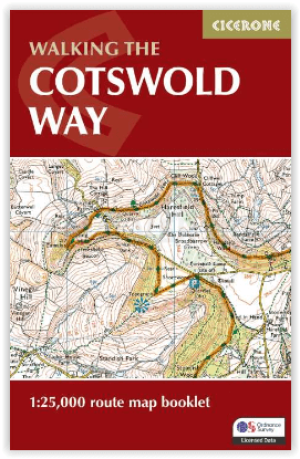
Wandelgids The Cotswold Way Map Booklet - Cicerone • 9781786312112
The Cotswold Way - Cicerone Productomschrijving: OPGELET: Dit artikel is reeds inbegrepen in de volledige wandelgids van de The Cotswold Way. Deze kunt u vinden met dit ISBN nr in te geven in onze zoekfunctie: 9781786312105 - Het boek gaat over de befaamde Cotswold Way, tussen Chipping Camden en Bath, dwars door het Cotswolds AONB regio van uitmuntend natuurschoon. 164 km lange route in 2…

Cotswolds Mountain Biking - Vertebrate Publ. • 9781906148140
Cotswolds AONB Mountain Biking - Vertebrate Productomschrijving: 20 Classic Rides - Cotwolds Mountain Biking by Tom Fenton features 20 classic MTB routes in the Cotswold Hills across the counties of Gloucestershire and Oxfordshire, and extending into parts of Wiltshire, Somerset, Worcestershire and Warwickshire. With Ordnance Survey mapping and easy-to-follow directions. The Cotswold H…

Wandelkaart 130 Salisburry & Stonehenge- Wiltshire - OSI • 9780319470053
Wandelkaart Salisburry & Stonehenge - Wiltshire England Productbeschrijving: Explorer kaart 130 omvat gegevens van rond Salisbury en Wilton in het zuiden tot Market Lavington en Pewsey in het noorden, en dekt delen van de North Wessex Downs AONB en de Cranborne Chase & West Wiltshire Downs gebieden van uitzonderlijke natuurlijke schoonheid, evenals Stonehenge. Ook aanwezig zijn delen van h…