

Wandelkaart 300 - Howardian Hills AONB - OSI
Omvat delen van de Howardian Hills AONB en The Wolds

Korte omschrijving
Wandelkaarten North Yorkshire, Engeland van Ordnance Survey. Ideaal voor tochten in England.
Wandelkaart Howardian Hills AONB & Malton - North Yorkshire Productbeschrijving: Gecentreerd rond Malton, bevat OS Explorer kaart 300 delen van de Howardian Hills AONB en The Wolds. Met veel...

Specificaties
- Uitgever: Ordnance Survey
- ISBN-13: 9780319471722
- HOOFDCATEGORIEËN: Wandelkaart
- Activiteiten: Wandelen, Hiking & Trekking
- Regio: North Yorkshire, Engeland
- Land: England
- Waterafstotende kaart: Ordnance Survey ACTIVE Explorer Weatherproof Maps
- TOPO's & Stafkaarten: Topografisch wandelen
- AONB - Area of Outstanding Beauty: Howardian Hills, Helmsley AONB
- Schaal: 1:25000
- Taal: Engels
- Reeks/Serie: Explorer ACTIVE Series OSI
Volledige omschrijving
Wandelkaart Howardian Hills AONB & Malton - North Yorkshire
Productbeschrijving: Gecentreerd rond Malton, bevat OS Explorer kaart 300 delen van de Howardian Hills AONB en The Wolds. Met veel mogelijkheden voor het verkennen van zowel het platteland (met inbegrip van het deel van de Yorkshire Wolds Way) en de historische gebouwen zoals Castle Howard, is het ideaal om te wandelen, of te fietsen. De OS Explorer kaart voor Howardian Hills & Malton is beschikbaar in zowel de standaard papieren versie als de weerbestendige 'Actief' versie.
Productdiscription: Centred around Malton, OS Explorer Map 300 contains parts of the Howardian Hills AONB and The Wolds. With ample opportunities for exploring both the countryside (including part of the Yorkshire Wolds Way) and historic buildings such as Castle Howard, it's ideal for walking, bycycling or horse riding. The OS Explorer map for Howardian Hills & Malton is available in both the standard paper version and weatherproof 'Active' version.
Locatie op kaart
Gekoppelde artikelen

Wandelkaart 300 Howardian Hills AONB & Malton - OSI • 9780319245521
standaard versieWandelkaart Howardian Hills AONB & Malton - North Yorkshire 300 / Howardian Hills AONB & Malton, North Torkshire, England - Kaart nummer 300 is een all purpose kaart vol gepakt met informatie om u het gebied te helpen leren kennen. De 204 Landranger-kaarten bestrijken het land. Elke kaart heeft een oppervlakte van 40 km door 40 km (25 mijl door 25 mijl) en zoals andere kaarten van Ordnance…

Wandelkaart 300 - Howardian Hills AONB - OSI • 9780319471722
weatherproof versieWandelkaart Howardian Hills AONB & Malton - North Yorkshire Productbeschrijving: Gecentreerd rond Malton, bevat OS Explorer kaart 300 delen van de Howardian Hills AONB en The Wolds. Met veel mogelijkheden voor het verkennen van zowel het platteland (met inbegrip van het deel van de Yorkshire Wolds Way) en de historische gebouwen zoals Castle Howard, is het ideaal om te wandelen, of te fiet…
Overzichtskaarten

Area's of Outstanding Natural Beauty - AONB's UK
Area's of Outstanding Natural Beauty - AONB's UK

Producten op de overzichtskaart
Klik op een product om naar de detailpagina te gaan.
- Wandelgids - Guide to the Cotswolds AONB - AA
- Wandelkaart 24 - Chilterns AONB - AA
- Wandelgids - Cotswold classic walks guidebook - Goldeneye
- Wandelgids - Cotswold Classic Walks - Goldeneye
- Wandelgids - The Cotswold Way 30 classic routes - Cicerone
- Wandelgids - North Downs Way Nat. trail - Cicerone
- Wandelgids - Chilterns walking guide - Cicerone
- Wandelgids - Suffolk coast & Heaths walks - Cicerone
- Wandelgids - North Downs Way - Map Booklet - Cicerone
- Wandelgids - North Pennines AONB walking guide - Cicerone
- Wandelgids - Ridgeway National Trail - Cicerone
- Wandelgids - Forest of Bowland & Pendle - Cicerone
- Wandelgids - Hampshire's Test Way walking guide - Cicerone
- Wandelgids & Fietsgids - The Cotswold AONB - Cicerone
- Wandelgids - North Wessex Downs - Cicerone Press
- Wandelgids - Walking on the North Wessex Downs - Cicerone
- Wandelgids - Silverdale & Arnside AONB - Cicerone
- Wandelkaart OL2 - Yorkshire Dales- Southern & Western Areas - OSI
- Wandelkaart OL19 - Howgill Fells and Upper Eden Valley - OSI
- Wandelkaart OL21 - South Pennines - Yorkshire - OSI
- Wandelkaart OL31 - North Pennines- Teesdale & Weardale - OSI
- Wandelkaart OL40 - The Broads - OSI
- Wandelkaart OL41 - Forest of Bowland & Ribblesdale - OSI
- Wandelkaart OL45 - The Cotswolds AONB- Gloucestershire - OSI
- Wandelkaart 108 - Lower Tamer Valley & Plymouth- Cornwall- OSI
- Wandelkaart 115 - Exmouth & Sidmouth- Devon - OSI
- Wandelkaart 137 - Ashford- Kent downs AONB- England - OSI
- Wandelkaart 140 - Quantock Hills AONB- Somerset - OSI
- Wandelkaart 140 - Quantock Hills AONB & Bridgwater- Devon - OSI
- Wandelkaart 147 - Sevenoaks & Tonbridge- Kent - OSI
- Wandelkaart 164 - Gower AONB & Gwyr- South Wales - OSI
- Wandelkaart 164 - Gower AONB & Gwyr- Wales - OSI
- Wandelkaart 171 - Chiltern Hills West & Henley-on-Thames OSI
- Wandelkaart 171 - Chiltern Hills West AONB- Wycombe - OSI
- Wandelkaart 172 - Chiltern Hills East AONB- Wycombe - OSI
- Wandelkaart 181 - Chiltern Hills AONB North- England - OSI
- Wandelkaart 181 - Chiltern Hills North AONB- Wycombe - OSI
- Wandelkaart 190 - Malvern Hills & Bredon Hill - OSI
- Wandelkaart 190 - Malvern Hills AONB & Bredon Hill - OSI
- Wandelkaart 203 - Ludlow- Shropshire Hills AONB - OSI
- Wandelkaart 217 - Long Mynd & Wenlock Edge- Schropshire- OSI
- Wandelkaart 254 - Lleyn Peninsular East- North Wales - OSI
- Wandelkaart 261 - Boston- Lincolnshire AONB - OSI
- Wandelkaart 262 - Anglesey West- Wales AONB - OSI
- Wandelkaart 263 - Anglesey East AONB- Wales - OSI
- Wandelkaart 273 - Lincolnshire Wolds South AONB - OSI
- Wandelkaart 282 - Lincolnshire Wolds North AONB - OSI
- Wandelkaart 298 - Nidderdale AONB- Yorkshire - OSI
- Wandelkaart 298 - Nidderdale AONB North Yorkshire - OSI
- Wandelkaart 300 - Howardian Hills AONB - OSI
- Wandelkaart 300 - Howardian Hills AONB & Malton - OSI
- Wandelkaart - Mourne Mountains N. Ireland - Harvey maps
- Wandelkaart - Fietskaart Forest of Bowland - Harvey maps
- Wandelkaart XT40 - Anglesey Coastal Path N. Wales - Harvey Maps
- Wandelkaart XT40 - Pennine Way Noord - Harvey Maps
- Wandelkaart XT40 - Pennine Way Zuid - Harvey Maps
- Wandelgids Cotswold - Way Two-way trekking guide - Knife Edge
- Reisgids Cotswolds England - Rough Guides
Artikelen uit dezelfde regio

Wandelkaart OL41 - Forest of Bowland & Ribblesdale - OSI • 9780319469590
Wandelkaart Forest of Bowland & Ribblesdale - North Yorkshire Omvat ook: Pendle Hill, Clitheroe & Settle Productbeschrijving: Kaart nummer OL41 in de OS Explorer kaarten reeks omvat de Forest of Bowland en Yorkshire Dales National Park in de buurt van Clitheroe. Hoogtepunten van het gebied zijn onder andere: Ribble way & Wyre way, Lune Valley walkway en Pendle way, samen met de steden …
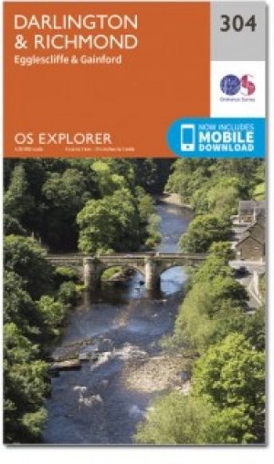
Wandelkaart 304 Darlington & Richmond- England - OSI • 9780319471760
Wandelkaart Darlington & Richmond - North Yorkshire England Omvat ook: Egglescliffe & Gainford. Productbeschrijving: De dubbel zijdige OS Explorer kaart 304 volgt de rivier de Tees en de Teesdale way, evenals het Tees Forest- en markettown Darlington worden getoont. De Tees Forest host outdoor activiteiten zoals raften, wandelen, loopwadstrijden en mountainbiken. De OS Explorer kaart v…

Fietskaart North York Moors - Goldeneye • 9781859652763
Fietskaart North York Moors - Goldeneye Productomschrijving: Het North York Moors National Park beslaat een gebied met hooggelegen, glooiende heidevelden, die in het noorden en westen een steile helling vormen, en in het oosten een ruige, grillige kustlijn. In het zuiden loopt de grond zachter af naar de Vales of Mowbray en Pickering. De Moors worden doorsneden door een reeks kleine stroom…

Wandelkaart 99 Northallerton & Ripon- N. Yorkshire - OSI • 9780319261972
Wandelkaart Northallerton & Ripon - North Yorkshire England Productbeschrijving: Ligt tussen de Yorkshire Dales en de North York Moors, het gebied gedekt door OS Landranger kaart 99 wordt vaak vergeten, maar omvat de oude kathedraal stad van Ripon, Northallerton en andere kleinere steden. De OS Landranger kaarten reeks heeft betrekking op Groot-Brittannië met 204 gedetailleerde kaarten…

Wandelkaart 101 Scarborough- Bridlington & Filey - OSI • 9780319474242
Wandelkaart Scarborough- Bridlington & Filey - North Yorkshire Productbeschrijving: Kaart OS Landranger 101 beslaat de kust stad van Scarborough, evenals de zuidoostelijke hoek van het North York Moors National Park. De Wolds Way en Cleveland way (onderdeel van het Europese lange pad E2) ontmoeten hier, en u vindt er ook de steden Bridlington en Filey. Hoogtepunten van het gebied zijn het …