

Wandelgids - The Cotswold Way 30 classic routes - Cicerone
Omschrijft 30 circulaire wandelingen in de Cotswolds AONB

Korte omschrijving
Wandelgidsen Gloucestershire, Egland van CICERONE Press. Ideaal voor tochten in England.
Wandelgids - The Cotswold Way 30 classic routes - Cicerone Productomschrijving: Deze gids beschrijft 30 circulaire wandelingen in de Cotswolds AONB van Zuid-Engeland. De gegradeerde routes z...

Specificaties
- Uitgever: CICERONE Press
- ISBN-13: 9781852848330
- HOOFDCATEGORIEËN: Wandelgids
- Activiteiten: Wandelen, Hiking & Trekking
- Auteur: Damian Hall
- Regio: Gloucestershire, Egland
- Land: England
- Lange afstand wandelroutes: Cotswold Way, England (164km)
- AONB - Area of Outstanding Beauty/National Landscape: Cotswolds AONB
- Editie: 2
- Taal: Engels
- National Trails UK, England & Wales: Cotswolds Way, England
Volledige omschrijving
Wandelgids - The Cotswold Way 30 classic routes - Cicerone
Productomschrijving: Deze gids beschrijft 30 circulaire wandelingen in de Cotswolds AONB van Zuid-Engeland. De gegradeerde routes zijn 4 tot 15 km lang, en omvat heuvel forten, lange kruiwagens en steencirkels, pittoreske dorpjes en delen van de Cotswold way National Trail als circulaire wandeling om te bezoeken. Bevat informatie over geschiedenis, geologie en dieren aangetroffen langs de routes.
Product description: Guidebook describing 30 circular walks in the Cotswolds AONB of southern England. The graded routes are 4-12 miles long, visiting hill forts, long barrows and stone circles, picturesque villages and parts of the Cotswold Way National Trail as circular walks. Includes information about history, geology and wildlife encountered along the routes.
Seasons:
Fantastic walking options all year round.
Centres:
Evesham, Chipping Campden, Broadway, Tewkesbury, Winchcombe, Moreton-on-the-Marsh, Chipping Norton, Stow-on-the-Wold, Bourton-on-the-Water, Cheltenham, Gloucester, Painswick, Stroud, Cirencester, Nailsworth, Dursley, Wotton-under-Edge, Tetbury, Malmesbury, Chippenham, Bristol, Bath and Bradford-on-Avon.
Difficulty:
The Cotswolds offer safe walking for less experienced hikers but there are also testing gradients for seasoned hill-walkers.
Must See:
The wide views from the Edge - especially from the likes of the wildflower-dotted, Jurassic grasslands of Cleeve Common, Leckhampton Hill and Selsley Common, or from the dramatic hillforts of Uley Bury, Painswick Beacon and Crickley Hill.
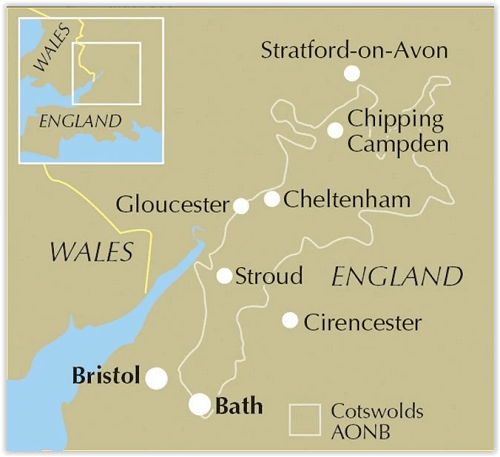
Locatie op kaart
Overzichtskaarten

Area's of Outstanding Natural Beauty - AONB's UK
Area's of Outstanding Natural Beauty - AONB's UK

Producten op de overzichtskaart
Klik op een product om naar de detailpagina te gaan.
- Wandelgids - Guide to the Cotswolds AONB - AA
- Wandelkaart 24 - Chilterns AONB - AA
- Wandelgids - Cotswold classic walks guidebook - Goldeneye
- Wandelgids - Cotswold Classic Walks - Goldeneye
- Wandelgids - The Cotswold Way 30 classic routes - Cicerone
- Wandelgids - North Downs Way Nat. trail - Cicerone
- Wandelgids - Chilterns walking guide - Cicerone
- Wandelgids - Suffolk coast & Heaths walks - Cicerone
- Wandelgids - North Downs Way - Map Booklet - Cicerone
- Wandelgids - North Pennines AONB walking guide - Cicerone
- Wandelgids - Ridgeway National Trail - Cicerone
- Wandelgids - Forest of Bowland & Pendle - Cicerone
- Wandelgids - Hampshire's Test Way walking guide - Cicerone
- Wandelgids & Fietsgids - The Cotswold AONB - Cicerone
- Wandelgids - North Wessex Downs - Cicerone Press
- Wandelgids - Walking on the North Wessex Downs - Cicerone
- Wandelgids - Silverdale & Arnside AONB - Cicerone
- Wandelkaart OL2 - Yorkshire Dales- Southern & Western Areas - OSI
- Wandelkaart OL19 - Howgill Fells and Upper Eden Valley - OSI
- Wandelkaart OL21 - South Pennines - Yorkshire - OSI
- Wandelkaart OL31 - North Pennines- Teesdale & Weardale - OSI
- Wandelkaart OL40 - The Broads - OSI
- Wandelkaart OL41 - Forest of Bowland & Ribblesdale - OSI
- Wandelkaart OL45 - The Cotswolds AONB- Gloucestershire - OSI
- Wandelkaart 108 - Lower Tamer Valley & Plymouth- Cornwall- OSI
- Wandelkaart 115 - Exmouth & Sidmouth- Devon - OSI
- Wandelkaart 137 - Ashford- Kent downs AONB- England - OSI
- Wandelkaart 140 - Quantock Hills AONB- Somerset - OSI
- Wandelkaart 140 - Quantock Hills AONB & Bridgwater- Devon - OSI
- Wandelkaart 147 - Sevenoaks & Tonbridge- Kent - OSI
- Wandelkaart 164 - Gower AONB & Gwyr- South Wales - OSI
- Wandelkaart 164 - Gower AONB & Gwyr- Wales - OSI
- Wandelkaart 171 - Chiltern Hills West & Henley-on-Thames OSI
- Wandelkaart 171 - Chiltern Hills West AONB- Wycombe - OSI
- Wandelkaart 172 - Chiltern Hills East AONB- Wycombe - OSI
- Wandelkaart 181 - Chiltern Hills AONB North- England - OSI
- Wandelkaart 181 - Chiltern Hills North AONB- Wycombe - OSI
- Wandelkaart 190 - Malvern Hills & Bredon Hill - OSI
- Wandelkaart 190 - Malvern Hills AONB & Bredon Hill - OSI
- Wandelkaart 203 - Ludlow- Shropshire Hills AONB - OSI
- Wandelkaart 217 - Long Mynd & Wenlock Edge- Schropshire- OSI
- Wandelkaart 254 - Lleyn Peninsular East- North Wales - OSI
- Wandelkaart 261 - Boston- Lincolnshire AONB - OSI
- Wandelkaart 262 - Anglesey West- Wales AONB - OSI
- Wandelkaart 263 - Anglesey East AONB- Wales - OSI
- Wandelkaart 273 - Lincolnshire Wolds South AONB - OSI
- Wandelkaart 282 - Lincolnshire Wolds North AONB - OSI
- Wandelkaart 298 - Nidderdale AONB- Yorkshire - OSI
- Wandelkaart 298 - Nidderdale AONB North Yorkshire - OSI
- Wandelkaart 300 - Howardian Hills AONB - OSI
- Wandelkaart 300 - Howardian Hills AONB & Malton - OSI
- Wandelkaart - Mourne Mountains N. Ireland - Harvey maps
- Wandelkaart - Fietskaart Forest of Bowland - Harvey maps
- Wandelkaart XT40 - Anglesey Coastal Path N. Wales - Harvey Maps
- Wandelkaart XT40 - Pennine Way Noord - Harvey Maps
- Wandelkaart XT40 - Pennine Way Zuid - Harvey Maps
- Wandelgids Cotswold - Way Two-way trekking guide - Knife Edge
- Reisgids Cotswolds England - Rough Guides
Artikelen uit dezelfde regio

Wandelgids & Fietsgids - The Cotswold AONB - Cicerone • 9781852847067
Wandelgids & Fietsgids - The Cotswold AONB - Cicerone Productomschrijving: De Cotswolds is de thuisbasis van mooie honing-hued stenen dorpen in een glooiende landschap. De dramatische 100-mijl lange kalkstenen helling biedt een adembenemend uitzicht, terwijl het netwerk van rustige wegen, fietsvriendelijke kanaalwegen, sporen en ruiterpaden perfect is voor verkenning op een fiets. De Cotwo…
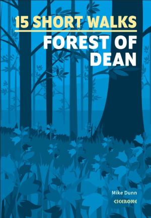
Wandelgids Forest of Dean, 15 Short Walks - Cicerone • 9781786312884
Wandelgids 15 Short Walks in the Forest of Dean - Cicerone Productomschrijving: Would you like to explore the best of the Forest of Dean? This guidebook covers 15 of the best short walks in the area (between 4 and 9km, all under three hours), including the Dean Sculpture Trail, Tidenham Chase and the Devil’s Pulpit, Nagshead Nature Reserve and May Hill. Why choose this guidebook? -…

Wandelgids 006 Pathfinder guides Cotswolds AONB - OS • 9780319090282
Wandelgids Cotswolds AONB - OS Productomschrijving: 28 carefully selected and tested country walks around The Cotswolds, graded by length and ranging from just over four to 10 miles. All of the walks in this book include written directions, an extract of the OS map for the area and some background on the history and natural environment you may see. Most of the walks avoid busy roads, a…
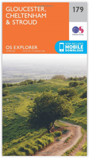
Wandelkaart 179 Gloucester- Cheltenham & Stroud - OSI • 9780319243725
Wandelkaart Gloucester- Cheltenham & Stroud - Gloucestershire Productbeschrijving: Gloucester & Cheltenham 179 / Gloucester, Cheltenham & Stroud, Gloucestershire, England - Kaart nummer 179 in de OS Explorer reeks heeft betrekking op de omgeving van Gloucester, Cheltenham, Stroud. Hoogtepunten van het gebied zijn onder meer: The Cotswolds AONB gebied van uitzonderlijke natuurlijke scho…

Wandelkaart XT Malvern Hills AONB England - Harvey map • 9781851376056
Wandelkaart - Malvern Hills AONB England - Harvey map Productomschrijving: Deze Mavern Hills zijn een samenstelling van heuvels in de Engelse counties, Worcestershire, Herefordshire, en een klein deel van Gloucestershire, en domineren de volledige regio rond deze counties van het district van Alvern Hills. Het hoogst gelegen punt van deze regio biedt een panorama van de Severn vallei met d…