

Wandelgids - Chilterns walking guide - Cicerone
Gelegen ten westen van de hoofdstad london

Korte omschrijving
Wandelgidsen South & South East England van CICERONE Press. Ideaal voor tochten in England.
Wandelgids - Chilterns walking guide - Cicerone Productomschrijving: Deze plaats werd geklasseerd als gebied van uitmuntende schoonheid, of in Engelse termen beter gezegd, een "Area of Ousta...

Specificaties
- Uitgever: CICERONE Press
- ISBN-13: 9781786310187
- HOOFDCATEGORIEËN: Wandelgids
- Activiteiten: Wandelen, Hiking & Trekking
- Auteur: Steve Davison
- Regio: South & South East England
- Land: England
- AONB - Area of Outstanding Beauty: Chiltern Hills AONB
- Schaal: 1:25000
- Editie: 2
- Taal: Engels
Volledige omschrijving
Wandelgids - Chilterns walking guide - Cicerone
Productomschrijving: Deze plaats werd geklasseerd als gebied van uitmuntende schoonheid, of in Engelse termen beter gezegd, een "Area of Oustanding Natural Beauty". Gelegen ten westen van de hoofdstad lonon is dit een soort getaway voor de londonaars die de stad even moe zijn, en de natuur willen opsnuiven. Steve Davison, is de auteur die deze wandelgids tot zijn recht bracht, en u een dikke 35 wandelingen voorstelt in de Chilterns AONB, verdeel tussen de 4 en 12 miles zoals ze zeggen in Engeland.
Engelse omschrijving: Guidebook to 35 walks in the Chiltern Hills of southern England. These chalk hills and ancient woodlands stretch from Reading and the Thames valley through Oxfordshire, Buckinghamshire and Hertfordshire to Luton. The selected walks, which range from 4 to 12 miles, showcase the best of this AONB and are as suitable for walkers of most abilities.
Seasons:
Spring and early summer are best for wild flowers; in autumn, the beech woods are clothed in golden-brown autumnal colours; a frosty winter's day gives impressive views.
Centres:
Aldbury, Amersham, Chesham, Dunstable, Goring, Great Hampden, Henley-on-Thames, High Wycombe, Ivinghoe, Nettlebed, Princes Risborough, Tring, Wallingford, Wendover, Whipsnade.
Difficulty:
Walks to suit most ages and abilities; no difficulties apart from some short steep uphill and downhill sections; can be muddy in winter.
Must See: Panoramic views from the crest of the Chilterns including Ivinghoe Beacon, Coombe Hill, Whiteleaf Hill and Watlington Hill; peaceful beech woods; riverside scenes along the River Thames, Chess, Gade and Misbourne; picturesque villages with thatched cottages, historic churches and cosy pubs.
.png)
Locatie op kaart
Overzichtskaarten

Area's of Outstanding Natural Beauty - AONB's UK
Area's of Outstanding Natural Beauty - AONB's UK

Producten op de overzichtskaart
Klik op een product om naar de detailpagina te gaan.
- Wandelgids - Guide to the Cotswolds AONB - AA
- Wandelkaart 24 - Chilterns AONB - AA
- Wandelgids - Cotswold classic walks guidebook - Goldeneye
- Wandelgids - Cotswold Classic Walks - Goldeneye
- Wandelgids - The Cotswold Way 30 classic routes - Cicerone
- Wandelgids - North Downs Way Nat. trail - Cicerone
- Wandelgids - Chilterns walking guide - Cicerone
- Wandelgids - Suffolk coast & Heaths walks - Cicerone
- Wandelgids - North Downs Way - Map Booklet - Cicerone
- Wandelgids - North Pennines AONB walking guide - Cicerone
- Wandelgids - Ridgeway National Trail - Cicerone
- Wandelgids - Forest of Bowland & Pendle - Cicerone
- Wandelgids - Hampshire's Test Way walking guide - Cicerone
- Wandelgids & Fietsgids - The Cotswold AONB - Cicerone
- Wandelgids - North Wessex Downs - Cicerone Press
- Wandelgids - Walking on the North Wessex Downs - Cicerone
- Wandelgids - Silverdale & Arnside AONB - Cicerone
- Wandelkaart OL2 - Yorkshire Dales- Southern & Western Areas - OSI
- Wandelkaart OL19 - Howgill Fells and Upper Eden Valley - OSI
- Wandelkaart OL21 - South Pennines - Yorkshire - OSI
- Wandelkaart OL31 - North Pennines- Teesdale & Weardale - OSI
- Wandelkaart OL40 - The Broads - OSI
- Wandelkaart OL41 - Forest of Bowland & Ribblesdale - OSI
- Wandelkaart OL45 - The Cotswolds AONB- Gloucestershire - OSI
- Wandelkaart 108 - Lower Tamer Valley & Plymouth- Cornwall- OSI
- Wandelkaart 115 - Exmouth & Sidmouth- Devon - OSI
- Wandelkaart 137 - Ashford- Kent downs AONB- England - OSI
- Wandelkaart 140 - Quantock Hills AONB- Somerset - OSI
- Wandelkaart 140 - Quantock Hills AONB & Bridgwater- Devon - OSI
- Wandelkaart 147 - Sevenoaks & Tonbridge- Kent - OSI
- Wandelkaart 164 - Gower AONB & Gwyr- South Wales - OSI
- Wandelkaart 164 - Gower AONB & Gwyr- Wales - OSI
- Wandelkaart 171 - Chiltern Hills West & Henley-on-Thames OSI
- Wandelkaart 171 - Chiltern Hills West AONB- Wycombe - OSI
- Wandelkaart 172 - Chiltern Hills East AONB- Wycombe - OSI
- Wandelkaart 181 - Chiltern Hills AONB North- England - OSI
- Wandelkaart 181 - Chiltern Hills North AONB- Wycombe - OSI
- Wandelkaart 190 - Malvern Hills & Bredon Hill - OSI
- Wandelkaart 190 - Malvern Hills AONB & Bredon Hill - OSI
- Wandelkaart 203 - Ludlow- Shropshire Hills AONB - OSI
- Wandelkaart 217 - Long Mynd & Wenlock Edge- Schropshire- OSI
- Wandelkaart 254 - Lleyn Peninsular East- North Wales - OSI
- Wandelkaart 261 - Boston- Lincolnshire AONB - OSI
- Wandelkaart 262 - Anglesey West- Wales AONB - OSI
- Wandelkaart 263 - Anglesey East AONB- Wales - OSI
- Wandelkaart 273 - Lincolnshire Wolds South AONB - OSI
- Wandelkaart 282 - Lincolnshire Wolds North AONB - OSI
- Wandelkaart 298 - Nidderdale AONB- Yorkshire - OSI
- Wandelkaart 298 - Nidderdale AONB North Yorkshire - OSI
- Wandelkaart 300 - Howardian Hills AONB - OSI
- Wandelkaart 300 - Howardian Hills AONB & Malton - OSI
- Wandelkaart - Mourne Mountains N. Ireland - Harvey maps
- Wandelkaart - Fietskaart Forest of Bowland - Harvey maps
- Wandelkaart XT40 - Anglesey Coastal Path N. Wales - Harvey Maps
- Wandelkaart XT40 - Pennine Way Noord - Harvey Maps
- Wandelkaart XT40 - Pennine Way Zuid - Harvey Maps
- Wandelgids Cotswold - Way Two-way trekking guide - Knife Edge
- Reisgids Cotswolds England - Rough Guides
Artikelen uit dezelfde regio
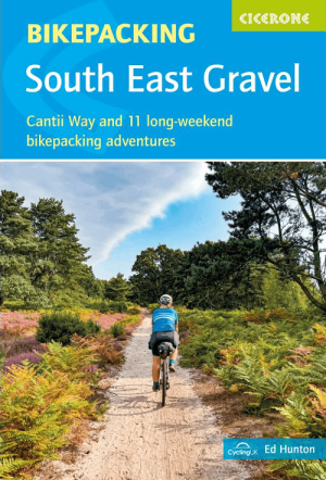
Fietsgids Gravel Bikepacking in South East England - Cicerone • 9781786312372
Gravel Bikepacking in South East England - Cicerone Productomschrijving: A guidebook to 12 of the best gravel bikepacking routes in the South and East, including the Cantii Way, exploring forest tracks, bridleways and quiet lanes over 1 to 5 days. Escape the urban sprawl and explore the region’s wildest off-road routes. The cycle routes are suitable for beginner and experienced MTB an…

Landkaart Wegenkaart 504 S.E. Engeland & East Anglia - Michelin • 9782067183322
Regionale Wegenkaart South East Engeland & East Anglia Productomschrijving: De volledig bijgewerkte MICHELIN-kaart van Engeland Zuid-Oost, Midlands, Oost-England geeft u alle WEG- EN TOERISME-informatie die u nodig hebt om uw reizen in deze regio te optimaliseren: een INDEX VAN LOCATIES, een TABEL VAN AFSTANDEN en REISTIJDEN. Dankzij de schaal van 1:400.000 (1 cm = 4 km) kun je zowel de h…
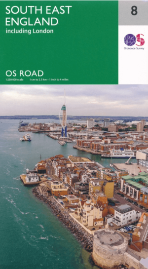
Landkaart Wegenkaart 8 Zuidoost Engeland - OSI • 9780319263808
Wegenkaart Zuidoost Engeland - OSI Productomschrijving: Plan your journey with this series of road maps from OS. Showing all major road, rail and ferry links as well as settlements and selected features in 1: 250 000 scale, this is the ideal map for planning trips and holidays by car or cycle. OS Road 8 covers: the south-east England.

Fietsgids 20 Rides in South East England - Cicerone • 9781852847432
Cycle the best Sportive routes in South East England Productomschrijving: Deze gids biedt 20 sportieve wielerroutes in de meest uitdagende en mooie fietsgebieden van Zuidoost-Engeland. Van Surrey en de Chiltern Hills naar het New Forest en de Berkshire Downs, het gebied heeft km's van fietsvriendelijke wegen geschikt voor sportieve training. De gesorteerde routes zijn allemaal op rustige l…

Reisgids Zuid-Engeland UK - Marco Polo • 9783829770101
Reisgids Zuid-Engeland - Marco Polo Productomschrijving: Marco Polo reisgids voor Zuid-Engeland! Handig pocket formaat, boordevol informatie, met 6 bladzijden atlas in de gids én uitneembare kaart. Met 'insider tips' om Zuid-Engeland, van Cornwall tot Kent, écht te ontdekken, de TOP 15 van bezienswaardigheden in één oogopslag, up-to-date informatie in overzichtelijke hoofdstukken: sightsee…