

Wandelgids Cotswold - Way Two-way trekking guide - Knife Edge
The Cotswold way - 164 km

Korte omschrijving
Wandelgidsen Somerset South West England, Warwickshire, West Midlands, Wiltshire, West England, Worcestershire, West England, Gloucestershire, Egland en Oxfordshire west England van Knife Edge Outdoor Limited. Ideaal voor tochten in England.
Cotswold - Way Two-way trekking guide - Knife Edge Productomschrijving: De Cotswold Way legt 102 mijl af door het sublieme landschap van de Cotswolds, een streek die het toonbeeld is van his...

Specificaties
- Uitgever: Knife Edge Outdoor Limited
- ISBN-13: 9781912933136
- HOOFDCATEGORIEËN: Wandelgids
- Activiteiten: Wandelen, Hiking & Trekking
- Regio: Gloucestershire, Egland, Oxfordshire west England, Somerset South West England, Warwickshire, West Midlands, Wiltshire, West England, Worcestershire, West England
- Land: England
- Lange afstand wandelroutes: Cotswold Way, England (164km)
- AONB - Area of Outstanding Beauty: Cotswolds AONB
- Editie: 1
- Taal: Engels
- National Trails UK, England & Wales: Cotswolds Way, England
Volledige omschrijving
Cotswold - Way Two-way trekking guide - Knife Edge
Productomschrijving: De Cotswold Way legt 102 mijl af door het sublieme landschap van de Cotswolds, een streek die het toonbeeld is van historisch Engeland. Onderweg gaat u over de top van de Cotswold Escarpment door een prachtig glooiend landschap en historische chocolade-doosdorpjes, gebouwd van prachtige honingkleurige stenen, die eeuwenlang onveranderd zijn gebleven. De Cotswold behoren tot de befaamde AONB regio's, de Area of Outstanding Natural Beaty.
De trekker doorkruist dit prachtige terrein op een nauwkeurig aangegeven reeks paden en wegen, ver weg van de grote stedelijke centra van de regio. Af en toe passeert u een klein dorp of gehucht (met niet veel meer dan een plaatselijke pub en een paar overnachtingsmogelijkheden), maar verder is de ervaring er een van rust. Dit is Engeland op zijn best en het zal een avontuur zijn dat u nooit zult vergeten.
Engelse omschrijving: The Cotswold Way travels 102 miles through the sublime scenery of the Cotswolds, a region which is the epitome of historic England. Along the way, you will travel the crest of the Cotswold Escarpment through exquisite rolling countryside and historic chocolate-box villages, built from lovely honey-coloured stone, which have remained unchanged for centuries.
The trekker negotiates this wonderful terrain on a meticulously waymarked series of paths and tracks, far removed from the region’s large urban centres. Occasionally, you will pass through a small village or hamlet (with little more than a local pub and a few places to stay) but otherwise, the experience is one of tranquillity. This is England at its best and it will be an adventure that you will never forget.
The definitive two-way guide to the Cotswold Way: both southbound and northbound routes are described in full. Real Maps: Full Ordnance Survey mapping inside (1:25,000). All accommodation is numbered and marked on the maps. 18 different itineraries: schedules of 4, 5, 6, 7, 8, 9, 10, 11 and 12 days for hikers and runners. Includes both southbound and northbound itineraries. Difficult calculations of time, distance and altitude gain/loss are done for you.
Also includes:
• Detailed information on equipment and travelling light
• Everything the trekker needs to know: route, costs, difficulty, weather, travel, and more
• Full accommodation listings: the best inns, B&Bs and hotels
• Detailed section on camping
• What to see in the City of Bath
• Essential info for both self-guided and guided trekkers
• Information on history, plants and wildlife
• Numbered waypoints linking the Real Maps to our clear descriptions
Locatie op kaart
Overzichtskaarten

Area's of Outstanding Natural Beauty - AONB's UK
Area's of Outstanding Natural Beauty - AONB's UK

Producten op de overzichtskaart
Klik op een product om naar de detailpagina te gaan.
- Wandelgids - Guide to the Cotswolds AONB - AA
- Wandelkaart 24 - Chilterns AONB - AA
- Wandelgids - Cotswold classic walks guidebook - Goldeneye
- Wandelgids - Cotswold Classic Walks - Goldeneye
- Wandelgids - The Cotswold Way 30 classic routes - Cicerone
- Wandelgids - North Downs Way Nat. trail - Cicerone
- Wandelgids - Chilterns walking guide - Cicerone
- Wandelgids - Suffolk coast & Heaths walks - Cicerone
- Wandelgids - North Downs Way - Map Booklet - Cicerone
- Wandelgids - North Pennines AONB walking guide - Cicerone
- Wandelgids - Ridgeway National Trail - Cicerone
- Wandelgids - Forest of Bowland & Pendle - Cicerone
- Wandelgids - Hampshire's Test Way walking guide - Cicerone
- Wandelgids & Fietsgids - The Cotswold AONB - Cicerone
- Wandelgids - North Wessex Downs - Cicerone Press
- Wandelgids - Walking on the North Wessex Downs - Cicerone
- Wandelgids - Silverdale & Arnside AONB - Cicerone
- Wandelkaart OL2 - Yorkshire Dales- Southern & Western Areas - OSI
- Wandelkaart OL19 - Howgill Fells and Upper Eden Valley - OSI
- Wandelkaart OL21 - South Pennines - Yorkshire - OSI
- Wandelkaart OL31 - North Pennines- Teesdale & Weardale - OSI
- Wandelkaart OL40 - The Broads - OSI
- Wandelkaart OL41 - Forest of Bowland & Ribblesdale - OSI
- Wandelkaart OL45 - The Cotswolds AONB- Gloucestershire - OSI
- Wandelkaart 108 - Lower Tamer Valley & Plymouth- Cornwall- OSI
- Wandelkaart 115 - Exmouth & Sidmouth- Devon - OSI
- Wandelkaart 137 - Ashford- Kent downs AONB- England - OSI
- Wandelkaart 140 - Quantock Hills AONB- Somerset - OSI
- Wandelkaart 140 - Quantock Hills AONB & Bridgwater- Devon - OSI
- Wandelkaart 147 - Sevenoaks & Tonbridge- Kent - OSI
- Wandelkaart 164 - Gower AONB & Gwyr- South Wales - OSI
- Wandelkaart 164 - Gower AONB & Gwyr- Wales - OSI
- Wandelkaart 171 - Chiltern Hills West & Henley-on-Thames OSI
- Wandelkaart 171 - Chiltern Hills West AONB- Wycombe - OSI
- Wandelkaart 172 - Chiltern Hills East AONB- Wycombe - OSI
- Wandelkaart 181 - Chiltern Hills AONB North- England - OSI
- Wandelkaart 181 - Chiltern Hills North AONB- Wycombe - OSI
- Wandelkaart 190 - Malvern Hills & Bredon Hill - OSI
- Wandelkaart 190 - Malvern Hills AONB & Bredon Hill - OSI
- Wandelkaart 203 - Ludlow- Shropshire Hills AONB - OSI
- Wandelkaart 217 - Long Mynd & Wenlock Edge- Schropshire- OSI
- Wandelkaart 254 - Lleyn Peninsular East- North Wales - OSI
- Wandelkaart 261 - Boston- Lincolnshire AONB - OSI
- Wandelkaart 262 - Anglesey West- Wales AONB - OSI
- Wandelkaart 263 - Anglesey East AONB- Wales - OSI
- Wandelkaart 273 - Lincolnshire Wolds South AONB - OSI
- Wandelkaart 282 - Lincolnshire Wolds North AONB - OSI
- Wandelkaart 298 - Nidderdale AONB- Yorkshire - OSI
- Wandelkaart 298 - Nidderdale AONB North Yorkshire - OSI
- Wandelkaart 300 - Howardian Hills AONB - OSI
- Wandelkaart 300 - Howardian Hills AONB & Malton - OSI
- Wandelkaart - Mourne Mountains N. Ireland - Harvey maps
- Wandelkaart - Fietskaart Forest of Bowland - Harvey maps
- Wandelkaart XT40 - Anglesey Coastal Path N. Wales - Harvey Maps
- Wandelkaart XT40 - Pennine Way Noord - Harvey Maps
- Wandelkaart XT40 - Pennine Way Zuid - Harvey Maps
- Wandelgids Cotswold - Way Two-way trekking guide - Knife Edge
- Reisgids Cotswolds England - Rough Guides
Artikelen uit dezelfde regio
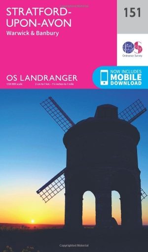
Wandelkaart 151 Stratford-upon-Avon- England - OSI • 9780319262498
Wandelkaart Stratford-upon-Avon - England Productbeschrijving: Als de geboorteplaats van William Shakespeare, is de schilderachtige stad van Stratford-upon-Avon doordrenkt van een rijke geschiedenis en cultuur, en ligt in het hart van het landschap van Warwickshire. OS Landranger kaart 151 toont dit gebied, en omvat een deel van het pad van de E2 Europese lange afstand die door de regio sn…

Wandelgids The Kennet and Avon Canal walk - Cicerone • 9781786312303
The Kennet and Avon Canal walk - Cicerone Productomschrijving: Wandelgids langs het Kennet & Avon kanaal. De 151 Km lange route van Reading naar Bristol is verdeeld in 7 etappes van redelijk gemakkelijke wandelingen en omvat het UNESCO werelderfgoed Bath en de drijvende haven van Bristol. Er zijn ook 20 rondwandelingen opgenomen, variërend van 4¼ tot 9 mijl, waarbij de beste delen van het …

Cotswolds Mountain Biking - Vertebrate Publ. • 9781906148140
Cotswolds AONB Mountain Biking - Vertebrate Productomschrijving: 20 Classic Rides - Cotwolds Mountain Biking by Tom Fenton features 20 classic MTB routes in the Cotswold Hills across the counties of Gloucestershire and Oxfordshire, and extending into parts of Wiltshire, Somerset, Worcestershire and Warwickshire. With Ordnance Survey mapping and easy-to-follow directions. The Cotswold H…
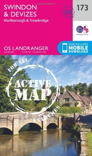
Wandelkaart 173 Swindon- Devizes & Marlborough - OSI • 9780319474969
Wandelkaart Swindon- Devizes & Marlborough - Witlshire De OS Landranger kaarten reeks heeft betrekking op Groot-Brittannië met 204 gedetailleerde kaarten, perfect voor dagtochten en korte pauzes. Elke kaart bevat alle informatie die u nodig heeft om dit lokaal gebied te leren kennen en omvat plaatsen van belang, toeristische informatie, picknickplaatsen en campings, plus doorgangsrechten i…
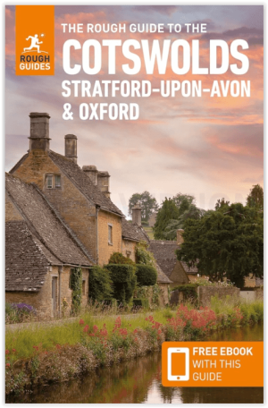
Reisgids Cotswolds AONB - Rough Guides • 9781839059728
The Cotswolds AONB - Rough Guides Productomschrijving: Deze omvat het Cotswolds gebied in zuid-oost Engeland. Een gebied van uitmuntend natuurschoon, of in andere meer lokalere woorden, een AONB area, of Area of Outstanding Natural Beauty. Bij ons is dat bijvoorbeeld de westhoek, het Zwin, enz... Deze reisgids biedt u deze regio inclusief de locaties van Stratford-Uppon-Avon & Oxford die a…