

Wandelkaart OL41 - Forest of Bowland & Ribblesdale - OSI
Forest of Bowland en Yorkshire Dales National Park


Korte omschrijving
Wandelkaarten Lanacshire, England en North Yorkshire, Engeland van Ordnance Survey. Ideaal voor tochten in England.
Wandelkaart Forest of Bowland & Ribblesdale - North Yorkshire Omvat ook: Pendle Hill, Clitheroe & Settle Productbeschrijving: Kaart nummer OL41 in de OS Explorer kaarten reeks omvat de F...

Specificaties
- Uitgever: Ordnance Survey
- ISBN-13: 9780319469590
- HOOFDCATEGORIEËN: Wandelkaart
- Activiteiten: Wandelen, Hiking & Trekking
- Regio: Lanacshire, England, North Yorkshire, Engeland
- Land: England
- Waterafstotende kaart: Ordnance Survey ACTIVE Explorer Weatherproof Maps
- Regionale parken: Forest of Bowland, England
- TOPO's & Stafkaarten: Topografisch wandelen
- AONB - Area of Outstanding Beauty: Forest of Bowland AONB
- Schaal: 1:25000
- Taal: Engels
- Reeks/Serie: Explorer ACTIVE Series OSI
Volledige omschrijving
Wandelkaart Forest of Bowland & Ribblesdale - North Yorkshire
Omvat ook: Pendle Hill, Clitheroe & Settle
Productbeschrijving: Kaart nummer OL41 in de OS Explorer kaarten reeks omvat de Forest of Bowland en Yorkshire Dales National Park in de buurt van Clitheroe. Hoogtepunten van het gebied zijn onder andere: Ribble way & Wyre way, Lune Valley walkway en Pendle way, samen met de steden van Settle, Clitheroe en Lancaster. De OS Explorer kaart voor bos van Bowland & Ribblesdale is beschikbaar in zowel de standaard papieren versie als de weerbestendige 'Actief' versie.
Kaart nummer OL41 is een all purpose kaart vol gepakt met informatie om u het gebied te helpen leren kennen. De kaarten bestrijken het land. Elke kaart heeft een oppervlakte van 40 km door 40 km (25 mijl door 25 mijl) en zoals andere kaarten van Ordnance Survey, National Grid-vierkanten worden verstrekt zodat elke functie een unieke referentienummer kan worden gegeven.
Productdiscription: Map sheet OL41 in the OS Explorer series covers the Forest of Bowland and Yorkshire Dales National Park near Clitheroe. Highlights of the area include: Ribble Way, Wyre Way, Lune Valley Ramble and Pendle Way, along with the towns of Clitheroe, Settle and Lancaster. The OS Explorer map for Forest of Bowland & Ribblesdale is available in both the standard paper version and weatherproof 'Active' version.
Locatie op kaart
Gekoppelde artikelen

Wandelkaart OL41 - Forest of Bowland & Ribblesdale - OSI • 9780319469590
weatherproof versieWandelkaart Forest of Bowland & Ribblesdale - North Yorkshire Omvat ook: Pendle Hill, Clitheroe & Settle Productbeschrijving: Kaart nummer OL41 in de OS Explorer kaarten reeks omvat de Forest of Bowland en Yorkshire Dales National Park in de buurt van Clitheroe. Hoogtepunten van het gebied zijn onder andere: Ribble way & Wyre way, Lune Valley walkway en Pendle way, samen met de steden …
Overzichtskaarten

Area's of Outstanding Natural Beauty - AONB's UK
Area's of Outstanding Natural Beauty - AONB's UK

Producten op de overzichtskaart
Klik op een product om naar de detailpagina te gaan.
- Wandelgids - Guide to the Cotswolds AONB - AA
- Wandelkaart 24 - Chilterns AONB - AA
- Wandelgids - Cotswold classic walks guidebook - Goldeneye
- Wandelgids - Cotswold Classic Walks - Goldeneye
- Wandelgids - The Cotswold Way 30 classic routes - Cicerone
- Wandelgids - North Downs Way Nat. trail - Cicerone
- Wandelgids - Chilterns walking guide - Cicerone
- Wandelgids - Suffolk coast & Heaths walks - Cicerone
- Wandelgids - North Downs Way - Map Booklet - Cicerone
- Wandelgids - North Pennines AONB walking guide - Cicerone
- Wandelgids - Ridgeway National Trail - Cicerone
- Wandelgids - Forest of Bowland & Pendle - Cicerone
- Wandelgids - Hampshire's Test Way walking guide - Cicerone
- Wandelgids & Fietsgids - The Cotswold AONB - Cicerone
- Wandelgids - North Wessex Downs - Cicerone Press
- Wandelgids - Walking on the North Wessex Downs - Cicerone
- Wandelgids - Silverdale & Arnside AONB - Cicerone
- Wandelkaart OL2 - Yorkshire Dales- Southern & Western Areas - OSI
- Wandelkaart OL19 - Howgill Fells and Upper Eden Valley - OSI
- Wandelkaart OL21 - South Pennines - Yorkshire - OSI
- Wandelkaart OL31 - North Pennines- Teesdale & Weardale - OSI
- Wandelkaart OL40 - The Broads - OSI
- Wandelkaart OL41 - Forest of Bowland & Ribblesdale - OSI
- Wandelkaart OL45 - The Cotswolds AONB- Gloucestershire - OSI
- Wandelkaart 108 - Lower Tamer Valley & Plymouth- Cornwall- OSI
- Wandelkaart 115 - Exmouth & Sidmouth- Devon - OSI
- Wandelkaart 137 - Ashford- Kent downs AONB- England - OSI
- Wandelkaart 140 - Quantock Hills AONB- Somerset - OSI
- Wandelkaart 140 - Quantock Hills AONB & Bridgwater- Devon - OSI
- Wandelkaart 147 - Sevenoaks & Tonbridge- Kent - OSI
- Wandelkaart 164 - Gower AONB & Gwyr- South Wales - OSI
- Wandelkaart 164 - Gower AONB & Gwyr- Wales - OSI
- Wandelkaart 171 - Chiltern Hills West & Henley-on-Thames OSI
- Wandelkaart 171 - Chiltern Hills West AONB- Wycombe - OSI
- Wandelkaart 172 - Chiltern Hills East AONB- Wycombe - OSI
- Wandelkaart 181 - Chiltern Hills AONB North- England - OSI
- Wandelkaart 181 - Chiltern Hills North AONB- Wycombe - OSI
- Wandelkaart 190 - Malvern Hills & Bredon Hill - OSI
- Wandelkaart 190 - Malvern Hills AONB & Bredon Hill - OSI
- Wandelkaart 203 - Ludlow- Shropshire Hills AONB - OSI
- Wandelkaart 217 - Long Mynd & Wenlock Edge- Schropshire- OSI
- Wandelkaart 254 - Lleyn Peninsular East- North Wales - OSI
- Wandelkaart 261 - Boston- Lincolnshire AONB - OSI
- Wandelkaart 262 - Anglesey West- Wales AONB - OSI
- Wandelkaart 263 - Anglesey East AONB- Wales - OSI
- Wandelkaart 273 - Lincolnshire Wolds South AONB - OSI
- Wandelkaart 282 - Lincolnshire Wolds North AONB - OSI
- Wandelkaart 298 - Nidderdale AONB- Yorkshire - OSI
- Wandelkaart 298 - Nidderdale AONB North Yorkshire - OSI
- Wandelkaart 300 - Howardian Hills AONB - OSI
- Wandelkaart 300 - Howardian Hills AONB & Malton - OSI
- Wandelkaart - Mourne Mountains N. Ireland - Harvey maps
- Wandelkaart - Fietskaart Forest of Bowland - Harvey maps
- Wandelkaart XT40 - Anglesey Coastal Path N. Wales - Harvey Maps
- Wandelkaart XT40 - Pennine Way Noord - Harvey Maps
- Wandelkaart XT40 - Pennine Way Zuid - Harvey Maps
- Wandelgids Cotswold - Way Two-way trekking guide - Knife Edge
- Reisgids Cotswolds England - Rough Guides
Artikelen uit dezelfde regio

Wandelkaart 299 Ripon & Boroughbridge- North Yorkshire - OSI • 9780319245514
Wandelkaart Ripon & Boroughbridge - North Yorkshire England Omvat ook: Easingwold Productbeschrijving: Kaart nummer 299 in de OS Explorer kaarten reeks is ideaal voor het ontdekken van North Yorkshire rond Ripon en Boroughbridge. Bezoek de kathedraal stad van Ripon en bewonder de Ripon markt, of de Ripon Hornblower, een traditie van de Middeleeuwen. Andere hoogtepunten van het gebied z…

Wandelkaart 290 York- Selby & Tadcaster- North Yorkshire - OSI • 9780319244876
Wandelkaart York- Selby & Tadcaster - North Yorkshire England Productbeschrijving: Deze twee-zijdige kaart (OS Explorer kaart 290) toont York tot Selby, met inbegrip van de Trans Pennine Way en de Ebor Way. U kunt de historische stad verkennen, of verder gaan en de rivier de Ouse volgen. De OS Explorer kaart voor York is beschikbaar in zowel de standaard papieren versie als de weerbestendi…

Wandelkaart 297 Lower Wharfedale & Washburn Valley - OSI • 9780319245491
Wandelkaart Lower Wharfedale & Washburn Valley - North Yorkshire Omvat ook: Harrogate & Ilkley Moor Productomschrijving: Kaart nummer 297 in de OS Explorer kaarten reeks heeft betrekking op het Nidderdale AONB en het Yorkshire Dales National Park. De stad van Harrogate is omgeven door het Harrogate Ringway recreatief pad, terwijl de Dales Way loopt langs Ilkley, Otley en Guisely. Ander…
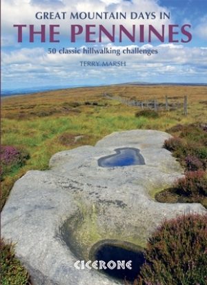
Wandelgids Great Mountain Days in the Pennines - Cicerone • 9781852846503
Wandelgids - Great Mountain Days in the Pennines - Cicerone Productomschrijving: Een inspirerende gids naar 50 klassieke wandelingen op het glooiende landschap van de Walliser. De gesorteerde routes, tussen 6 en 13 mijl in lengte, dekken de klassieke Walliser fells en veenland zoals Whernside, Ilkley Moor en Pendle Hill; verkennen van Noord- en Zuid-Pennines, Yorkshire Dales, Howgills en D…
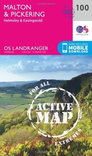
Wandelkaart 100 Malton & Pickering- Yorkshire - OSI • 9780319474235
Wandelkaart Malton & Pickering - North Yorkshire England - OSI Productbeschrijving: Landranger kaart 100 bestrijkt het zuidwesten van het North York Moors National Park, en omvat de steden Malton, Pickering, Helmsley en Easingwold. De start van de Cleveland Way die (eindigt) in Helmsley en 177km lang is, of die verschillende wandelpaden volgt langs de pittoreske rivier Derwent. De kaart OS…